Translate

Friday, 12 October 2012

Trier

Trier


Trier, historically called in English Treves, is a city in Germany on the banks of the Moselle. It is the oldest city in Germany, founded in or before 16 BC. Trier lies in a valley between low vine-covered hills of ruddy sandstone in the west of the state of Rhineland-Palatinate, near the border with Luxembourg and within the important Mosel wine region.

The city is the oldest seat of a Christian bishop north of the Alps. In the Middle Ages, the Archbishop of Trier was an important prince of the church, as the Archbishopric of Trier controlled land from the French border to the Rhine. The Archbishop also had great significance as one of the seven electors of the Holy Roman Empire.


According to the legendarium recorded in the 12th-century Gesta Treverorum, the city was founded by an eponymous otherwise unrecorded Trebeta, an Assyrian prince, placing the city's founding legend centuries before and independently of ancient Rome: a medieval inscription on the facade of the Red House in Trier market,

ANTE ROMAM TREVIRIS STETIT ANNIS MILLE TRECENTIS.PERSTET ET ÆTERNA 
PACE FRVATVR. AMEN.

"Thirteen hundred years before Rome, Trier stood / may it stand on and enjoy eternal peace, amen," reflects the proud city tradition. Further embroidery in the monkish Gesta made of Trebeta the son of Ninus, a "King of Assyria" imagined by the ancient Greeks, by a wife prior to his marriage to the equally non-historical Queen Semiramis. His stepmother, Semiramis, despised him and when she took over the kingdom after the death of his father, Ninus, Trebeta left Assyria and went to Europe. After wandering for a time, he led a group of colonizers to the site of Trier. Upon his death, his body was cremated on Petrisberg by the people of Trier. The image of "Trebeta" became an icon of the city during the Middle Ages.

In historical time, the Roman Empire subdued the Treveri in the 1st century BC and established Augusta Treverorum (Lit: August (Regal, noble) [City] of the Treveri) in 30 BC. The name is likely to be taken from the title Augustus held by the Princeps or head of state at the time, Augustus Caesar. The city later became the capital of the Roman province of Gallia Belgica, as well as the Roman prefecture of Gaul. It covered 282 ha within its walls and may have had as many as 70,000 inhabitants. The Porta Nigra is counted among the Roman architecture of the city. A residence of the Western Roman Emperor, Roman Trier was the birthplace of Saint Ambrose. Sometime between 395 and 418 the Roman administration moved the staff of Pretorian Prefecture from the city to Arles. The city continued to be inhabited, but was not as prosperous as before, because of the absence of 2,000 staff members of the Prefecture and military. However, the city remained the seat of a governor and had state factories for the production of ballistae and armor, and a wool mill for uniforms for the troops, clothing for the civil service and high-quality garments for the Court. Northern Gaul was held by the Romans along a line from north of Cologne to the coast at Boulogne through what is today southern Belgium until 460. South of this line, Roman control was firm, as evidenced by the continuing operation of the imperial arms factory at Amiens.
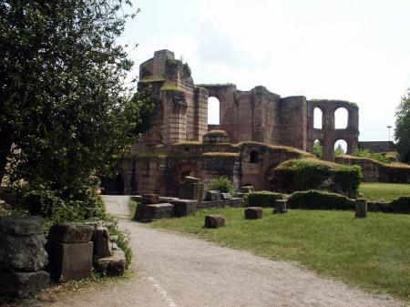
The Franks seized Trier from Roman administration in 459 AD. In 870, it became part of Eastern Francia, which developed into the Holy Roman Empire. Relics of Saint Matthias brought to the city initiated widespread pilgrimages. The bishops of the city grew increasingly powerful and the Archbishopric of Trier was recognized as an electorate of the empire, one of the most powerful states of Germany. The University of Trier was founded in the city in 1473.

In the 17th century, the Archbishops and Prince-Electors of Trier relocated their residences to Philippsburg Castle in Ehrenbreitstein, near Koblenz. A session of the Reichstag was held in Trier in 1512, during which the demarcation of the Imperial Circles was definitively established.

In the 17th and 18th centuries, Trier was sought after by France, who invaded during the Thirty Years' War, the War of the Grand Alliance, the War of the Spanish Succession, and the War of the Polish Succession. France succeeded in finally claiming Trier in 1794 during the French Revolutionary Wars, and the electoral archbishopric was dissolved. After the Napoleonic Wars ended in 1815, Trier passed to the Kingdom of Prussia. Karl Marx was born in the city in 1818.

As part of the Prussian Rhineland, Trier developed economically during the 19th century. The city rose in revolt during the revolutions of 1848 in the German states, although the rebels were forced to concede. It became part of the German Empire in 1871.

In June 1940 over 60,000 British prisoners of war, captured at Dunkirk and Northern France, were marched to Trier, which became a staging post for British soldiers headed for German prisoner-of-war camps. Trier was heavily bombed and bombarded in 1944 during World War II. The city became part of the new state of Rhineland-Palatinate after the war. The university, dissolved in 1797, was restarted in the 1970s, while the Cathedral of Trier was reopened in 1974. Trier officially celebrated its 2,000th anniversary in 1984.


                                                       Trier’s Top 5:
       
  1. The Cathedral of Saint Peter is the oldest cathedral in Germany. The edifice is notable for its extremely long life span under multiple different eras each contributing some elements to its design, including the center of the main chapel being made of Roman brick laid under the direction of Saint Helen, resulting in a cathedral added on to gradually rather than rebuilt in different eras. Its dimensions, 112.5 by 41 m, make it the largest church structure in Trier. Since 1986 it has been on the UNESCO list of World Heritage Sites. The structure is raised upon the foundations of Roman buildings of Augusta Treverorum. Following the conversion of the Emperor Constantine the Bishop Maximin of Trier (329-346) coordinated the construction of the grandest ensemble of ecclesiastical structures in the West outside Rome: on a groundplan four times the area of the present cathedral no less than four basilicas, a baptistery and outbuildings were constructed; the four piers of the crossing formed the nucleus of the present structure. The fourth century structure was left in ruins by the Franks and rebuilt. Normans destroyed the structure again in 882. Under Bishop Egbert the Dom was restored once more.
  2. The Porta Nigra (Latin for black gate) is a large Roman city gate in Trier. It is today the largest Roman city gate north of the Alps and has been designated a World Heritage Site. The name Porta Nigra originated in the Middle Ages due to the darkened color of its stone; the original Roman name has not been preserved. Locals commonly refer to the Porta Nigra simply as Porta. The Porta Nigra was built in grey sandstone between 186 and 200 AD. The original gate consisted of two four-storied towers, projecting as near semicircles on the outer side. A narrow courtyard separated the two gate openings on either side. For unknown reasons, however, the construction of the gate remained unfinished. For example, the stones at the northern (outer) side of the gate were never abraded, and the protruding stones would have made it impossible to install movable gates. Nonetheless, the gate was used for several centuries until the end of the Roman era in Trier.
  3. St. Matthias' Abbey is a Benedictine monastery in Trier. The abbey church, a Romanesque basilica, is a renowned place of pilgrimage because of the tomb of Saint Matthias the Apostle, after whom the abbey is named, located here since the 12th century, and the only burial of an apostle in Germany and north of the Alps. The abbey was originally named after Saint Eucharius, first Bishop of Trier, whose tomb is in the crypt. The church has been given the status of a basilica minor.
  4. The Basilica of Constantine. or Aula Palatina, is a Roman palace basilica that was built by the emperor Constantine (306–337 AD) at the beginning of the 4th century.
    Today it is owned and used as church by a congregation within the Evangelical Church in the Rhineland. The basilica contains the largest extant hall from antiquity ranked a World Heritage Site. The room has a length of 67 m, a width of 26.05 m and a height of 33 m. The Aula Palatina was built around 310 AD as a part of the palace complex. Originally it was not a free standing building, but had other smaller buildings (such as a forehall, an entrance vestibule and some service buildings) attached to it. The Aula Palatina was equipped with a floor and wall heating system (hypocaust). During the Middle Ages, it was used as the residence for the bishop of Trier. For that, the apse was redesigned into living quarters and pinnacles were added to the top of its walls. In the 17th century, the archbishop Lothar von Metternich constructed his palace just next to the Aula Palatina and incorporating it into his palace some major redesign was done. Later in the 19th century, Frederick William IV of Prussia ordered the building to be restored to its original Roman state, which was done under the supervision of the military architect Carl Schnitzler. In 1856, the Aula Palatina became a Protestant church. In 1944, the building burned due to an air raid of the allied forces during World War II. When it was repaired after the war, the historical inner decorations from the 19th century were not reconstructed, so that the brick walls are visible from the inside as well.
  5. The Roman Bridge is an ancient structure over the Mosel. It is the oldest standing bridge in the country. The nine bridge pillars date from the 2nd century AD. The upper part was renewed twice, in the early 12th and in the early 18th century, after suffering destruction in war.


Thursday, 11 October 2012

Trondheim

Trondheim


Trondheim, historically, Nidaros and Trondhjem, is a city and municipality in Sør-Trøndelag county, Norway. With a population of 177,258, it is the third most populous municipality in Norway and city in the country, although the fourth largest urban area. It is the administrative centre of Sør-Trøndelag county. Trondheim lies on the south shore of the Trondheimsfjord at the mouth of the river Nidelva. 


Trondheim was named Kaupangen (English: market place or trading place) by Viking King Olav Tryggvason in 997. Fairly soon, it came to be called Nidaros. In the beginning it was frequently used as a military retainer of King Olav. It was frequently used as the seat of the king, and was the capital of Norway until 1217.

People have been living in the region for thousands of years as evidenced by the rock carvings in central Norway, the Nøstvet and Lihult cultures and the Corded Ware culture. In ancient times, the Kings of Norway were hailed at Øretinget in Trondheim, the place for the assembly of all free men by the mouth of the river Nidelva. Harald Fairhair (865–933) was hailed as the king here, as was his son, Haakon I – called 'the Good'. The battle of Kalvskinnet took place in Trondheim in 1179: King Sverre Sigurdsson and his Birkebeiner warriors were victorious against Erling Skakke (a rival to the throne). Some scholars believe that the famous Lewis chessmen, 12th century chess pieces carved from walrus ivory found in the Hebrides and now at the British Museum, may have been made in Trondheim.

Trondheim was the seat of the (Catholic) Archdiocese of Nidaros for Norway from 1152. Due to the introduction of Lutheran Protestantism in 1537, the last Archbishop, Olav Engelbrektsson, had to flee from the city to the Netherlands, where he died in present-day Lier, Belgium.

The city has experienced several major fires. Since it was a city of log buildings, made out of wood, most fires caused severe damage. Great fires ravaged the city in 1598, 1651, 1681, 1708, twice in 1717, 1742, 1788, 1841 and 1842; these were only the worst cases. The 1651 fire destroyed 90% of all buildings within the city limits. The fire in 1681 (the "Horneman Fire") led to an almost total reconstruction of the city, overseen by General Johan Caspar von Cicignon, originally from Luxembourg. Broad avenues like Munkegaten were created, with no regard for property rights, in order to stop the next fire. At the time, the city had a population of roughly 8000 inhabitants. After the Treaty of Roskilde on 26 February 1658, Trondheim and the rest of Trøndelag, became Swedish territory for a brief period, but the area was reconquered after 10 months. The conflict was finally settled by the Treaty of Copenhagen on 27 May 1660.

Gamle Bybro -The Old Town Bridge
During World War II, Trondheim was occupied by Nazi Germany from 9 April 1940, the first day of the invasion of Norway, until the end of the war in Europe, 8 May 1945. The home of the most notorious Norwegian Gestapo agent, Henry Rinnan, it was also subject to harsh treatment by the occupying powers, including imposition of martial law in October 1942. During this time the Germans turned the city and its environs into a major base for submarines, and also contemplated a scheme to build a new city for 300,000 inhabitants, Nordstern ("Northern Star"), centred 15 km (10 mi) southwest of Trondheim, near the wetlands of Øysand in the outskirts of Melhus municipality. This new metropolis was to be accompanied by a massively expanded version of the already existing naval base, which was intended to become the primary future stronghold of the German Kriegsmarine. Today there are few physical remains of this enormous construction project.

Following the example set by the renaming of the capital Kristiania to Oslo, Nidaros was reintroduced as the official name of the city for a brief period from 1 January 1930 until 6 March 1931. The name was restored in order to reaffirm the city's link with its glorious past, despite the fact that a 1928 referendum on the name of the city had given this result: 17,163 votes in favour of Trondhjem and 1,508 votes in favour of Nidaros. Public outrage later in the same year, even taking the form of riots, forced the Storting to settle for the medieval city name Trondheim. The name of the diocese was, however, changed from Trondhjem stift to Nidaros bispedømme (English: Diocese of Nidaros) in 1918.

Shortly during World War II Trondheim has been named Drontheim, as a German exonym.

Historically, Trondheimen indicates the area around the Trondheimsfjord. The spelling Trondhjem was officially rejected, but many still prefer that spelling of the city's name. Today, most natives still refer to the city as Trånnjæmm.

Most of the downtown area of Trondheim is scattered with small specialty stores and shops, however a considerable part of the downtown shopping area is concentrated around the pedestrianized streets Nordre gate (English: Northern street), Olav Tryggvasons gate and Thomas Angells gate even though the rest of the city center also is riddled with everything from old, well established companies to new, hip and trendy shops.

In the mid- to late 1990s, the area surrounding the old drydock and ship construction buildings of the defunct Trondhjems mekaniske Værksted shipbuilding company at the Nedre Elvehavn were renovated and old industrial buildings were torn down to make way for condominiums. A shopping mall was also built, known as Solsiden (The Sunny Side). This is a popular residential and shopping area, especially for young people.


                                                        Trondheim’s Top 5:
       
  1. Nidaros Cathedral  is a Church of Norway cathedral located in the city of Trondheim. It is the traditional location for the consecration of the King of Norway. King Harald was consecrated at Nidaros Cathedral on June 23, 1991. It was the cathedral of the Roman Catholic Archdiocese of Nidaros from its establishment in 1152 until its abolition in 1537. Since the Reformation, it has been the cathedral of the Lutheran bishops of Trondheim (or Nidaros) in the Diocese of Nidaros. The architectural style of the cathedral is Romanesque and Gothic. Historically it was an important destination for pilgrims coming from all of Northern Europe. It is the northernmost medieval cathedral in the world. Work on the cathedral started in 1070 and was finished sometime around 1300. The cathedral was badly damaged by fires in 1327 and again in 1531. The nave west of the transept was destroyed and was not rebuilt until the restoration in early 1900s. In 1708 it burned down completely except for the stone walls. It was struck by lightning in 1719, and was again ravaged by fire. Major rebuilding and restoration of the cathedral started in 1869, initially led by architect Heinrich Ernst Schirmer, and nearly completed by Christian Christie. It was officially completed in 2001. Maintenance of the cathedral is an ongoing process.
  2. Kristiansten Fortress  is located on a hill east of the city. It was built after the city fire of Trondheim in 1681 to protect the city against attack from the east. Construction was finished in 1685. It fulfilled its purpose in 1718 when Swedish forces laid siege against Trondheim. The fortress was decommissioned in 1816 by king Charles XIV John. The fortress was built during the period from 1682 to 1684 and strengthened to a complete defence fortification in 1691 by building an advanced post Kristiandsands bastion in the east and in 1695 with the now vanished Møllenberg skanse by the river Nidelven. These fortifications were encircled by a continuous palisade and thereby connected to the fortified city. In 1750 the fortress was modernized with new bastions and casemates to protect against mortar artillery. Two new isolated defensive works were also built to the east - Grüners and Frølichs redutt - but they are hardly visible today.
  3. The Old Town Bridge. Known locally as Gamle Bybro, crosses the Nidelva River from the south end of the main street Kjøpmannsgata connecting to the Trondheim neighborhood of Bakklandet. Gamle Bybro was constructed by Johan Caspar von Cicignon in 1681 in conjunction with the reconstruction of Trondheim after the great fire of 1681. Johan Caspar von Cicignon laid out plans for the reconstruction of Trondheim as well as its fortification. The bridge location was of military-strategic significance. King Christian V of Denmark assumed the cost of construction. It was completed in 1685. The bridge was built in the vicinity of the original Elgeseter Bridge. When it was opened the older bridge was allowed to decay and collapse. Since then Gamle Bybro has undergone many changes. Originally Gamle Bybro was constructed of wood, but the wood was supported on three stone piers. In the middle of the bridge, an iron gate was placed. This remained a guarded city gate until 1816. At each end of the bridge there was a toll and guardhouse. The access house on the west end still stands, but that on the east side was taken down in 1824. Gamle Bybro was reconstructed in 1861 by the engineer Carl Adolf Dahl (1828-1907). Today Gamle Bybro is one of Trondheim's characteristic landmarks.
  4. Stiftsgården is the royal residence in Trondheim. It is centrally situated on the city’s most important thoroughfare, Munkegaten. At 140 rooms constituting 4000 m² (43000 ft²), it is possibly the largest wooden building in Northern Europe, and it has been used by royals and their guests since 1800. It was built 1774–1778 for Cecilie Christine Schøller (1720–1786), the wealthy widow of Stie Tønsberg Schøller (1700–1769), chamberlain and merchant in Trondheim. Through her mother she was descended from some of the most prominent noble families in Denmark. From her father, the army Commander in Chief of central Norway, she inherited a large property in the city centre. When she inherited her husband's large fortune, she commenced the construction of the largest private town house in Trondheim. In 1777 she was given the title of privy counselor. She is a representative of the cultural and commercial growth that Trondheim experienced in the late 18th century, and of the city's strong women in that period. She often traveled abroad and seldom used the palace herself before she died in Copenhagen in 1786. The palace was constructed on the grounds of the former residence of her father, General Johan Friderich Frølich (1681–1757).
  5. Museum of Natural History and Archaeology  is a department of the Norwegian University of Science and Technology with collections and displays related to natural history and cultural history. The archaeological displays show findings from the stone, bronze, iron and viking ages. In addition the museum has a separate display about the development of Trondheim as a city in the middle ages, a display on Sami culture and a display about church art and church inventory until ca. 1700. The natural science sections show birds, fish, mammals, insects, minerals and Northern European nature types nature-environment display. The museum dates back to 1767 when the Royal Norwegian Society of Sciences and Letters (DKNVS) was officially founded.


    Kristiansten Fortress


Wednesday, 10 October 2012

Turin

Turin


Turin is a city and major business and cultural centre in northern Italy, capital of the Piedmont region, located mainly on the left bank of the Po River and surrounded by the Alpine arch.

The city has a rich culture and history, and is known for its numerous art galleries, restaurants, churches, palaces, opera houses, piazzas, parks, gardens, theatres, libraries, museums and other venues. Turin is well known for its baroque, rococo, neo-classical, and Art Nouveau architecture. Much of the city's public squares, castles, gardens and elegant palazzi such as Palazzo Madama, were built in the 16th and 18th century, after the capital of the Duchy of Savoy (later Kingdom of Sardinia) was moved to Turin from Chambery ( nowadays France) as part of the urban expansion.


The Taurini were an ancient Celto-Ligurian Alpine people, who occupied the upper valley of the river Po, in the centre of modern Piedmont. In 218 BC, they were attacked by Hannibal since his allies were the Insubres. The Taurini and the Insubres had a long-standing feud. Their chief town (Taurasia) was captured by Hannibal's forces after a three-day siege. As a people they are rarely mentioned in history. It is believed that a Roman colony was established in 27 BC with the name Castra Taurinorum and afterwards Julia Augusta Taurinorum (modern Turin). Both Livy and Strabo speak of the country of the Taurini as including one of the passes of the Alps, which points to a wider use of the name in earlier times.

In the first century BC, probably 28 BC, the Romans created a military camp (Castra Taurinorum), later dedicated to Augustus (Augusta Taurinorum). The typical Roman street grid can still be seen in the modern city, but especially in the neighborhood known as theQuadrilatero Romano. Via Garibaldi traces the exact path of the Decumanus of the Roman City which began at the Porta Decumani which was later incorporated into the Castello or Palazzo Madama. The Porta Palatina, on the north side of the district is still preserved in a park near the Cathedral. Turin reached about 5,000 inhabitants at the time, all living inside the high walls.

After the fall of the Roman Empire, the town was conquered by the Lombards, then the Franks of Charlemagne (773). The Contea di Torino (countship) was founded in the 940s, which was held by the Arduinic dynasty until 1050. After the marriage of Adelaide of Susa with Humbert Biancamano's son Otto, the family of the Counts of Savoy gained control. While the dignity of count was held by the Bishop as count of Turin (1092–1130 and 1136–1191) it was ruled as a prince-bishopric by the Bishops. In 1230–1235 it was a lordship under the Marquess of Montferrat, styled Lord of Turin. At the end of the 13th century, when it was annexed to the Duchy of Savoy, the city already had 20,000 inhabitants. Many of the gardens and palaces were built in the fifteenth century when the city was redesigned. The University of Turin was also founded during this period.

Emmanuel Philibert, known with the nickname "Iron Head", made Turin the capital of the Duchy of Savoy in 1563. Piazza Reale, today named Piazza San Carlo and Via Nuova, today called Via Roma were added with the first enlargement of the walls, in the first half of the 17th century; in the same period the Royal palace (Palazzo Reale) was also built. In the second half of that century, a second enlargement of the walls was planned and executed, with the building of the arcaded Via Po, connecting diagonally Piazza Castello with the bridge on the Po through the regular street grid.

In 1706, during the Battle of Turin, the French besieged the city for 117 days without conquering it. By the Treaty of Utrecht the Duchy of Savoy acquired part of the former Duchy of Milan, including Turin, and the architect Filippo Juvarra began a major redesign of the city. Now the capital of a European kingdom, Turin had about 90,000 inhabitants at the time.

Turin, like the rest of Piedmont, was annexed by the French Empire in 1802. The city thus became seat of the prefecture of Pô department until the fall of Napoleon in 1814, when the Kingdom of Piedmont-Sardinia was restored with Turin as its capital. In the following decades, the Kingdom of Piedmont-Sardinia led the struggle towards the unification of Italy. In 1861, Turin became the capital of the newly proclaimed united Kingdom of Italy until 1865, when the capital was moved to Florence and then to Rome after the conquest of the Papal States in 1870. In 1871, the Fréjus Tunnel was opened, making Turin an important communication node between Italy and France. The city in that period had 250,000 inhabitants. Some of the most iconic landmarks of the city, like the Mole Antonelliana, the Egyptian Museum, the Gran Madre di Dio Church and Piazza Vittorio Veneto were built in this period. The late 1800s were also a period of rapid industrialization, especially in the automotive sector: in 1899 Fiat was established in the city, followed by Lancia in 1906. The Universal Exposition held in Turin in 1902 is often considered the pinnacle of Art Nouveau design, and the city hosted the same event in 1911. By this time, Turin had grown to 430,000 inhabitants.

After the Great War, harsh conditions brought a wave of strikes and workers protests. In 1920 the Lingotto Fiat factory was occupied. The Fascist regime put and end to the social unrest banning trade unions and jailing socialist leaders, notably as Turinese Antonio Gramsci. On the other hand, Benito Mussolini largely subsidized the automotive industry, in order to provide vehicles to the army. Turin was then a target of Allied strategic bombing during World War II, being heavily damaged in its industrial areas by the air raids. The Allied campaign in Italy, that started from the South, slowly moved northwards in the following two years, so leaving northern regions occupied by Germans and collaborationist forces. Turin was not captured by the Allies until the end of Spring Offensive of 1945, and by when the vanguard of the armored reconnaissance units of Brazilian Expeditionary Force reached the city, it was already freed by the Italian Partisans, that had began revolting against the Germans on 25 April 1945. Days later, troops from the U.S. Army's 1st Armored and 92nd Infantry Divisions came to substitute the Brazilian ones.

In the postwar years, Turin was rapidly rebuilt. The city's automotive industry played a pivotal role in the Italian economic miracle of the 1950s and 1960s, attracting to the city hundred of thousands of immigrants, particularly from rural southern regions of Italy. The population soon reached 1 million in 1960 and peaked at almost 1.2 million in 1971. The exceptional growth gained to the city the nickname of "Automobile Capital of Italy" or "Detroit of Italy" (Turin is twinned with Detroit since 1998). In the 1970s and 1980s, the oil and automotive industry crisis severely hit the city, and its population began to sharply decline, losing more than one-fourth of its total in 30 years. The long population decline of the city has begun to reverse itself only in recent years, as the population grew from 865,000 to slightly over 900,000 by the end of the century. In 2006, Turin hosted the Winter Olympic Games.


                                                        Turin’s Top 5:
       
  1. Turin Cathedral is the major Roman Catholic church of Turin. Dedicated to Saint John the Baptist, it was built during 1491-1498 and it is adjacent to an earlier campanile (1470). The Chapel of the Holy Shroud, the current resting place of the Shroud of Turin, was added to the structure in 1668-1694. The church lies in the place where the theatre of the ancient Roman city was located. The original Christian sacred house included three churches, dedicated to the Holy Saviour, Saint Mary of Dompno (Santa Maria de Dompno) and, the main of three, St. John the Baptist. According to some sources, the latter's consecration was carried on by Agilulf, the Lombard King of northern Italy from 591 to 613. Here, in 662, Garibald, Duke of Torino was assassinated in the church by a follower of Godepert, whose murder Garibald is believed to have had a part in. The three churches were demolished between 1490 and 1492. The new cathedral, again entitled to St. John the Baptist, was begun in 1491 under design of Amedeo de Francisco di Settignano, also known as Meo del Caprino, who finished it in seven years. The bell tower, however, remained the one erected in 1469, which is still visible today. Filippo Juvarra brought some modifications in the 17th century. Pope Leo X officially confirmed it as metropolitan see in 1515.  
  2. The Shroud of Turin or Turin Shroud is a linen cloth bearing the image of a man who appears to have suffered physical trauma in a manner consistent with crucifixion. It is kept in the royal chapel of the Cathedral of Saint John the Baptist. The image on the shroud is commonly associated with Jesus Christ, his crucifixion and burial. It is much clearer in black-and-white negative than in its natural sepia color. The negative image was first observed in 1898, on the reverse photographic plate of amateur photographer Secondo Pia, who was allowed to photograph it while it was being exhibited in the Turin Cathedral.
  3. The Palatine Gate was the ancient Porta Principalis Dextera which allowed access from the North to Julia Augusta Taurinorum, the roman civitas now known as Turin.
    It is the main archaeological evidence of a Roman age town, and one of the best preserved structures from the 1st century BC in the world . Together with the ancient theatre, located a short distance away,  it is contained within a Archaeological Park opened in 2006. Built in the 1st century BC during the Augustan Era or Flavia Era, Porta Principalis Dextera may have preceded the construction of the walls and perhaps was built on an earlier port of the Republican era. 
  4.  Palazzo Madama e Casaforte degli Acaja is a palace in Turin. At the beginning of the first century BC, the site of the palace was occupied by a gate in the Roman walls from which the decumanus maximus of Augusta Taurinorum (the ancient name of Turin) departed. Two of the towers, although restored, still testify to this original nucleus. After the fall of the Western Roman Empire, the gate was used as a fortified stronghold in the defences of the city. The Palazzo Madama houses Turin's Museo Civico d'Arte Antica. The museum has a rare collection of artifacts from Gandhara, coming from the Italian excavations of the IsMEO at the Butkara Stupa in Pakistan. 
  5. The Mole Antonelliana is a major landmark building, named for the architect who built it, Alessandro Antonelli. A mole is a building of monumental proportions. Construction began in 1863, soon after Italian unification, and was completed in 1889, after the architect's death. Originally conceived of as a synagogue, it now houses the Museo Nazionale del Cinema, and is the tallest museum in the world. The Mole appears on the reverse of the two cent Italian euro coins and was the inspiration for the official emblem of the 2006 Winter Olympics, as well as those of the 2005 World Bocce Championships and the 2006 World Fencing Championships. On one side of the four-faced dome, the first Fibonacci numbers are written with red neon lights: they are part of the artistic work Il volo dei Numeri ("Flight of the numbers") by Mario Merz.


Monday, 8 October 2012

Salzburg

Salzburg


Salzburg is the fourth-largest city in Austria and the capital city of the federal state of Salzburg. Salzburg's "Old Town" (Altstadt) has internationally renowned baroque architecture and one of the best-preserved city centres north of the Alps. It was listed as a UNESCO World Heritage Site in 1997. The city is noted for its Alpine setting.

Salzburg was the birthplace of 18th-century composer Wolfgang Amadeus Mozart. His mother was born at St Gilgen on the Wolfgangsee and his father in Augsburg. In the mid-20th century, the city was the setting for parts of the musical and film The Sound of Music.


Traces of human settlements have been found in the area dating to the Neolithic Age. The first settlements at Salzburg were apparently begun by the Celts around the 5th century BC.

Around 15 BC the separate settlements were merged into one city by the Roman Empire. At this time the city was called Juvavum and was awarded the status of a Roman municipium in 45 AD. Juvavum developed into an important town of the Roman province of Noricum. After the collapse of the Norican frontier, Juvavum declined so sharply that by the late 7th century it had become a "near ruin".

The Life of Saint Rupert credits the 8th-century saint with the city's rebirth. When Theodo of Bavaria asked Rupert to become bishop c. 700, Rupert reconnoitered the river for the site of his basilica. Rupert chose Juvavum, ordained priests, and annexed the manor Piding. Rupert named the city "Salzburg". He traveled to evangelise among pagans.

The name Salzburg means "Salt Castle". It derives its name from the barges' carrying salt on the Salzach River, which were subject to a toll in the 8th century, as was customary for many communities and cities on European rivers.

Independence from Bavaria was secured in the late 14th century. Salzburg was the seat of the Archbishopric of Salzburg, a prince-bishopric of the Holy Roman Empire.

On 31 October 1731, the 214th anniversary of Martin Luther's nailing of his 95 Theses to the Wittenberg School door, Roman Catholic Archbishop Count Leopold Anton von Firmian signed an Edict of Expulsion, the Emigrationspatent, directing all Protestants to recant their non-Catholic beliefs or be banished from the city. The story of their plight spread quickly as their columns marched north. Goethe wrote the poem "Hermann and Dorothea", which, though depicting disruptions caused in the aftermath of the French Revolution, was prompted by the story of the Salzburg exiles' march.

Finally, in 1732 King Frederick William I of Prussia accepted 12,000 Salzburger Protestant emigrants, who settled in areas of East Prussia that had been devastated by the plague twenty years before. Other smaller groups made their way to Debrecen and the Banat regions of the Kingdom of Hungary, to what is now Hungary and Serbia; the Kingdom of Hungary recruited Germans to repopulate areas along the Danube River decimated by the plague and the Ottoman invasion. The Salzburgers also migrated to Protestant areas near Berlin and Hanover in Germany; and to the Netherlands.

The ethnic German refugees went to western Europe, the United States and other western nations. Those who settled in West Germany founded a community association to preserve their historic identity as Salzburgers.

Salzburg, which was a capital of an Austro-Hungarian territory, became part of German Austria in 1918 and the First Austrian Republic in 1919, after the Treaty of Versailles.

During the Anschluss, Austria, with Salzburg being a part of it, was annexed to the German Third Reich on 12 March 1938, one day before a scheduled referendum about Austria's independence. German troops were moved to the city. Political opponents, Jewish citizens and other minorities were subsequently arrested and deported. The synagogue was destroyed and several POW camps for prisoners from the Soviet Union and other nations were organized in the area.

During World War II, the Salzburg-Maxglan concentration camp was located here. It was a Roma camp and provided slave labour to local industry.

Allied bombing destroyed 7,600 houses and killed 550 inhabitants. A total of 15 strikes destroyed 46 percent of the city's buildings especially around Salzburg train station. Although the town's bridges and the dome of the cathedral were demolished, much of its Baroque architecture remained intact. As a result, it is one of the few remaining examples of a town of its style. 


In the 1960s, the movie The Sound of Music used some locations in and around Salzburg and the state of Salzburg. The movie was based on the true story of Maria von Trapp who took up with an aristocratic family and fled the German Anschluss. Although the film is not particularly popular among Austrians, the town draws many visitors who wish to visit the filming locations, alone or on tours.


The Getreidegasse is probably one of the loveliest shopping streets in the world: a wide range of stores inviting visitors to browse and shop are found behind the elaborately decorated façades, in the traditional passageways and inside the landmarked buildings.
Whether designer fashions at one of the numerous boutiques or the traditional "trachten" apparel popular across Europe, whether antiques, jewelry, books or music – you will find just what you're looking for in the romantic old streets of the inner city. 800 stores offer top quality merchandise, trained salespeople and a wide selection. Numerous traditional and modern coffeehouses and restaurants invite guests to sit back and relax after a long day of shopping.

The popular "Green Market" is held in front of the magnificent Collegiate Church from Monday to Saturday, selling fresh local fruit and vegetables as well as exotic delicacies, meat, poultry, fish and seafood, bread, cheese and pastries.
Hobby cooks meet at the "Schranne" market in front of St. Andrew's Church every Thursday morning. The traditional farmers' market has a wide selection of fresh local produce.
These markets are supplemented by smaller, weekly farmers' markets.


Mozart souvenirs such as CDs, books, T-shirts, stationery, pads, posters, coins and postcards with the famous family portrait are the most popular souvenirs to take back home from a trip to Salzburg. Those who wish to take a musical momento of the Salzburg Festival back home can purchase CDs of the latest Festival performances and performers – available in good music shops throughout the city.

Illustrated books and books on Salzburg's history, art and culture are also great memorabilia. Salzburg cookbooks with traditional recipes and tempting dishes are also popular keepsakes.
Numerous second-hand bookshops, art shops and galleries offer watercolor paintings, sketches, etchings and photographs of the city dating back to the late 19th century. Facsimiles of historic documents or famous compositions such as the famous Christmas carol "Silent Night" also make charming souvenirs.

Fragrant nosegays decorated with cinnamon, cloves and a number of other spices, traditional "trachten" costumes and leather apparel and of course the "Original Mozartkugel" chocolates are also typical of Salzburg.


                                                        Salzburg’s Top 5:
       
  1. The Salzburg Cathedral  is a 17th century baroque cathedral of the Roman Catholic Archdiocese of Salzburg, dedicated to Saint Rupert of Salzburg. It is the site of Mozart's baptism. And the composer Anton Diabelli sang in the Salzburg Cathedral boys' choir in the late 1700s. The first cathedral was built under Saint Vergilius of Salzburg, who might have used foundations by St. Rupert. The first Dom was recorded in 774. The so-called Virgil Dom was built from 767 to 774 and was 66 metres long and 33 metres wide. Archbishop Arno (785 – 821) was the first to arrange renovations of the Dom, which was in place for less than 70 years. In 842, the building burned down after being struck by lightning. Three years later, the re-erection of the building started.
  2. Hohensalzburg Castle  is a castle atop the Festungsberg mountain. Erected at the behest of the Prince-Archbishops of Salzburg, it today with a length of 250 m (820 ft) and a width of 150 m (490 ft), is one of the largest medieval castles in Europe. Construction of the fortress began in 1077 under Archbishop Gebhard von Helfenstein. This original design was just a basic bailey with a wooden wall. In the Holy Roman Empire, the Salzburg Archbishops already were powerful political figures, and they expanded the castle to protect their interests. Gebhard's conflict with Emperor Henry IV during the Investiture Controversy influenced the expansion of the castle, with the Archbishop taking the side of Pope Gregory VII and the German anti-king Rudolf of Rheinfelden. The castle was gradually expanded during the following centuries. The ring walls and towers were built in 1462 under Prince-Archbishop Burkhard II von Weißpriach. Hohensalzburg was refurbished from the late 19th century onwards and became a major tourist attraction, with the Festungsbahn cable car, opened in 1892, leading up from the town to the Hasengrabenbastei. It stands today as one of the best preserved castles in Europe. During the early 20th century it was used as a prison, holding Italian prisoners of war during World War I and Nazi activists (before the Anschluss with Germany) in the 1930s.
  3. The Salzburg Residenz.  The Alte Residenz was the city palace of the Archbishops of Salzburg in the Old Town. A spacious building first documented in 1120. It was rebuilt in the 15th and 16th centuries, especially by archbishop Wolf Dietrich von Raitenau. The wing of the Alter Markt was built under Markus Sittikus, whilst the Haupthof was completed under Paris Lodron, expanded under Guidobald von Thun and given a new facade under Franz Anton von Harrach. It now houses the Residenzgalerie. The gallery presents paintings of the 16th to the 18th century and Austrian paintings of the 19th century.
  4. Mozart's Birthplace. The Mozart family lived on the third floor of the "Hagenauer House" at Getreidegasse 9 for twenty-six years, from 1747 to 1773. The celebrated composer, Wolfgang Amadeus Mozart, was born here on January 27, 1756. The building is named after the merchant and toy dealer, Johann Lorenz Hagenauer (1712-1792), who owned the building and was a friend of the Mozart family. The International Mozarteum Foundation first installed a museum in Mozart's Birthplace on June 15, 1880. It was systematically remodeled and enlarged over the decades and has become a cultural venue that draws thousands of visitors from around the world to Salzburg each year.  Visitors are conducted through the original Mozart rooms at Mozart's Birthplace containing historic instruments, documents, memorabilia and most of the portraits painted during his lifetime, including the unfinished oil painting "Mozart at the Piano" painted by Mozart's brother-in-law, Joseph Lange, in 1789. The famous exhibits include Mozart's child violin, his concert violin, his clavichord, the harpsichord, portraits and letters from the Mozart family.
  5. The Mirabell Palace and Gardens.  Prince-Archbishop Franz Anton von Harrach had Mirabell Palace redesigned by the famous baroque architect, Lukas von Hildebrandt, from 1721 to 1727, integrating the individual buildings into a self-contained complex. The palace was damaged by the great fire that swept through the city on April 30, 1818. A number of frescoes including those by Johann Michael Rottmayr and Gaetano Fanti fell victim to the flames. The grand marble staircase that led into the palace and the marble hall survived unscathed. Mirabell Palace owes its present unassuming appearance to Peter de Nobile, the court's architectural consultant and director of the Vienna School of Architecture. Details such as the edging of the windows, the capitals and stuccowork bear witness to the palace's former splendor. The masterly staircase by Lukas von Hildebrandt is one of the most precious works of art at Mirabell Palace. Charming putti (cherubs) decorate the marble balustrade; the sculptures in the niches are the work of the famous Georg Raphael Donner and among the finest products of the European baroque. The famous Mirabell Gardens were redesigned around 1690 under Prince-Archbishop Johann Ernst Graf von Thun to plans by Johann Bernhard Fischer von Erlach and completely remodeled around 1730 by Franz Anton Danreiter. The Pegasus Fountain, a work by Kaspar Gras from Innsbruck, was installed in 1913. The four groups of statues around the fountain were sculpted by Ottavio Mosto (1690) and symbolize the 4 elements: fire, air, earth and water. The Mirabell Gardens were opened to the public by Emperor Franz Joseph in 1854. Today they are a horticultural masterpiece and popular backdrop for photographers.


Sunday, 7 October 2012

Sarajevo

Sarajevo


Sarajevo is the capital and largest city of Bosnia and Herzegovina, with an estimated population of over 411,161 people within its administrative limits. It is also the capital of the Federation of Bosnia and Herzegovina entity, as well as the center of the Sarajevo Canton, which has a population of 578,757. Nestled within the greater Sarajevo valley of Bosnia, it is surrounded by the Dinaric Alps and situated along the Miljacka River in the heart of Southeastern Europe and the Balkans.

Sarajevo is the leading political, social and cultural center of Bosnia and Herzegovina, and its region-wide influence in politics, education, entertainment, media, fashion, science, and the arts contribute to its status as Bosnia and Herzegovina's major economic centre.


Archaeologists have found that the Sarajevo region has been continuously inhabited by humans since the Neolithic age. The most famous example of a Neolithic settlement in the Sarajevo area is that of the Butmir culture. The discoveries at Butmir were made on the grounds of the modern-day Sarajevo suburb Ilidža in 1893 by Austro-Hungarian authorities during the construction of an agricultural school. The area’s richness in flint was no doubt attractive to Neolithic man, and the settlement appears to have flourished. The settlement developed unique ceramics and pottery designs, which characterize the Butmir people as a unique culture. This was largely responsible for the International congress of archaeologists and anthropologists meeting in Sarajevo in 1894.

The next prominent culture in Sarajevo were the Illyrians. The ancient people, who considered most of the West Balkans as their homeland, had several key settlements in the region, mostly around the river Miljacka and Sarajevo valley. The Illyrians in the Sarajevo region belonged to the Daesitiates, a war-like people who were probably the last Illyrian people in Bosnia and Herzegovina to resist Roman occupation. Their defeat by the Roman emperor Tiberius in 9 A.D. marks the start of Roman rule in the region. The Romans never built up the region of modern-day Bosnia very much, but the Roman colony of Aquae Sulphurae was located near the top of present-day Ilidža, and was the most important settlement of the time. After the Romans, the Goths settled the area, followed by the Slavs in the 7th century.

During the Middle Ages Sarajevo was part of the Bosnian province of Vrhbosna near the traditional center of the kingdom. Though a city called Vrhbosna existed, the exact settlement of Sarajevo at this time is debated. Various documents of the high Middle Ages note a place called Tornik in the region. By all indications, Tornik was a very small marketplace surrounded by a proportionally small village, and was not considered very important by Ragusan merchants.


Other scholars say that Vrhbosna was a major city located at the site of modern-day Sarajevo. Papal documents say that in 1238, a cathedral dedicated to Saint Paul was built in the city. Disciples of the notable saints Cyril and Methodius stopped by the region, founding a church at Vrelobosna. Whether or not the city was located at modern-day Sarajevo, the documents attest to its and the region's importance. Vrhbosna was a Slavic citadel from 1263 until it was occupied by the Ottoman Empire in 1429.

Sarajevo was founded by the Ottoman Empire in the 1450s upon its conquest of the region, with 1461 used as the city’s founding date. The first Ottoman governor of Bosnia, Isa-Beg Ishaković, transformed the cluster of villages into a city and state capitol by building a number of key structures, including a mosque, a closed marketplace, a public bath, a hostel, and of course the governor’s castle (“Saray”) which gave the city its present name. The mosque was named “Careva Džamija” (the Tsar’s Mosque) in honor of the Sultan Mehmed II. With the improvements Sarajevo quickly grew into the largest city in the region. Many Christians converted to Islam at this time. The settlement was established as a city, named Bosna-Saraj, around the citadel in 1461. The name Sarajevo is derived from Turkishsaray ovası, meaning the field around saray.

Under leaders such as the second governor Gazi Husrev-beg, Sarajevo grew at a rapid rate. Husrev-beg greatly shaped the physical city, as most of what is now the Old Town was built during his reign. Sarajevo became known for its large marketplace and numerous mosques, which by the middle of the 16th century numbered more than 100. At the peak of the empire, Sarajevo was the biggest and most important Ottoman city in the Balkans after Istanbul. By 1660, the population of Sarajevo was estimated to be over 80,000. By contrast, Belgrade in 1838 had 12,963 inhabitants, and Zagreb as late as 1851 had 14,000 people. As political conditions changed, Sarajevo became the site of warfare.

In 1697, during the Great Turkish War, a raid was led by Prince Eugene of Savoy of the Habsburg Monarchy against the Ottoman Empire, which conquered Sarajevo and left it plague-infected and burned to the ground. After his men had looted thoroughly, they set the city on fire and destroyed nearly all of it in one day. Only a handful of neighborhoods, some mosques, and the Orthodox church, were left standing.

Numerous other fires weakened the city, as well. The city was later rebuilt, but never fully recovered from the destruction. By 1807, it had only some 60,000 residents.

In the 1830s, several battles of the Bosnian uprising had taken place around the city. These had been led by Husein Gradaščević. Today, a major city street is named Zmaj od Bosne (Dragon of Bosnia) in his honor. The rebellion failed and, for several more decades, the crumbling Ottoman state remained in control of Bosnia.

The Ottoman Empire made Sarajevo an important administrative centre by 1850.

The Austro-Hungarian occupation of Bosnia and Herzegovina happened in 1878 as part of the Treaty of Berlin, and complete annexation followed in 1908. Sarajevo was industrialized by Austria-Hungary, who used the city as a testing area for new inventions, such as tramways, established in 1885, before installing them in Vienna. Architects and engineers wanting to help rebuild Sarajevo as a modern European capital rushed to the city. A fire that burned down a large part of the central city area (čaršija) left more room for redevelopment. The city has a unique blend of the remaining Ottoman city market and contemporary western architecture. Sarajevo has some examples of Secession- and Pseudo-Moorish styles that date from this period.

The Austria-Hungarian period was one of great development for the city, as the Western power brought its new acquisition up to the standards of the Victorian age. Various factories and other buildings were built at this time, and a large number of institutions were both Westernized and modernized. For the first time in history, Sarajevo’s population began writing in Latin script.

In the event that triggered World War I, Archduke Franz Ferdinand of Austria was assassinated, along with his wife Sophie, Duchess of Hohenberg in Sarajevo on 28 June 1914 by a self-declared Yugoslav, Gavrilo Princip. In the ensuing war, however, most of the Balkan offensives occurred near Belgrade, and Sarajevo largely escaped damage and destruction.

Following the war, after the Balkans were unified under the Kingdom of Yugoslavia, Sarajevo became the capital of Drina Province.

After World War I and contributions from the Serbian army alongside rebelling Slavic nations in Austria-Hungary, Sarajevo became part of the Kingdom of Yugoslavia. Though it held some political importance, as the center of first the Bosnian region and then the Drinska Banovina, it was not treated with the same attention or considered as significant as it was in the past. Outside of today's national bank of Bosnia and Herzegovina, virtually no significant contributions to the city were made during this period.

During World War II the Kingdom of Yugoslavia put up an inadequate defense. Following a German bombing campaign, Sarajevo was captured on 15 April 1941 by the 16th Motorized infantry Division. The Axis powers created the Independent State of Croatia and included Sarajevo in its territory. On 12 October 1941 a group of 108 notable Muslim citizens of Sarajevo signed the Resolution of Sarajevo Muslims by which they condemned the persecution of Serbs organized by Ustaše, made a distinction between the Muslims who participated in such persecutions and the rest of the Muslim population, presented information about the persecutions of Muslims by Serbs, and requested security for all citizens of the country, regardless of their identity.

The city was bombed by the Allies from 1943 to 1944. The Yugoslav Partisan movement was represented in the city. Resistance was led by a NLA Partisan named "Walter" Perić. He died while leading the final liberation of the city on 6 April 1945. Many of the WWII shell casings that were used during the attacks have been carved and polished in Sarajevo tradition and are sold as art.

Following the liberation, Sarajevo was the capital of the Socialist Republic of Bosnia and Herzegovina within the Socialist Federal Republic of Yugoslavia. The communists invested heavily in Sarajevo, building many new residential blocks in Novi Grad Municipalityand Novo Sarajevo Municipality, while simultaneously developing the city's industry and transforming Sarajevo once again into one of the Balkans' chief cities. From a post-war population of 115,000, by the end of Yugoslavia Sarajevo had 429,672 people. Sarajevo grew rapidly as it became an important regional industrial center in Yugoslavia. Modern communist-city blocks were built west of the old city, adding to Sarajevo's architectural uniqueness. The Vraca Memorial Park, a monument for victims of World War II, was dedicated on 25 November, the "Day of Statehood of Bosnia and Herzegovina" when the ZAVNOBIH held their first meeting in 1943.

The crowning moment of Sarajevo’s time in Socialist Yugoslavia was the 1984 Winter Olympics. Sarajevo beat out Sapporo, Japan; and Falun/Göteborg, Sweden for the privilege. They were followed by an immense boom in tourism, making the 1980s one of the city's best decades in a long time.

The Bosnian War for independence resulted in large scale destruction and dramatic population shifts during the Siege of Sarajevo between 1992 and 1995. Thousands of Sarajevans lost their lives under the constant bombardment and sniper shooting at civilians by the Serb forces during the siege. It is the longest siege of a capital city in the history of modern warfare. Serb forces of the Republika Srpska and the Yugoslav People's Army besieged Sarajevo, the capital city of Bosnia and Herzegovina, from 5 April 1992 to 29 February 1996 during the Bosnian War.

When Bosnia and Herzegovina declared independence from Yugoslavia and achieved United Nations recognition, the Serbian leaders and army whose goal was to create a "greater Serbia", declared a new Serbian national state Republika Srpska (RS) which was carved from the territory of Bosnia and Herzegovina, encircled Sarajevo with a siege force of 18,000 stationed in the surrounding hills, from which they assaulted the city with weapons that included artillery, mortars, tanks, anti-aircraft guns, heavy machine-guns, multiple rocket launchers, rocket-launched aircraft bombs, and sniper rifles. From 2 May 1992, the Serbs blockaded the city. The Bosnian government defence forces inside the besieged city were poorly equipped and unable to break the siege.

During the siege, 11,541 people lost their lives, including over 1,500 children. An additional 56,000 people were wounded, including nearly 15,000 children. The 1991 census indicates that before the siege the city and its surrounding areas had a population of 525,980.

Today, Sarajevo is one of the fastest developing cities in the region. Various new modern buildings have been built, most significantly the Bosmal City Center, BBI Centar and the Avaz Twist Tower, which is the tallest skyscraper in the Balkans. A new highway was recently (2006–2011) completed between Sarajevo and the city of Kakanj. Due to growth in population, tourism and airport traffic the service sector in the city is developing fast and welcoming new investors from various businesses.

The near-future Sarajevo will have one the most developed commercial infrastructures in Southeastern Europe. The business enclave to be known collectively as the Sarajevo City Center will be one of the largest and most modern shopping and business centers in the region upon its completion in early 2013. Airport Center Sarajevo which will be connected directly to the new airport terminal will offer a great variety of brands, products and services.


                                                        Sarajevo’s Top 5:
       
  1. The Cathedral of Jesus' Heart  commonly referred as the Sarajevo Cathedral is the largest cathedral in Bosnia and Herzegovina. It is the seat of the Vrhbosanski Archbishop, currently Cardinal Vinko Puljić, and centre of Catholic worship in the city. The Cathedral is located in the city's Old Town district. The Cathedral of Jesus' Heart was built in honor of the Sacred Heart of Jesus, an important Catholic concept. Architect Josip Vancaš modeled it after the Notre-Dame de Paris using the neo-Gothic style and elements of Romanesque architecture. Work began on August 25, 1884, and was completed in the same month in 1889. The Bishop of Dubrovnik was present for the opening.
  2. Latin Bridge  is a historic Ottoman bridge over the River Miljacka. The northern end of the bridge was the site of the assassination of Archduke Franz Ferdinand of Austria by Gavrilo Princip in 1914, which became a factor in the start of World War I. Judging by its foundation, it is the oldest among the preserved bridges in the city. The census of the Sanjak of Bosnia from 1541 mentions the bridge on this spot, built by the leather-worker Hussein, son of Sirmerd. This first bridge seems to have been made of wood, because the court record from 1565 witness that the stone bridge was built here by eminent citizen of Sarajevo Ali-Ajni Beg. Terrible floods on November 15, 1791 badly damaged the bridge and its reconstruction was financed by the Sarajevo merchant Abdullah-aga Briga. Someone worked out that the year when it was rebuilt can be obtained from the numerical values in the word 'Briga' it is 1213 which by Islamic calendar equals the year of the reconstruction 1798/99.
  3. The Sebilj is a pseudo-Moorish style wooden fountain in the centre of Baščaršija square in Sarajevo built by Mehmed-pasha Kukavica in 1753. It was relocated by Czech architect Alexander Vitek in 1891. It is also frequently called “the pigeon square”. A multi-national collaborative public arts project created a life-size contemporary interpretation of the famous public fountain and landmark in Birmingham, utilising traditional Bosnian design and craft techniques and combined with modern digital technology.
  4. The Avaz Twist Tower is a 176 m tall skyscraper which is the headquarters for Dnevni avaz, a Bosnia and Herzegovina newspaper company. The tower is located in the Marijin Dvor district, Sarajevo's business district. Construction began in 2006 and was finished in 2008. The tower is specific for its twisted facade. German company Schüco has chosen it among the 10 most beautiful buildings in the world. At the height of 150m, there is a public viewpoint from which the rest of the city can be seen.
  5. The Emperor's Mosque is an important landmark in Sarajevo, being the first mosque to be built (1457) after the Ottoman conquest of Bosnia. It is the largest single-subdome mosque in Bosnia and Herzegovina, built in the classical Ottoman style of the era. It was built by one Isaković-Hranušić who dedicated it to the Sultan, Muhammad al-Fatih, the conqueror of Constantinople. Considered one of the most beautiful mosques of the Ottoman period in the Balkans, the mosque features a roomy interior and high quality decorative details, such as the mihrab.