Tallinn Tampere Tarragona Tbilisi Thessaloniki Timisoara Tirana Toledo Toulon Toulouse Tournai Tours Trier Trieste Trondheim Turin Turku
Tallinn

Tallinn is the capital and largest city of Estonia. It is situated on the northern coast of the country, on the shore of the Gulf of Finland, 80 km (50 mi) south of Helsinki, east of Stockholm and west of Saint Petersburg. Tallinn's Old Town is in the list of UNESCO World Heritage Sites. It is ranked as a global city and has been listed among the top 10 digital cities in the world. The city was a European Capital of Culture for 2011, along with Turku, Finland.
Tallinn is the oldest capital city in Northern Europe. The city was known as Reval from the 13th century until 1917.
The first traces of human settlement found in Tallinn's city center by archeologists are about 5000 years old. The comb ceramic pottery found on the site dates to about 3000 BC and corded ware pottery c. 2500 BC.

As an important port for trade between Russia and Scandinavia, it became a target for the expansion of the Teutonic Knights and the Kingdom of Denmark during the period of Northern Crusades in the beginning of the 13th century when Christianity was forcibly imposed on the local population. Danish rule of Tallinn and Northern Estonia started in 1219.
In 1285 the city became the northernmost member of the Hanseatic League – a mercantile and military alliance of German-dominated cities in Northern Europe. The Danes sold Tallinn along with their other land possessions in northern Estonia to the Teutonic Knights in 1346. Medieval Tallinn enjoyed a strategic position at the crossroads of trade between Western and Northern Europe and Russia. The city, with a population of 8,000, was very well fortified with city walls and 66 defence towers.With the start of the Protestant Reformation the German influence became even stronger as the city was converted to Lutheranism. In 1561 Tallinn politically became a dominion of Sweden.
During the Great Northern War, plague stricken Tallinn along with Swedish Estonia and Livonia capitulated to Imperial Russia in 1710, but the local self-government institutions (Magistracy of Reval and Chivalry of Estonia) retained their cultural and economical autonomy within Imperial Russia as the Duchy of Estonia. The Magistracy of Reval was abolished in 1889. The 19th century brought industrialization of the city and the port kept its importance. During the last decades of the century Russification measures became stronger.
 |
| St. Olaf's Church |
On 24 February 1918, the Independence Manifesto was proclaimed in Tallinn, followed by Imperial German occupation and a war of independence with Russia. On 2 February 1920, the Tartu Peace Treaty was signed with Soviet Russia, wherein Russia acknowledged the independence of the Estonian Republic. Tallinn became the capital of an independent Estonia. After World War II started, Estonia was occupied by the Soviet Union (USSR) in 1940, and later occupied by Nazi Germany from 1941 to 1944. After the Nazi retreat in 1944, it was again occupied by the USSR. After annexation into the Soviet Union, Tallinn became the capital of the Estonian SSR.
In August 1991 an independent democratic Estonian state was re-established and a period of quick development to a modern European capital ensued. Tallinn became the capital of a de facto independent country once again on 20 August 1991.
Tallinn has historically consisted of three parts:
In August 1991 an independent democratic Estonian state was re-established and a period of quick development to a modern European capital ensued. Tallinn became the capital of a de facto independent country once again on 20 August 1991.
Tallinn has historically consisted of three parts:
The Toompea (Domberg) or "Cathedral Hill", which was the seat of the central authority: first the Danish captains, then the komturs of the Teutonic Order, and Swedish and Russian governors. It was until 1877 a separate town (Dom zu Reval), the residence of the aristocracy; it is today the seat of the Estonian parliament, government and some embassies and residencies.
The Old Town, which is the old Hanseatic town, the "city of the citizens", was not administratively united with Cathedral Hill until the late 19th century. It was the centre of the medieval trade on which it grew prosperous.
The Estonian town forms a crescent to the south of the Old Town, where the Estonians came to settle. It was not until the mid-19th century that ethnic Estonians replaced the local Baltic Germans as the majority amongst the residents of Tallinn.

Historically, the city has been attacked, sacked, razed, and pillaged on numerous occasions. Although extensively bombed by Soviet air forces during the latter stages of World War II, much of the medieval Old Town still retains its charm. The Tallinn Old Town (includingToompea) became a UNESCO World Cultural Heritage site in 1997.
Since its return to independence, improving air and sea transport links with Western Europe and Estonia's accession to the European Union have made Tallinn easily accessible to tourists.
Estonia has made rapid economic progress since independence and this is reflected in local prices. Although not extortionate, neither are prices as cheap as in other former Eastern Bloc countries.
The main attractions are in the two old towns (Lower Town and Toompea) which are both easily explored on foot. Eastern districts around Pirita and Kadriorg are also worth visiting and the Estonian Open Air Museum (Eesti Vabaõhumuuseum) in Rocca al Mare, west of the city, preserves aspects of Estonian rural culture and architecture.

Tallinn’s Top 5:
- The Alexander Nevsky Cathedral is an orthodox cathedral in the Tallinn Old Town. It was built to a design by Mikhail Preobrazhensky in a typical Russian Revival style between 1894 and 1900, during the period when the country was part of the Russian Empire. The Alexander Nevsky Cathedral is Tallinn's largest and grandest orthodox cupola cathedral. It is dedicated to Saint Alexander Nevsky who in 1242 won the Battle of the Ice on Lake Peipus, in the territorial waters of present-day Estonia. The late Russian patriarch, Alexis II, started his priestly ministry in the church.
- The War of Independence Victory Column is located in Freedom Square. It was opened on 23 June 2009 as a memorial for those who fell during the Estonian War of Independence, through which the people of Estonia will be able to commemorate all those who had fought for freedom and independence. The pillar is 23.5 meters high and consists of 143 glass plates. The memorial incorporates the Cross of Liberty, Estonia’s most distinguished award established in 1919.
- Toompea Castle is a castle on the limestone hill of Toompea in the central part of Tallinn, which for a time was also one of the names for the whole settlement of Tallinn during the times of Danish Estonia in the 13th and 14th centuries.The first wooden castle (in some Finnic sources referred to as Kesoniemi), is believed to have been built on the hill in either the 10th or 11th century by residents of the ancient Estonian county of Rävala (Revalia). It was probably one of the first inhabited areas of what later became Tallinn. The much-rebuilt Toompea Castle, topped by the Pikk Hermann tower, still dominates Toompea today. It houses the Parliament of Estonia.
- St. Olaf’s Church or St. Olav's Church is believed to have been built in the 12th century and to have been the centre for old Tallinn's Scandinavian community before Denmark conquered Tallinn in 1219. Its dedication relates to King Olaf II of Norway (a.k.a. Saint Olaf, 995-1030). The first known written records referring to the church date back to 1267, and it was extensively rebuilt during the 14th century. Around 1500, the building reached a height of 159 meters. The motivation for building such an immensely tall steeple must have been to use it as a maritime signpost, which made the trading city of Tallinn visible from far out at sea. Between 1549 and 1625, until the spire burnt down after a lightning strike, it was the tallest building in the world. The steeple of St. Olav has been hit by lightning at least eight times, and the whole church has burned down three times throughout its known existence. Following several rebuildings, its overall height is now 123.7 meters.
- Catherinethal ("Catherine's valley") is a Petrine Baroque palace of Catherine I of Russia in Tallinn. It was built after the Great Northern War to Nicola Michetti's designs by Gaetano Chiaveri and Mikhail Zemtsov. In the 20th century the Estonian version of the name,Kadriorg, gained currency and came to be applied to the surrounding district. The palace currently houses an art gallery. The KUMU Museum is sited in the park. After the successful siege of Reval in 1710 Peter the Great of Russia bought a Dutch-style manor house at Lasnamäe for his wife Catherine. The house today is the result of a drastic renovation ordered by Nicholas I of Russia in 1827. The new palace was started on 25 July 1718. Peter and Catherine visited the unfinished residence on several occasions, but after the emperor's death in 1725 Catherine showed no interest in the seaside property. The great hall with Catherine's initials and profuse stucco decor (attributed to Heinrich von Bergen) survives, but many other interiors have been altered.


Tampere

Tampere is a city in southern Finland. It is the most populous inland city in any of the Nordic countries.
Tampere is located between two lakes, Näsijärvi and Pyhäjärvi. Since the two lakes differ in level by 18 metres (59 ft), the rapids linking them, Tammerkoski, have been an important power source throughout history, most recently for generating electricity.
Helsinki can be reached in 1.5 hours by train and 2 hours by car. The distance to Turku is approximately the same. Tampere Airport is the third-busiest airport in Finland, with 800,000 passengers annually.

Tampere was founded as a market place on the banks of the Tammerkoski channel in 1775 by Gustav III of Sweden and four years later, 1 October 1779, Tampere was granted full city rights. At this time, it was a rather small town, consisting of only a few square kilometres of land around the Tammerkoski.
Tampere grew as a major market town and industrial centre in the 19th century. During the latter half of 19th century Tampere had almost half of Finland's industrial labour. The town's industrial nature in the 19th and 20th centuries gave it the nickname "Manchester of the North", Manse for short (in Finnish).
Tampere was the centre of many important political events of Finland in the early 20th century. On 1 November 1905, during the general strike, the famous Red Declaration was proclaimed on the Keskustori, the central square of Tampere, subsequently leading to universal suffrage in Finland and the Tsar of Russia granting larger freedoms to Finns. In 1918, when Finland had recently gained independence, Tampere also played a major role, being one of the strategically important scenes during the Civil War in Finland (28 January–15 May 1918). Tampere was a red stronghold during the war, with Hugo Salmela in command. White forces captured Tampere, seizing about 10,000 Red prisoners on 6 April.
Prevalent in Tampere's post-World War II municipal politics was the so-called Brothers-in-Arms Axis (aseveliakseli), the alliance of conservatives and social democrats against the communists and Agrarian party. During this era some of the most renowned city managers of Tampere were Erkki Napoleon Lindfors (who was responsible for many ambitious construction projects such as the Näsinneula tower and the construction of the suburb of Hervanta, Tampere's "daughter town"), Pekka Paavola (who gained some notoriety in corruption scandals) and Jarmo Rantanen. From 2007 on, Tampere switched to a new model of having a mayor and four deputy mayors, chosen for a periods of two years. Timo P. Nieminen was elected as the first mayor of Tampere for the years 2007–09.

After World War II, Tampere was enlarged by joining some neighbouring areas. Messukylä was incorporated in 1947, Lielahti in 1950, Aitolahti in 1966 and finally Teisko in 1972. Tampere was known for its textile and metal industries, but these have been largely replaced by information technology and telecommunications during the 1990s. The technology centre Hermia in Hervanta is home to many companies in these fields.
Grocery stores in Tampere (and in Finland) are usually quite easy to find. There are grocery departments in the bottom floors of all three department stores downtown (see below). In addition, look for e.g. K-market, S-market, Sale, Siwa, and Lidl for small to mid-size grocery stores. Supermarkets (Prisma,Citymarket) are large stores located outside the city centre, and you can buy a range of different products (e.g. food, clothes, electronics) there. For emergencies, small Siwa grocery store at Puutarhakatu 14 in downtown has the best hours: 06-24 every day. Alcohol, however, can only be sold from 09-21. Wine or strong liquor are only sold at Alko stores that are closed on Sundays. They are usually located next to larger grocery stores and the three department stores.
Tampere is (in)famous for its black sausage (mustamakkara), a sausage made of blood and barley. The most authentic way to sample it is from one of the stalls at the Tammelantori or Laukontori markets which will serve it with a dab of lingonberry jam and a carton of milk on the side. Order by price, not weight: "two euros" will get you a nice hefty chunk. Both markets close by 2PM and are closed Sundays too. If you can't make it to the stalls, go to the Market Hall, or as a last resort, to the food sections of any of the three department stores.

For inexpensive fast food, you can always visit local fast food chains Hesburger (McDonald's with added mayo) and Kotipizza pizzeria (which are actually rather good - they win international pizza contests on regular basis) that have restaurants everywhere. Ethnic pizza and kebab restaurants can be found throughout the city, and they are usually even cheaper than the fast food restaurants. Some restaurants stay open as late as 5am in weekends.
Many of the more pricey restaurants also have lunch specials under €10 during weekdays, most notably the lunch at Ravintola C is a steal at 10-12€. Lunch can also be bought in several places inside Kauppahalli market hall in Keskustori central square, and in University restaurants located on downtown campus.
Many of the more pricey restaurants also have lunch specials under €10 during weekdays, most notably the lunch at Ravintola C is a steal at 10-12€. Lunch can also be bought in several places inside Kauppahalli market hall in Keskustori central square, and in University restaurants located on downtown campus.
There's no shortage of nightlife in Tampere, and better yet, it's all concentrated to a very manageable area downtown. Virtually all the noteworthy establishment are located either on the main street Hämeenkatu or on the adjacent streets. Therefore, pub crawling is ridiculously easy and there is virtually no fear of getting lost even on the morning hours.

As anywhere in Finland, most pubs close at 2 am, but nightclubs stay open until 4, at least on weekends. People enter the clubs quite early by central European standards, and the queues are the longest around 11. Most clubs have an entrance fee of 3-10€ plus an added mandatory service fee of 2-3€. The legal drinking age in Finland is 18, but some places have even more strict limit at 20 or 22. Dresscode is rather informal even in the highest end clubs (one might even say that there are no high end clubs in Tampere), but locals still often try to dress to impress.
Bartenders in night clubs are usually not very knowledgeable and drinks are almost always poorly made, if available at all. This is probably because of the hardcore alcohol laws in Finland that ban all drinks with more than 4cl of strong alcohol. On the other hand, there might be a rather good selection of shooters at clubs and Finnish and foreign beers in pubs. While the standard big brewery Finnish lagers are rather bland, new and exciting microbrews are popping up every year. Be sure to give them a try somewhere along the way. Nearly every decent pub has some of them nowadays, but you won't find them in clubs. Also, a kind of Finnish drink speciality are ciders and long drinks (gin and grapefruit flavoured mild drink) which are flavoured with (sometimes exotic) artificial essences. The ciders do not bear a strong resemblance to their Continental European counterparts.
Bartenders in night clubs are usually not very knowledgeable and drinks are almost always poorly made, if available at all. This is probably because of the hardcore alcohol laws in Finland that ban all drinks with more than 4cl of strong alcohol. On the other hand, there might be a rather good selection of shooters at clubs and Finnish and foreign beers in pubs. While the standard big brewery Finnish lagers are rather bland, new and exciting microbrews are popping up every year. Be sure to give them a try somewhere along the way. Nearly every decent pub has some of them nowadays, but you won't find them in clubs. Also, a kind of Finnish drink speciality are ciders and long drinks (gin and grapefruit flavoured mild drink) which are flavoured with (sometimes exotic) artificial essences. The ciders do not bear a strong resemblance to their Continental European counterparts.

Tampere’s Top 5:
- The Tampere Cathedral is the seat of the Diocese of Tampere. The building was designed in the National Romantic style by Lars Sonck, and built between 1902 and 1907. The cathedral is famous for its frescoes, painted by the symbolist Hugo Simberg between 1905 and 1906. The paintings aroused considerable adverse criticism in their time, featuring versions of Simberg's The Wounded Angel and The Garden of Death. Of particular controversy was Simberg's painting of a winged serpent on a red background in the highest point of the ceiling, which some contemporaries interpreted as a symbol of sin and corruption. The altar-piece, representing the future resurrection of people of all races, was painted by Magnus Enckell.
- Tammerkoski rapids crossing Hämeenkatu just by the central square, split the centre into east and west side. The rapids run from Lake Näsijärvi north of Tampere to Lake Pyhäjärvi in the south. The height difference between the two lakes is 18 meters, but the formerly thundering heart of Tampere now flows through the city centre rather peacefully, because of the several hydroelectric dams harnessing its power.
- The Tampere Hall is the largest concert and congress centre in the Nordic countries, located in the southern edge of Sorsapuisto, in the centre of Tampere. Opposite of the Tampere Hall is the main building of the University of Tampere, and the Tampere railway station is only half a kilometre away. The main auditorium has capacity of 1,756 seats. Due to its central location, Tampere Hall hosts many small fairs, including the first ever Finncon in Tampere. The Tampere Opera and the Tampere Philharmonic Orchestra are also based there. As of the year 2012, the Tampere Hall has been nominated five times as the best congress venue in Finland.
- Särkänniemi is an adventure park in Tampere. The park features an aquarium, a planetarium, a children's zoo, an art museum, an observation tower (Näsinneula), an amusement park, and the world's northernmost dolphinarium. Särkänniemi is the most popular amusement park in Finland. Särkänniemi has seven rollercoasters: inverted coaster Tornado, flying coaster Trombi, MotoGee, Jet Star, Half Pipe, family coaster Vauhtimato ("Speedy Worm") and Tukkijoki ("Flume Ride"). Särkänniemi is owned by the city of Tampere.
- Näsinneula is an observation tower overseeing Lake Näsijärvi. It was built in 1970–1971 and was designed by Pekka Ilveskoski. It is the tallest free-standing structure in Finland and the tallest observation tower in the Nordic countries at a height of 168 metres (551 ft). The tower opened in 1971 and is located in the Särkänniemi amusement park. There is a revolving restaurant in the tower 124 metres (407 ft) above the ground; one revolution takes 45 minutes. The design of Näsinneula was inspired by the Space Needle in Seattle. The idea of a revolving restaurant was taken from the Puijo tower in Kuopio. The base of the tower is at about 15 metres (49 ft) of elevation from lake Näsijärvi. There are two elevators, made by Valmet-Schlieren. The elevators go up to a height of 120 metres (390 ft), to the Pilvilinna ("Cloud Castle") café. The restaurant (called Näsinneula) is one story higher. The elevator ride to the top takes 27 seconds with a maximum speed of 6 m/s (20 ft/s) and the elevators carry a maximum of 16 people. The elevators are still the fastest public elevators in Finland. In the event of a blackout, the tower's own diesel emergency generator will start. In an emergency people can be evacuated with stairs that have 700 steps.


Tarragona

Tarragona is a city located in the south of Catalonia in the north-east of Spain, by the Mediterranean. It is the capital of the Spanish province of the same name and the capital of the Catalan comarca Tarragonès. In the medieval and modern times it was the capital of the Vegueria of Tarragona.
One Catalonian legend holds it was named for Tarraho, eldest son of Tubal in c. 2407 BC; another (derived from Strabo and Megasthenes) attributes the name to 'Tearcon the Ethiopian', a 7th century BC pharaoh who supposedly campaigned in Spain. The real founding date of Tarragona is unknown.

In Roman times, the city was named Tarraco and was capital of the province of Hispania Tarraconensis (after being capital of Hispania Citerior in the Republican era). The Roman colony founded at Tarraco had the full name of Colonia Iulia Urbs Triumphalis Tarraco.
The city may have begun as an Iberic town called Kesse or Kosse, named for the Iberic tribe of the region, the Cosetans, though the identification of Tarragona with Kesse is not certain. The lexicographer, Smith suggests that the city was probably founded by the Phoenicians, who called it 'Tarchon, which, according to Samuel Bochart, means a citadel. This name was probably derived from its situation on a high rock, between 250 and 300 feet above the sea.
The city may have begun as an Iberic town called Kesse or Kosse, named for the Iberic tribe of the region, the Cosetans, though the identification of Tarragona with Kesse is not certain. The lexicographer, Smith suggests that the city was probably founded by the Phoenicians, who called it 'Tarchon, which, according to Samuel Bochart, means a citadel. This name was probably derived from its situation on a high rock, between 250 and 300 feet above the sea.

Tarragona has a number of small bars, restaurants, and cafes serving the usual selection of tapas, bocadillos (sandwiches), and local seafood dishes. The best area to browse for tapas and full meals is from The Plaça de la Font along the Carrer Major up to the Cathedral, with Carrer Nau and the Plaça del Rei and Plaça del Fòrum particularly worthwhile.
The Serrallo neighbourhood near the fishing harbour has some excellent fish and seafood restaurants, which are particularly popular for Sunday lunch. There is a market hall just off the Rambla Nova in the middle of town where the basics of a good picnic can be bought cheaply.
The nicest place to spend and evening is in one of Tarragona's many plazas with a glass of beer and plate of tapas. At night if you want to have some drinks and dance you should go to "El Port" (the port), there are a lot of pubs and dance locals there.
 Tarragona is home to a large port and the Universitat Rovira i Virgili. Much of its economic activity comes from a large number of chemical industries located in the city or in surrounding areas.
The main living heritage is the Popular Retinue, a great parade of dances, bestiary and spoken dances- and the human towers. They specially participate in Santa Tecla Festival. They are so popular in Tarragona and also in all Catalonia that they have got their own home. It is called "Casa de la Festa", Festivities House, where you can visit them all the year.
A number of beaches, some awarded a Blue Flag designation, line the Mediterranean coast near the city.
Tarragona is located near the holiday resort of Salou and the theme park PortAventura, one of the largest in Europe.
The city is located a few kilometers away from Reus Airport, which has many low-cost destinations and charter-flights (over a million passengers per year). Reus is the second city of Tarragona area (101,767 inhabitants in 2006), known by its commercial activity and for being the place where the architect Gaudí was born.

Tarragona’s Top 5:
- The Cathedral of Tarragona is a Roman Catholic church in Tarragona. Located in a site previously occupied by a Roman temple dating to the time of Tiberius, a Visigothic cathedral and a Moorish mosque, it was declared a national monument in 1905. The original, early 12th century cathedral had perhaps a single nave and a large apse, and was in Romanesque style. At the time attention was posed to defensive elements, such as the massive bell tower, annexed to the sacristy. A new project was launched in 1195, changing the church's plan to a basilica one, adding two aisles and a transept with four new secondary apses, covered by cross vaults in Gothic style. The construction benefited of donations from bishops and kings Alfonso II and Peter IV of Aragon. Part of the new edifice was opened to worship under bishop Aspàreg de la Barca (1215-1234). In 1250 Pedro de Albalat ordered the construction of a tower-dome over the transept and in 1277 Bartolomeu de Gerona was commissioned the realization of the entrance gate. The tympanum and the apostles figures of the latter are however were executed by Jaume Cascalls and his workshop (including Jordi de Déu) around 1375. The new cathedral was consecrated by archbishop Juan of Aragon and Anjou, son of king James II, in 1331.
- Torre dels Escipions is a funerary tower built by the Romans on the outskirts of Tarraco, ancient Roman city that corresponds to the present city of Tarragona. The Torre dels Escipions is one of the elements of the Archaeological Ensemble of Tarraco, declared a World Heritage Site by UNESCO. It was built in the middle of the 1st century AD, to six kilometers from the city of Tarraco, capital of the Hispania Citerior, in the course of the Via Augusta, the Roman road that crossed the entire peninsula from the Pyrenees to Gades (Cadiz) and is one of the funerary monuments of the Roman era that still remain most important in the Iberian Peninsula.
- Tarragona Amphitheatre is a Roman amphitheatre built in the 2nd century AD, sited close to the forum of this provincial capital. The amphitheatre could house up to 15,000 spectators, and measured 130 x 102 m. It was built at the end of 1st century BC and the start of 2nd century BC, down from the walls and facing the sea. There are remains of a large inscription dating to the reign of Elagabalus (3rd century AD) and located in the podium.In 259, during the persecutions against the Christian order by Emperor Valerian, here the city's bishop, Fructuous, and his deacons, Augurius and Eulogius were burnt alive. After Christianity became the official religion of the empire, the amphitheatre lost its original functions. The following years part of the edifice's stones were used to build a basilica to commemorate the three martyrs. Tombs were excavated in the arena and funerary mausoleums were annexed to the church.
- The Roman Forum is a Roman archaeological site encompassing an area of 18 ha. Together with other Roman remains in the city makes the Archaeological Ensemble of Tarraco, which was listed in the UNESCO World Heritage Sites in 2000. It was built starting from 73 AD, by order of Emperor Vespasian, and remained in use until the 5th century. The worship area is now occupied by the Cathedral and other edifices.
- The Pont de les Ferreres also known as Pont del Diable in Catalan, (English: Devil's Bridge) is a Roman bridge, part of the Roman aqueduct built to supply water to the ancient city of Tárraco. The aqueduct bridge is located 4 kilometers north of the city. The aqueduct is part of the Archaeological Ensemble of Tarraco, which was added to the UNESCO's list of World Heritage Sites in 2000. The Tárraco aqueduct took water from the Francolí river, 15 kilometers north of Tarragona. It probably dates from the time of Augustus. The Pont de les Ferreres is composed of two levels of arches: the upper section has 25 arches, and the lower one has 11. All arches have the same diameter of 20 Roman feet (5.9m) with a variation of 15 cm. The distance between centres of the pillars is 26 Roman feet (7.95m). It has a maximum height of 27 metres (89 ft) and a length of 249 metres (817 ft), including the ends where the specus (water channel) runs atop a wall.


Tbilisi

Tbilisi is the capital and the largest city of Georgia, lying on the banks of the Kura River. Founded in the 5th century by Vakhtang Gorgasali, the monarch of Georgia's precursor Kingdom of Iberia, Tbilisi has served, with various intervals, as Georgia's capital for nearly 1500 years and represents a significant industrial, social, and cultural center of the country. Located near the southeastern edge of Europe, Tbilisi's proximity to lucrative east-west trade routes often made the city a point of contention between various rival empires throughout history and the city's location to this day ensures its position as an important transit route for global energy and trade projects. Tbilisi's varied history is reflected in its architecture, which is a mix of medieval, classical, and Soviet structures.

Archaeological studies of the region have revealed that the territory of Tbilisi was settled by humans as early as the 4th millennium BCE. The earliest actual (recorded) accounts of settlement of the location come from the second half of the 4th century CE, when a fortress was built during King Varaz-Bakur's reign. Towards the end of the 4th century the fortress fell into the hands of the Persians after which the location fell back into the hands of the Kings of Kartli (Georgia) by the middle of the 5th century. King Vakhtang I Gorgasali (reigned in the middle and latter part of the 5th century), who is largely credited for founding Tbilisi, was actually responsible for reviving and building up the city and not founding it. The present-day location of the area which Gorgasali seems to have built up is spread out around the Metekhi cliff and the latter-day Abanotubani neighbourhood.

Tbilisi's favourable and strategic location did not necessarily bode well for its existence as Eastern Georgia's/Iberia's capital. Located strategically in the heart of the Caucasus between Europe and Asia, Tbilisi became an object of rivalry between the region's various powers such as Persia, the Byzantine Empire, Arabia and the Seljuk Turks. The cultural development of the city was therefore heavily dependent on who ruled the city at various times. Even though Tbilisi (and Eastern Georgia in general) was able to maintain a certain degree of autonomy from its conquerors, the foreign domination of the city began in the latter half of the 6th century and lasted well into the 10th century.
 From 570–580, the Persians took over Tbilisi and ruled it for about a decade. In the year 627,Tbilisi was sacked by the Byzantine/Khazar armies and later, in 736–738, Arab armies entered the town under Marwan II Ibn-Muhammad. After this point, the Arabs established an emirate centered in Tbilisi. The Arab domination brought a certain order to the region and introduced a more formal/modernized judicial system into Georgia. In 764, Tbilisi, still under Arab control was once again sacked by the Khazars. In 853, the armies of Arab leader Bugha Al-Turki (Bugha the Turk) invaded Tbilisi in order to enforce its return to Abbasid allegiance. The Arab domination of Tbilisi continued until about 1050. In 1068, the city was once again sacked, only this time by the Seljuk Turks under Sultan Alp Arslan.

In 1122, after heavy fighting with the Seljuks that involved at least 60,000 Georgians and up to 300,000 Turks, the troops of the King of Georgia David the Builder entered Tbilisi. After the battles for Tbilisi concluded, David moved his residence from Kutaisi (Western Georgia) to Tbilisi, making it the capital of a unified Georgian State. From 12–13th centuries, Tbilisi became a dominant regional power with a thriving economy (with well-developed trade and skilled labour) and a well-established social system/structure. By the end of the 12th century, the population of Tbilisi had reached 100,000. The city also became an important literary and a cultural center not only for Georgia but for the larger civilized world as well. During Queen Tamar's reign, Shota Rustaveli worked in Tbilisi while writing his legendary epic poem, The Knight in the Panther's Skin. This period is often referred to as "Georgia's Golden Age" or the Georgian Renaissance.
 In 1801, after the Georgian kingdom of Kartl-Kakheti joined the Russian Empire, Tbilisi became the center of the Tbilisi Governorate (Gubernia). At that time, Tbilisi was an overwhelmingly Armenian city, with Armenians forming 74.3% of the population. From the beginning of the 19th century Tbilisi started to grow economically and politically. New buildings mainly of European style were erected throughout the town. New roads and railroads were built to connect Tbilisi to other important cities in Russia and other parts of the Transcaucasus (locally) such as Batumi, Poti, Baku, and Yerevan. By the 1850s Tbilisi once again emerged as a major trade and a cultural center.

Since the break-up of the Soviet Union, Tbilisi has experienced periods of significant instability and turmoil. After a brief civil war, which the city endured for two weeks from December 1991 to January 1992 (when pro-Gamsakhurdia and Opposition forces clashed with each other), Tbilisi became the scene of frequent armed confrontations between various mafia clans and illegal business entrepreneurs. Even during the Shevardnadze Era (1993–2003), crime and corruption became rampant at most levels of society. Many segments of society became impoverished because of unemployment caused by the crumbling economy. Average citizens of Tbilisi started to become increasingly disillusioned with the existing quality of life in the city (and in the nation in general). Mass protests took place in November 2003 after falsified parliamentary elections forced more than 100,000 people into the streets and concluded with the Rose Revolution. Since 2003, Tbilisi has experienced considerably more stability with decreasing crime rates, an improved economy and a real estate boom. During the 2008 South Ossetia war the Tbilisi area was hit by multiple Russian air attacks.
After the war, several large-scale projects were started, including a streetcar system, a railway bypass and a relocation of the central station and new urban highways.

After the war, several large-scale projects were started, including a streetcar system, a railway bypass and a relocation of the central station and new urban highways.

Tbilisi’s Top 5:
- The Holy Trinity Cathedral of Tbilisi commonly known as Sameba is the main Cathedral of the Georgian Orthodox Church. Constructed between 1995 and 2004, it is the third-tallest Eastern Orthodox Cathedral in the World. Sameba is a synthesis of traditional styles dominating the Georgian church architecture at various stages in history and has some Byzantine undertones. The idea to build a new cathedral to commemorate 1,500 years of autocephaly of the Georgian Orthodox Church and 2,000 years from the birth of Jesus emerged as early as 1989, a crucial year for the national awakening of the then-Soviet republic of Georgia. In May 1989, the Georgian Orthodox Patriarchate and the authorities of Tbilisi announced an international contest for the "Holy Trinity Cathedral" project. No winner was chosen at the first round of the contest when more than a hundred projects were submitted. Finally the design by architect Archil Mindiashvili won. The subsequent turbulent years of civil unrest in Georgia deferred this grandiose plan for six years, and it was not until November 23, 1995, that the foundation of the new cathedral was laid. The construction of the church was proclaimend as a "symbol of the Georgian national and spiritual revival" and was sponsored mostly by anonymous donations from several businessmen and common citizens. On November 23, 2004, on St. George's Day, the cathedral was consecrated by Catholicos Patriarch of Georgia Ilia II and high-ranking representatives of fellow Orthodox Churches of the world.
- Tbilisi State Academic Opera and Ballet Theatre is situated on Rustaveli Avenue, in the center of Tbilisi. It is the oldest opera house in Georgia. The Tbilisi Opera has hosted opera stars such as Montserrat Caballé and José Carreras, and has held many ballet performances. On the initiative of Mikhail Vorontsov on 15 April 1847 there were laid the foundations of the building of the opera theatre, which took 4 years under the guidance of the Italian Architect, Antonio Scudieri bering completed in 1851. The theatre was built on the central square of the city of Tbilisi (the modern Liberty Square, the territory next to the municipality). Given the varied musical practices and traditions in Tbilisi, the opera theater became an important heart of the cultural life of the country. It was the first opera theater in all Transcaucasia, holding 800 spectators, and notable by its façade and interior, comparable to European theaters of the time
- The "Sioni" Cathedral of the Dormition is a Georgian Orthodox cathedral. Following a medieval Georgian tradition of naming churches after particular places in the Holy Land, the Sioni Cathedral bears the name of Mount Zion at Jerusalem. It is commonly known as the "Tbilisi Sioni" to distinguish it from several other churches across Georgia bearing the name Sioni. The Tbilisi Sioni Cathedral is situated in historic Sionis Kucha (Sioni Street) in downtown Tbilisi, with its eastern façade fronting the right embankment of the Mtkvari River. It was initially built in the 6th-7th centuries. Since then, it has been destroyed by foreign invaders and reconstructed several times. The current church is based on a 13th-century version with some changes from the 17th to 19th centuries. The Sioni Cathedral was the main Georgian Orthodox Cathedral and the seat of Catholicos-Patriarch of All Georgia until the Holy Trinity Cathedral was consecrated in 2004.
- The Anchiskhati Basilica of St Mary is the oldest surviving church in Tbilisi, Georgia. It belongs to the Georgian Orthodox Church and dates from the sixth century. According to the old Georgian annals, the church was built by the King Dachi of Iberia (circa 522-534) who had made Tbilisi his capital. Originally dedicated to the Virgin Mary, it was renamed Anchiskhati (i.e., icon of Ancha) in 1675 when the treasured icon of the Saviour created by the twelfth-century goldsmith Beka Opizari at the Ancha monastery in Klarjeti (in what is now part of northeast Turkey) was moved to Tbilisi so preserve it from an Ottoman invasion. The icon was preserved at the Basilica of St Mary for centuries (it is presently on display at the Art Museum of Georgia).
- Narikala is an ancient fortress overlooking Tbilisi and the Kura River. The fortress consists of two walled sections on a steep hill between the sulphur baths and the botanical gardens of Tbilisi. On the lower court there is the recently restored St Nicholas church. The fortress was established in the 4th century as Shuris-tsikhe (i.e., "Invidious Fort"). It was considerably expanded by the Umayyads in the 7th century and later, by king David the Builder (1089-1125). The Mongols renamed it "Narin Qala" (i.e., "Little Fortress"). Most of extant fortifications date from the 16th and 17th centuries. In 1827, parts of the fortress were damaged by an earthquake and demolished.


Thessaloniki

Thessaloniki is the capital of Macedonia and second largest city of Greece. It was first established in 316 B.C. by Kassandros and named after his wife, Thessaloniki, half sister of Alexander the Great. Thessaloniki was the second most important city of the Byzantine Empire, next to Constantinople, and is full of beautiful examples of Byzantine art and architecture.
It became a part of the modern state of Greece in 1913, but burned in 1917 creating a homeless population of 70,000. The city was rebuilt in the 1920s and today Thessaloniki is a lively modern city bustling with life and movement. Large avenues, parks and squares, lines of trees that frame commercial streets with showy shop windows. Old houses, neoclassical buildings, stand side by side with modern dwellings which makes a walk through any section of the city an interesting journey. The past and present merge at old taverns, "ouzeries", restaurants next to hotels and luxury bars, "bouzouki halls" (Thessaloniki is the cradle of modern Greek popular song, "rembetika"), cinema halls, theaters and sidewalk cafes on street pavements and squares. Small family run taverns and basement pastry shops offer a delicious variety of famous Macedonian specialties, next to stalls of ice-cream sellers for busy pedestrians.

The main squares are Platia Elefterias and Platia Aristotelous, both on the waterfront and alive with cafes and restaurants, children playing or people just strolling. This is the place to be in the summer at sunset if you enjoy people watching. Afterwards walk a few blocks to the Ladadika neighborhood, the old Red Light district (and before that the Egyptian market and later the oil market from where it got its name), full of ouzeries, bars, cafes and bistro-style restaurants and tavernas.

Ano Poli (also called Old Town and literally the Upper Town) is the heritage listed district north of Thessaloniki’s city center that was not engulfed by the great fire of 1917 and was declared a UNESCO heritage site by ministerial actions of Melina Merkouri during the 1980s. It consists of Thessaloniki’s most traditional part of the city, still featuring small stone paved streets, old squares and homes featuring old Greek and Ottoman architecture.
The old port area is being rennovated with the warehouses being turned into large restaurants and clubs and even an art gallery or two. If you follow the port road of Leoforos Nikis heading east along the bay you will come to the Lefkos Pyrgos, or White Tower is the symbol of the city and is close to the University area with its clubs and bars, and the International Trade fairgrounds are located is nearby as is the excellent archaeology museum. The neighborhood of Kalamaria is a modern area on the eastern edge of the city, overlooking a large marina and the Thermaikos Gulf. There is a green park above the sea and a number of ouzeries, restaurants, bars and cafes and is a hangout for the young as well as families.
A must-visit place is Moudiano, the meat market, in a restored old building full of energy, smells, and some of the most famous old ouzeries in Thessaloniki, some of them with live rembetika music and spontaneous parties.
Thessaloniki is in the process of building their metro system which should do for them what the Athens Metro did for the capital, get more cars off the street and more people using public transport.
 |
| The Rotunda |
xxxx’s Top 5:
 |
| The White Tower |
- The White Tower. The White Tower is a defensive structure dated to the 15th century. Later, it was used as a guard's quarters by the Janissaries and as a prison for those who were convicted to death. It was built on the place where an older, Byzantine tower once stood. This Byzantine tower connected the east wall of the fortification of Thessalonike (the part preserved today) with the sea wall, which was demolished in1866. The museum in the White Tower contains various collections of sculptures, frescoes, fragments of mosaic floors and wall mosaics, icons, coins, inscriptions, pottery, glass and metal items. There is a small cafe with a great view at the top.
Opening Hours:
Monday: 12.30-19.00 Tuesday-Sunday: 08.00-19.00
Holy Spirit Day, 15 August, 28 October: 08.00-19.00 - Vergina. The ancient site of Aigai and the first capital of Macedonia has extensive ruins including the tomb of Phillip and the summer palace of King Antigonas Gonatas. Open from Tuesday to Sunday from 8:30 to 3:30 but stays open until 7 in the summer. Most of the best findings are in the archaeological museum in Thessaloniki.
- The Rotonda. A domed building of early 4th century A.D., served as a Pantheum or as a Mausoleum for emperor Galerius. Now the church of Saint George. Was a mosque during the Turkish occupation and the minaret still stands.
- Arch of Galerius. The Arch of Galerius, stands on what is now Egnatia & Dimitrios Gounari Street. The arch was built in 298 to 299 CE and dedicated in 303 CE to celebrate the victory of the tetrarch Galerius over the Sassanid Persians and capture of their capital Ctesiphon in 298. The structure was an octopylon (eight-pillared gateway) forming a triple arch that was built of a rubble masonry core faced first with brick and then with marble panels with sculptural relief.
- The City Walls. Erected during the time of Theodossios the Great to guard the city from Democracy Square of nowadays across Eptapyrgio up to the site later occupied by the White Tower, a work of the architect Sinan (first half of 16th century).
 |
| Arch of Galerius |
http://www.magicaljourneys.com/Macedonia/thessaloniki.html
http://www.sacred-destinations.com/greece/thessaloniki-rotunda
Timișoara

Timișoara is the capital city of Timiș County, in western Romania. One of the largest Romanian cities, with a population of 303,708 inhabitants (the third most populous city in the country, as of 2011), and considered the informal capital city of the historical region of Banat, Timișoara is the main social, economic and cultural center in the western part of Romania.
Timișoara was first mentioned as a place in either 1212 or 1266. The territory later to be known as Banat was conquered and annexed by the Kingdom of Hungary in 1030. Timișoara grew considerably during the reign of Charles I, who, upon his visit here in 1307, ordered the construction of a royal palace. Timișoara's importance also grew thanks to its strategic location, which facilitated control over the Banat plain. John Hunyadi established a permanent military encampment here, and moved here together with his family. In 1552, Ahmed Pasha conquered the city with a 16,000 Ottomans and transformed it into a capital city in the region. The local military commander, Stefan Losonczy, was captured and beheaded on July 27, 1552 after resisting the Ottoman invasion with just over 2,300 men.

Timișoara remained under Ottoman rule for nearly 160 years, controlled directly by the Sultan and enjoying a special status, similar to other cities in the region such as Budapest and Belgrade. During this period, Timișoara was home to a large Islamic community and produced famous historical figures such as Osman Aga of Temesvar, until Prince Eugene of Savoy conquered it in 1716. Subsequently, the city came under Austrian rule, and it remained so until the early 20th century except Ottoman occupation between 1788-1789 during the Ottoman-Hapsburg war. During this time, Timișoara evolved from a strategic fortress to an economic and industrial center: numerous factories were built, electric illumination and public transport were introduced, and railroad connections were established. The city was defortified, and several major road arteries were built to connect the suburbs with the city center, paving the way for further expansion of the city limits.
 It was the first mainland European city to be lit by electric street lamps in 1884. It was also the second European and the first city in what is now Romania with horse drawn trams in 1867. Gustave Eiffel, the creator of the Eiffel Tower in Paris, drew the projects of one of Timișoara's footbridges over the Bega.
On October 31, 1918, local military and political elites establish the "Banat National Council", together with representatives of the region's main ethnic groups: Hungarians, Romanians, Serbs and Germans. In the aftermath of World War I, the Banat region was divided between the Kingdom of Romania and the Kingdom of Serbs, Croats and Slovenes, and Timișoara came under Romanian administration after Serbian occupation between 1918-1919. In 1920, King Ferdinand I awarded Timișoara the status of a University Center, and the interwar years saw continuous economic and cultural development. A number of anti-fascist and anti-revisionist demonstrations also took place during this time.
During World War II, Timișoara suffered damage from both Allied and Axis bombing raids, especially during the second half of 1944. On August 23, 1944, Romania, which until then was a member of the Axis, declared war on Nazi Germany and joined the Allies. Surprised, the local Wehrmacht garrison surrendered without a fight, and German and Hungarian troops attempted to take the city by force throughout September, without success.
After the war, the People's Republic of Romania was proclaimed, and Timișoara underwent Sovietization and later, systematization. The city's population tripled between 1948 and 1992. In December 1989, Timișoara witnessed a series of mass street protests by Romanians, Hungarians and Serbs, in what was to become the Romanian Revolution of 1989.

Timisoara’s Top 5:
- The St George's Cathedral, or The Dome is located at Piaţa Unirii, in the centre of town. The cathedral's foundation stone was put on 6th of August 1736. It was designed by Joseph Emanuel Fischer von Erlach from Vienna, then Hans Lechner continued the building from 1750. It was finished by two architects from Timişoara, Johann Theodor Kostka and Carl Alexander Steinlein in 1774. The Dome was built in Austrian baroque style and it was dedicated to Saint George, the dioceses patron saint. The picture located at the high altar was painted by Michelangelo Unterberger, the director of fine arts academy of Vienna, illustrating the patron saint. The side altars were painted by Johann Nepomuk Schöpf in 1772. The precious oil-lamps were made by Josef Moser. The organ was made by Leopold Wegenstein, and it provides an impressive experience for the ears. The cathedrals bells were renewed in Germany in 1998.
- The Huniade Castle is the oldest monument of Timişoara, built between 1443 and 1447 by John Hunyadi over the old royal castle dating from the 14th century (built during the reign of Charles of Anjou). It currently houses the History Section and the Natural Sciencies Section of the Banat Museum.
- The Millennium Church is located in the Fabric quarter of Timişoara, near the main Traian square. The church was built in the Neo-Romanesque style by Lajos Ybl, the foundation-stone being placed in 1896. It was sanctified on 13th of October 1901 by Sándor Dessewffy. The main towers are 65m high, the central cupola 45m, and the capacity is for 3,000 people. The bell was made by Antal Novotny. The altar-piece was painted by György Vastagh and its organ was made by Leopold Wegenstein.
- Memorial Museum of the 1989 Revolution (Muzeul Revolutiei). The Memorial Museum exhibits uniforms of Romanian militia and military, written testimonies of witnesses and participants in the Revolution, official and personal documents, an audio-visual archive, a library and a collection of newspapers. A video charting the rise and fall of Nicolae and Elena Ceausescu may be shown on request.
- The Timişoara Orthodox Cathedral (Catedrala Ortodoxă) is a Romanian Orthodox cathedral built between 1937 and 1940. It is dedicated to the Three Holy Hierarchs, Saints Basil the Great, Gregory the Theologian, and John Chrysostom. It has 11 towers, of which the central and the highest has a height of 96 meters. It is home to many valuable religious objects such as old icons and early writings in Romanian, such as the 1648 Noul Testament de la Bălgrad ("The New Testament of Bălgrad") and the 1643 Cazania lui Varlaam ("The Homiliary of Metropolitan Varlaam"). The building's style is quite unusual among Romanian Orthodox buildings, although it is partly based on local religious tradition and partly on Byzantine architecture (the style developed by Moldavian and Byzantine artisans transplanted and adapted).


Tirana
.jpg)
Tirana is the capital and the largest city of Albania. Modern Tirana was founded as an Ottoman town in 1614 by Sulejman Bargjini, a local ruler from Mullet. Tirana became Albania’s capital city in 1920 and has a population of 400,000, with metro area population of 763,634. The city is host to public institutions and private universities, and is the center of the political, economical, and cultural life of the country.
The area occupied by Tirana has been populated since Paleolithic times dating back 10,000 to 30,000 years ago as suggested by evidence from tools found near Mount Dajt's quarry and in Pellumba Cave. As argued by various archaeologists, Tirana and its suburbs are filled with Illyrian toponyms as its precincts are some of the earliest regions in Albania to be inhabited.
The oldest discovery in downtown Tirana was a Roman house, later transformed into an aisleless church with a mosaic-floor, dating back to the 3rd century A.D., with other remains found near a medieval temple at Shengjin Fountain in eastern suburbs. A castle possibly called Tirkan or Theranda whose remnants are found along Murat Toptani Street, was built by Emperor Justinian in 520 AD and restored by Ahmed Pasha Toptani in the 18th century. The area had no special importance in Illyrian and classical times. In 1510, Marin Barleti, an Albanian Catholic priest and scholar, in the biography of the Albanian national hero Skanderbeg, Historia de vita et gestis Scanderbegi Epirotarum principis (The story of life and deeds of Skanderbeg, the prince of Epirotes), referred to this area as a small village.
The oldest discovery in downtown Tirana was a Roman house, later transformed into an aisleless church with a mosaic-floor, dating back to the 3rd century A.D., with other remains found near a medieval temple at Shengjin Fountain in eastern suburbs. A castle possibly called Tirkan or Theranda whose remnants are found along Murat Toptani Street, was built by Emperor Justinian in 520 AD and restored by Ahmed Pasha Toptani in the 18th century. The area had no special importance in Illyrian and classical times. In 1510, Marin Barleti, an Albanian Catholic priest and scholar, in the biography of the Albanian national hero Skanderbeg, Historia de vita et gestis Scanderbegi Epirotarum principis (The story of life and deeds of Skanderbeg, the prince of Epirotes), referred to this area as a small village.

Records from the first land registrations under the Ottomans in 1431–32 show that Tirana consisted of 60 inhabited areas, with nearly 2,028 houses and 7,300 inhabitants. In 1614, Sulejman Bargjini, a local ruler established the Ottoman town with a mosque, a commercial centre, and a hammam (Turkish sauna). The town was located along caravan routes and grew rapidly in importance until the early 19th century.
During this period, the Et'hem Bey Mosque built by Molla Bey of Petrela, was constructed. It employed the best artisans in the country and was completed in 1821 by Molla's son, who was also Sulejman Bargjini's grandnephew. In 1800, the first newcomers arrived in the settlement, the so-called ortodoksit. They were Vlachs from villages near Korçë and Pogradec who settled around modern day Park on the Artificial Lake. They started to be known as the llacifac and were the first Christians to arrive after the creation of the town. After Serb reprisals in the Debar region, thousands of locals fled to Tirana. In 1807, Tirana became the center of the Sub-Prefecture of Krujë-Tirana. After 1816, Tirana languished under the control of the Toptani family of Krujë. Later, Tirana became a Sub-Prefecture of the newly created Vilayet of Shkodër and Sanjak of Durrës. In 1889, the Albanian language started to be taught in Tirana's schools, while the patriotic club Bashkimi was founded in 1908. On 28 November 1912, the national flag was raised in agreement with Ismail Qemali. During the Balkan Wars, the town was temporarily occupied by the Serbian army, and it took part in uprising of the villages led by Haxhi Qamili. In 1917, the first city outline was compiled by Austro-Hungarian architects.
On 8 February 1920, the Congress of Lushnjë proclaimed Tirana as the temporary capital of Albania which had acquired independence in 1912. The city retained that status permanently on 31 December 1925. In 1923, the first regulatory city plan was compiled by Austrian architects. The center of Tirana was the project of Florestano de Fausto and Armando Brasini, well known architects of the Benito Mussolini period in Italy. Brasini laid the basis for the modern-day arrangement of the ministerial buildings in the city centre. The plan underwent revisions by Albanian architect Eshref Frashëri, Italian architect Castellani, and Austrian architects Weiss and Kohler. The rectangular parallel road system of Tirana e Re district took shape while the northern portion of the main Boulevard was opened.

Tirana experienced events such as intermittent attacks from the army of the Kingdom of Serbs, Croats and Slovenes and forces of Zogu on the Shkalla e Tujanit (Step of Tujan). In 1924, Tirana was at the center of a coup d'état led by Fan S. Noli. Since 1925, when they were banned in Turkey, the Bektashis, an order of dervishes who take their name from Haji Bektash, a Sufi saint of the 13th and 14th centuries, made Tirana their primary settlement. Modern Albanian parliamentary building served as a club of officers. It was there that in September 1928, Zog of Albania was crowned King Zog I, King of the Albanians.
In 1939, Tirana was captured by Fascist forces appointing a puppet government. In the meantime, Italian architect Gherardo Bosio was asked to elaborate on previous plans and introduce a new project in the area of present day Mother Teresa Square. By the early 1940s, the southern portion of the main boulevard and surrounding buildings were finished and renamed with Fascist names. A failed assassination attempt was carried towards Victor Emmanuel III of Italy by a local resistance activist during a visit in Tirana. In November 1941, Enver Hoxha founded the Communist Party of Albania.
The town soon became the center of the Albanian communists who mobilized locals against Italian fascists and later Nazi Germans, while spreading ideological propaganda. On 17 November 1944, the town was liberated after a fierce battle between the Communists and German forces. The Nazis eventually withdrew and the communists seized power.

From 1944 to 1991, the city experienced ordered development with a decline in architectural quality. Massive socialist-styled apartment complexes and factories began to be built, while Skanderbeg Square was redesigned with a number of buildings being demolished. For instance, Tirana's former Old Bazaar and the Orthodox Cathedral were razed to the ground for the erection of the Soviet-styled Palace of Culture. The Italian-built municipal building was detonated and the National Historical Museum was constructed instead, while the structure housing the Parliament of Albania during the monarchy was turned into a children's theater.
The northern portion of the main boulevard was renamed Stalin Boulevard and his statue erected in the city square. As private car ownership was banned, mass transport consisted mainly of bicycles, trucks, and buses. After Hoxha's death, a museum in the form of a pyramid was constructed in his memory by the government.
Prior and after the procclamation of Albania's self-isolationist policy, a number of high-profile figures paid visits to the city such as former Soviet President Nikita Khrushchev, former Premier of the People's Republic of China, Zhou Enlai and lately former Minister for Foreign Matters of the German Democratic Republic, Oskar Fischer. In 1985, Tirana served as the ceremonial venue of Enver Hoxha's funeral. A few years later, Mother Teresa became the first religious figure to visit the country following Albania's long declared atheist stance. She laid respect to her parents resting at a local cemetery. Starting at Student City and ending at Skanderbeg Square with the toppling of Enver Hoxha's statue, the city saw significant demonstrations by University of Tirana students demanding political freedoms.

In 2000, former Tirana mayor Edi Rama undertook a campaign to demolish illegal buildings around the city centre and on Lana River banks to bring the area to its pre-1990 state. In addition, Rama led the initiative to paint the façades of Tirana's buildings in bright colours, although much of their interiors continue to degrade. Public transport was privatized and newer second hand buses were introduced. Municipal services were expanded, a richer calendar of events introduced, and a Municipal Police force established. Most main roads underwent reconstruction such the Ring Road (Unaza), Kavaja Street, and the main boulevard. Common areas between apartment buildings were brought back to normality after decades of neglect, while parks, city squares, and sports recreational areas were renovated giving Tirana a more European look.
The northern portion of the main boulevard was renamed Stalin Boulevard and his statue erected in the city square. As private car ownership was banned, mass transport consisted mainly of bicycles, trucks, and buses. After Hoxha's death, a museum in the form of a pyramid was constructed in his memory by the government.
Prior and after the procclamation of Albania's self-isolationist policy, a number of high-profile figures paid visits to the city such as former Soviet President Nikita Khrushchev, former Premier of the People's Republic of China, Zhou Enlai and lately former Minister for Foreign Matters of the German Democratic Republic, Oskar Fischer. In 1985, Tirana served as the ceremonial venue of Enver Hoxha's funeral. A few years later, Mother Teresa became the first religious figure to visit the country following Albania's long declared atheist stance. She laid respect to her parents resting at a local cemetery. Starting at Student City and ending at Skanderbeg Square with the toppling of Enver Hoxha's statue, the city saw significant demonstrations by University of Tirana students demanding political freedoms.
The period following the fall of communism until the late 1990s is often described negatively in terms of urban development even though significant utility investments were made. Kiosks and apartment buildings started to be erected on public areas.

During this period, Tirana was transformed from a centrally planned economy into a market economy. Private car ownership was reinstated and businesses re-established. However poor city lighting and road quality became major problems as mud, potholes, street floods, and dust became permanent features on the streets. However, all buildings and apartments were denationalized, second-hand buses introduced, and modern water, telephone, and electrical systems built during 1992–1996 which form the backbone of modern Tirana. Enver Hoxha's Museum (Pyramid) was dismantled in 1991 and renamed in honor of persecuted activist Pjeter Arbnori.
On the political aspect, the city witnessed a number of events. Personalities visited the capital such as former U.S. Secretary of State James Baker and Pope John Paul II. The former visit came amidst the historical setting after the fall of communism, as hundreds of thousands were chanting in Skanderbeg Square Baker's famous saying of "Freedom works!". Pope John Paul II became the first leading religious figure to visit Tirana after Mother Teresa's visit few years ago. During the Balkans turmoil in the mid 1990s, the city experienced dramatic events such as the unfolding of the 1997 unrest in Albania, and a failed coup d'etat on 14 September 1998. In 1999, following the Kosovo War, Tirana Airport became a NATO airbase serving its mission in the former Yugoslavia.
On the political aspect, the city witnessed a number of events. Personalities visited the capital such as former U.S. Secretary of State James Baker and Pope John Paul II. The former visit came amidst the historical setting after the fall of communism, as hundreds of thousands were chanting in Skanderbeg Square Baker's famous saying of "Freedom works!". Pope John Paul II became the first leading religious figure to visit Tirana after Mother Teresa's visit few years ago. During the Balkans turmoil in the mid 1990s, the city experienced dramatic events such as the unfolding of the 1997 unrest in Albania, and a failed coup d'etat on 14 September 1998. In 1999, following the Kosovo War, Tirana Airport became a NATO airbase serving its mission in the former Yugoslavia.

Some critics argue that traditional houses are being threatened by continuous construction of apartment buildings while some green areas are being used for the construction of skyscrapers. In fact, Rama has been accused by critics of political corruption while issuing building permits, but he has dismissed the claims as baseless. Decreasing urban space and increased traffic congestion have become major problems as a general construction chaos is observed in Tirana.
In 2007, U.S. President George W. Bush marked the first time that such a high ranking American official visited Tirana. A central Tirana street was named in his honor. In 2008, the 2008 Gërdec explosions were felt in the capital as windows were shattered and citizens shaken. In 21 January 2011, Albanian police clashed with opposition supporters in front of the Government building as cars were set on fire, three persons killed, and 150 wounded.

In 2007, U.S. President George W. Bush marked the first time that such a high ranking American official visited Tirana. A central Tirana street was named in his honor. In 2008, the 2008 Gërdec explosions were felt in the capital as windows were shattered and citizens shaken. In 21 January 2011, Albanian police clashed with opposition supporters in front of the Government building as cars were set on fire, three persons killed, and 150 wounded.
Although much has been achieved, critics argue that there is no clear vision on Tirana's future. some of the pressing issues facing Tirana are loss of public space due to illegal and chaotic construction, unpaved roads in suburban areas, degradation of Tirana's Artificial Lake, rehabilitation of Skanderbeg Square, an ever present smog, the construction of a central bus station, and public parking lots. Plans include the continuation of the legalization process of illegal buildings, construction of the southwestern portion of the Big Ring Road, a tram system, and the rehabilitation of the Tirana Train Station area.

Tirana’s Top 5:
- The Et'hem Bey Mosque Construction was started in 1789 by Molla Bey and it was finished in 1823 by his son Haxhi Ethem Bey, great-grandson of Sulejman Pasha. Closed under communist rule, the mosque reopened as a house of worship in 1991, without permission from the authorities. 10,000 courageous people dared to attend and remarkably the police did not interfere. The event was a milestone in the rebirth of religious freedom in Albania. Take a look at the frescoes outside and in the portico which depict trees, waterfalls and bridges - motifs rarely seen in Islamic art. Take your shoes off before entering the inner room. During the totalitarianism of the Socialist People's Republic of Albania, the mosque was closed. On January 18, 1991, despite opposition from communist authorities, 10,000 people entered carrying flags. This was at the onset of the fall of communism in Albania. The frescoes of the mosque depict trees, waterfalls and bridges; still life paintings are a rarity in Islamic art. Tours of the mosque are given daily, though not during prayer service.
- Fortress of Justinian or simply known as Tirana Castle (Albanian: Kalaja e Tiranës) is a castle in Tirana. Its history dates back before 1300 and is a remnant from the Byzantine-era. The fortress is the place where the main east-west and north-south roads crossed, and formed the heart of Tirana. About all that's left of the fortress above ground is a 6m-high Ottoman-era wall, covered in vines. The recently uncovered wall foundations will be incorporated into the pedestrianised street
- The Clock Tower of Tirana was built in 1822 by Haxhi Et'hem Bey, who also finished the building of the Et'hem Bey Mosque. The stairs have 90 steps that go in a spiral fashion. It is 35 metres (115 ft) tall and was the tallest building in Tirana at the time.
The clock tower originally had a bell from Venice that marked the time every hour. In 1928 the Municipality of Tirana purchased a new clock in Germany to replace the existing one. The clock was destroyed by bombardments during World War II and was replaced in 1946 with a Roman numeral clock from a church in Shkoder, Albania. In 1970 the Roman numeral clock was replaced by a Chinese clock. The tower underwent renovation in 1981 and also in 1999. Access to the top of the tower has been available free of charge since 1996. - The National Historical Museum is the country's largest museum. It was opened on 28 October 1981 and is 27,000 square metres in size, while 18,000 square metres are available for expositions. The museum was designed by Albanian architect, Enver Faja.
The construction of the museum required the demolition of the former Tirana Municipal Building. The gigantic mosaic appearing at the main entrance is entitled The Albanians.
The National Historical Museum includes the following pavilions: Antiquity, Medieval, Rilindja Kombetare, Iconography, Culture of Albania, Albanian Resistance of World War II, and Communist genocide. - The Tanners' Bridge is an 18th century Ottoman period stone footbridge. The bridge was once part of the Shëngjergj Road that linked Tirana with the eastern highlands. The Shëngjergj Road furnished the city with agricultural produce and livestock. The bridge went across the Lanë stream and was adjacent to the area of butchers and leather workers. The Lanë was rerouted in the 1930s and the bridge was neglected. In the 1990s the bridge was restored to its former glory and is now used by pedestrians only.


Toledo

Toledo is a municipality located in central Spain, 70 km south of Madrid. It is the capital of the province of Toledo. It is also the capital of autonomous community of Castile–La Mancha. It was declared a World Heritage Site by UNESCO in 1986 for its extensive cultural and monumental heritage as one of the former capitals of the Spanish Empire and place of coexistence of Christian, Muslim and Jewish cultures, as well as the place where harsh religious persecutions were held against the Jews by the Visigoths.
 Having been populated since the Bronze Age, Toledo (Toletumin Latin) grew in importance during Roman times, being a main commercial and administrative centre in the Roman province of Tarraconensis. After the fall of the Roman Empire, Toledo served as the capital city of Visigothic Spain, beginning with Liuvigild (Leovigild), and was the capital of Spain until the Moors conquered Iberia in the 8th century.
Under the Caliphate of Cordoba, Toledo was the center of numerous insurrections dating from 761 to 857. The Banu Qasi gained nominal control of the city until 920 and in 932 Abd-ar-Rahman III captured the city following an extensive siege. Toledo experienced a period known as La Convivencia, i.e. the co-existence of Jews, Christians, and Muslims. Under Arab rule, Toledo was called Tulaytulah. After the fall of the Caliphate, Toledo was the capital city of one of the richest Taifas of Al-Andalus. Its population was overwhelmingly Muladi, and, because of its central location in the Iberian Peninsula, Toledo took a central position in the struggles between the Muslim and Christian rulers of northern Spain. The conquest of Toledo by Alfonso VI of Castile marked the first time a major city in Al-Andalus had fallen to Christian forces; it served to sharpen the religious aspect of the Christian reconquest.
On May 25, 1085, Alfonso VI of Castile took Toledo and established direct personal control over the Moorish city from which he had been exacting tribute, ending the medieval Taifa's Kingdom of Toledo. This was the first concrete step taken by the combined kingdom of Leon-Castile in the Reconquista by Christian forces. After Castilian conquest, Toledo continued to be a major cultural centre; its Arab libraries were not pillaged, and a tag-team translation centre was established in which books in Arabic would be translated from Arabic or Hebrew to Spanish by Muslim and Jewish scholars, and from Spanish to Latin by Castilian scholars, thus letting long-lost knowledge spread through Christian Europe again.

For some time during the 16th century, Toledo served as the capital city of Castile, and the city flourished. However, soon enough the Spanish court was moved, first to Valladolid and then to Madrid, thus letting the city's importance dwindle until the late 20th century, when it became the capital of the autonomous community of Castile–La Mancha. Nevertheless, the economic decline of the city helped to preserve its cultural and architectural heritage.
Today, because of this rich heritage, Toledo is one of Spain's foremost cities, receiving thousands of visitors yearly.
Toledo's cuisine is grouped with that of Castile–La Mancha, well-set in its traditions and closely linked to hunting and grazing. A good number of recipes are the result of a combination of Moorish and Christian influences.
Some of its specialties include lamb roast or stew, cochifrito, alubias con perdiz (beans with partridge) and perdiz estofoda (partridge stew), carcamusa, migas, gachas manchegas, andtortilla a la magra. Two of the city's most famous food productions are Manchego cheese and marzipan, which has a Protected Geographical Indication (mazapán de Toledo).
.jpg)
Toledo’s Top 5:
- The Primate Cathedral of Saint Mary of Toledo is a Roman Catholic cathedral in Toledo, Spain. The cathedral of Toledo is one of the three 13th-century High Gothic cathedrals in Spain and is considered, in the opinion of some authorities, to be the magnum opus of the Gothic style in Spain. It was begun in 1226 under the rule of Ferdinand III and the last Gothic contributions were made in the 15th century when, in 1493, the vaults of the central nave were finished during the time of the Catholic Monarchs. It was modeled after the Bourges Cathedral, although its five naves plan is a consequence of the constructors' intention to cover all of the sacred space of the former city mosque with the cathedral, and of the former sahn with the cloister. It also combines some characteristics of the Mudéjar style, mainly in the cloister, and with the presence of multifoiled arches in the triforium. The spectacular incorporation of light and the structural achievements of the ambulatory vaults are some of its more remarkable aspects. It is built with white limestone from the quarries of Olihuelas, near Toledo.
- The Palacio de Galiana is a palace on the borders of the Tagus River. It was built on the site of an earlier summer villa and garden of Al-Mamun, the king of the Taifa of Toledo, in the thirteenth century by king Alphonso X. The palace was built in the Mudéjar style and retains many characteristics of Moorish architecture in the Al-Andalus era. The palace consists of a hall divided into three parallel naves with rooms at each end linked by a passageway. The name of the palace, Galiana, is derived from a fictive character, Aisha Galiana, the daughter of an imaginary Moorish king Aljafra. She figures in medieval chansons and subsequently in the works of Cervantes and Lope de Vega.
- The Puerta de Bisagra Nueva ("The New Bisagra Gate") is the best known city gate of Toledo. The gate is of Moorish origin, but the main part was built in 1559 by Alonso de Covarrubias. It carries the coat of arms of the emperor Charles V. It superseded the Puerta Bisagra Antigua as the main entrance to the city.
- Santa María la Blanca (literally Saint Mary the White) is a museum and former synagogue in Toledo. Erected in 1180, it is disputably considered the oldest synagogue building in Europe still standing. It is now owned and preserved by the Catholic Church. Its stylistic and cultural classification is unique as it was constructed under the Christian Kingdom of Castile by Islamic architects for Jewish use. It is considered a symbol of the cooperation that existed among the three cultures that populated the Iberian Peninsula during the Middle Ages.
- The Alcázar of Toledo is a stone fortification located in the highest part of Toledo. Once used as a Roman palace in the 3rd century, it was restored under Charles I and Philip II of Spain in the 1540s. In 1521, Hernán Cortés was received by Charles I at the Alcázar, following Cortes' conquest of the Aztecs. During the Spanish Civil War, Colonel José Moscardó Ituarte held the building against overwhelming Spanish Republican forces in the Siege of the Alcázar.


Toulon

Toulon is a city in southern France and a large military harbor on the Mediterranean coast, with a major French naval base. Located in the Provence-Alpes-Côte-d'Azur region, Toulon is the capital of the Var department in the former province of Provence.
Toulon is an important centre for naval construction, fishing, wine making, and the manufacture of aeronautical equipment, armaments, maps, paper, tobacco, printing, shoes, and electronic equipment.
Archaeological excavations, such as those at the Cosquer Cave near Marseilles, show that the coast of Provence was inhabited since at least the Paleolithic era. Greek colonists came from Asia Minor in about the 7th century BC and established trading depots along the coast, including one, called Olbia, at Saint-Pierre de l'Almanarre south of Hyères, to the east of Toulon. The Ligurians settled in the area beginning in the 4th century BC.
In the 2nd century BC, the residents of Massalia (present-day Marseilles) called upon the Romans to help them pacify the region. The Romans defeated the Ligurians and began to start their own colonies along the coast. A Roman settlement was founded at the present location of Toulon, with the name Telo Martius – Telo, either for the goddess of springs or from the Latin tol, the base of the hill – and Martius, for the god of war. Telo Martius became one of the two principal Roman dye manufacturing centres, producing the purple colour used in imperial robes, made from the local sea snail called murex, and from the acorns of the oak trees. Toulon harbour became a shelter for trading ships, and the name of the town gradually changed from Telo to Tholon, Tolon, and Toulon.

Toulon was Christianized in the 5th century, and the first cathedral built. Honoratus and Gratianus of Toulon (Gratien), according to the Gallia Christiana, were the first bishops of Toulon, but Louis Duchesne gives Augustalis as the first historical bishop. He assisted at councils in 441 and 442 and signed in 449 and 450 the letters addressed to Pope Leo I from the province of Arles.
A Saint Cyprian, disciple and biographer of St. Cæsarius of Arles, is also mentioned as a Bishop of Toulon. His episcopate, begun in 524, had not come to an end in 541; he converted to Catholicism two Visigothic chiefs, Mandrier and Flavian, who became anchorites and martyrs on the peninsula of Mandrier. In 1095, a new cathedral was built in the city by Gilbert, Count of Provence. As barbarians invaded the region and Roman power crumbled, the town was frequently attacked by pirates and the Saracens.
In 1486 Provence became part of France. Soon afterwards, in 1494, Charles VIII of France, with the intention of making France a sea power on the Mediterranean, and to support his military campaign in Italy, began constructing a military port on the rade of Toulon. His Italian campaign failed, and 1497, the rulers of Genoa, who controlled commerce on that part of the Mediterranean, blockaded the new port.
In 1524, as part of his longtime battle against Emperor Charles V and the Holy Roman Empire, King Francis I of France completed a powerful new fort, the Tour Royale, Toulon, at the entrance of the harbour. However, a few months later the commander of the new fort sold it to the commander of an Army of the Holy Roman Empire, and Toulon surrendered.
In 1524, as part of his longtime battle against Emperor Charles V and the Holy Roman Empire, King Francis I of France completed a powerful new fort, the Tour Royale, Toulon, at the entrance of the harbour. However, a few months later the commander of the new fort sold it to the commander of an Army of the Holy Roman Empire, and Toulon surrendered.
 |
| Tour Royale |
In 1543, Francis I found a surprising new ally in his battle against the Holy Roman Empire. He invited the fleet of Ottoman Admiral Barbarossa to Toulon as part of the Franco-Ottoman alliance. The residents were forced to leave, and the Ottoman sailors occupied the town for the winter.
King Louis XIV was determined to make France a major sea power. In 1660, his Minister Jean-Baptiste Colbert ordered Sébastien Le Prestre de Vauban to build a new arsenal and to fortify the town. In 1707, during the War of the Spanish Succession, Toulon successfully resisted a siege by the Imperial Army led by the Duke of Savoy and Prince Eugene. However in 1720, the city was ravaged by the black plague, coming from Marseilles. Thirteen thousand people, or half the population, died.
In 1790, following the French Revolution, Toulon became the administrative centre of the département of the Var. The leaders of the city, however, were largely royalists, and they welcomed the arrival of a British fleet. At the siege of Toulon, the British were expelled by a French force whose artillery was led by a young captain, Napoleon Bonaparte. To punish Toulon for its rebellion, the town lost its status as department capital and was briefly renamed Port-la-Montagne.

During the Napoleonic Wars, from 1803 until 1805 a British fleet led by Admiral Horatio Nelson blockaded Toulon.
In 1820, the statue which became known as the Venus de Milo was discovered on the Greek island of Milo and seen by a French naval officer, Emile Voutier. He persuaded the French Ambassador to Turkey to buy it, and brought it to Toulon on his ship, the Estafette. From Toulon it was taken to the Louvre.
In 1820 Toulon became the base for the conquest of France's colonies in North Africa. In 1820 a French fleet with an army departed from Toulon for the conquest of Algeria.
1849, during the brief Second French Republic, Baron Haussmann was named Prefect of the Var. During his year as prefect, he began a major reconstruction of the city, similar to what he would later do in Paris. He tore down large parts of the old fortifications and built new boulevards and squares. The new Toulon Opera House, the second-largest in France, opened in 1862.
In 1867, on the orders of Napoleon III General François Achille Bazaine arrived in Toulon without an official welcome after abandoning the Mexican military campaign and Emperor Maximilian I of Mexico.
During World War II, after the Allied landings in North Africa (Operation Torch) the German Army occupied southern France (Case Anton), leading to the scuttling of the French Fleet at Toulon (27 November 1942). The city was bombed by the Allies in November of the following year, with much of the port destroyed and five hundred residents killed. Toulon was captured by the Free French Forces of General Jean de Lattre de Tassigny on 28 August 1944.
In 1974 Toulon became again the préfecture, or administrative centre, of the Var. Five years later the University of Toulon (University of the South, Toulon-Var) opened. Toulon was one of four French cities where the extreme-right Front National won the local elections in 1995. The Front National was voted out of power in 2001.
In 1974 Toulon became again the préfecture, or administrative centre, of the Var. Five years later the University of Toulon (University of the South, Toulon-Var) opened. Toulon was one of four French cities where the extreme-right Front National won the local elections in 1995. The Front National was voted out of power in 2001.

Toulon’s Top 5:
- Toulon Cathedral is a Roman Catholic cathedral and a national monument of France, begun in the 11th century and finished in the 18th century. From the 5th century onwards it was the seat of the Bishops of Toulon, and since 1957 has been the seat of the Bishops of Fréjus-Toulon. The Classical façade was created in 1696–1701, in the reign of Louis XIV. Angels on the tympanum of the massive porch, supported on Corinthian columns, hold the arms of Toulon. The façade was badly damaged in the French Revolution, but was restored to its original appearance in 1816. It also displays a memorial plaque from 1239, dedicated to Gilbert of Baux, who died in 1239, and to Gaufridet of Trets and Toulon, and his wife Dame Guillaumette, both of whom died in 1234. The clock tower was built between 1737 and 1740, the same time as the monumental gate of the Toulon Arsenal. It is 36 meters high, and three meters thick at the base. On top of the tower is an iron campanile, where a bell has kept time in Toulon since 1524. The original bells were taken and melted down during the French Revolution. In 1806 and 1807 they were replaced by four new bells.
- The Tour Royale (also known as La Grosse Tour) is a fort built in the 16th century to protect the entrance of the Petit Rade, the naval port of Toulon. It was the first fortification of the harbor, built 22 years after Provence became a part of France. The fort was commissioned in 1513 by King Louis XII at the request of the bishop of Toulon and of the Senechal of Provence. It was placed on the cap de la Manegue, at the end of the pointe de la Mitre, where it could fire at any ships coming into the Rade. The design was by the Italian engineer Gian-Antonio della Porta. It was a classical example of a Torrioni, a round tower with cannon, constructed around Renaissance Italy in the 16th century. The tower was sixty meters in diameter and seven meters thick. Construction began in 1514 and was finished in 1524, during the reign of Francis I of France, at a cost of 30,000 florins. Because of its impressive size, the residents of Toulon called "La Grosse Tour."
- The Toulon Opera (L'opéra de Toulon), inaugurated in 1862, is the second-largest opera house in France, after the Palais Garnier in Paris, and it is one of the country's national historic monuments. It is currently the home of the Opéra Toulon Provence Méditerranée, under the direction of Claude-Henri Bonnet. The house seats 1,797 people on five levels. The theatre sits on 2,000 square meters of foundation and has a stage width of 22 meters 80 centimeters and a depth of 12 metres (39 ft). The permanent opera staff consists of over 200 people.
- The Museum of the French Navy (Musée national de la marine) is located on Place Monsenergue, next on the west side of the old port, a short distance from the Hotel de Ville. The Museum was founded in 1814, during the reign of the Emperor Napoleon. It is located today behind what was formerly the monumental gate to the Arsenal of Toulon, built in 1738. The building of the museum, along with the clock tower next to it, is one of the few buildings of the port and arsenal which survived Allied bombardments during World War II. It contains displays tracing the history of Toulon as a port of the French Navy. Highlights include large 18th century ship models used to teach seamanship, models of the aircraft carrier Charles De Gaulle.
- Mount Faron (584 metres) dominates the city of Toulon. The top can be reached either by a cable car from Toulon, or by a narrow and terrifying road which ascends from the west side and descends on the east side. The road is one of the most challenging stages of the annual Paris–Nice and Tour Méditerranéen bicycle races.
At the top of Mount Faron is a memorial dedicated to the 1944 Allied landings in Provence (Operation Dragoon), and to the liberation of Toulon.


Toulouse

Toulouse is a city in the Haute-Garonne department in southwestern France. It lies on the banks of the River Garonne, halfway between the Atlantic Ocean and the Mediterranean Sea, and 590 km (366 mi) away from Paris. The city of Toulouse can be traced back to ancient times. It was the capital of the County of Toulouse in the Middle Ages and today is the capital of the Midi-Pyrénées region.
Archaeological evidence dates human settlement in Toulouse to the 8th century BC. The location was very advantageous, at a place where the Garonne River bends westward toward the Atlantic Ocean and can be crossed easily. It was a focal point for trade between the Pyrenees, the Mediterranean and the Atlantic Immediately north of these hills was a large plain suitable for agriculture. People gathered on the hills overlooking the river, south of the plain, 9 kilometers south of today's downtown Toulouse. The name of the city was Tolosa. Researchers today agree that the name is probably Aquitanian, related to the old Basque language, but the meaning is unknown.
.jpg)
The first inhabitants seem to have been Aquitanians, of whom little is known. Later came Iberians from the south, who, like the Aquitanians, were non-Indo-European people. In the 3rd century BC there came a Celtic Gallic tribe called the Volcae Tectosages from Belgium or southern Germany, the first Indo-European people to appear in the region. They settled in Tolosa and interbred with the local people. Their Gaulish language became predominant. By 200 BC Tolosa is attested to be the capital of the Volcae Tectosages, which C. Julius Caesar later called Tolosates in his famous account of Gallic wars, singular Tolosas. Archeologists say Tolosa was one of the most important cities in Gaul, and certainly it was famed in pre-Roman times for being the wealthiest one. There were many gold and silver mines nearby, and the offerings to the holy shrines and temples in Tolosa had accumulated a tremendous wealth in the city.
The Romans started their conquest of southern Gaul (later known as the Provincia) in 125 BC. Moving westward, they founded in 118 BC the colony of Narbo Martius (Narbonne), the Mediterranean city nearest to inland Toulouse, and so they came into contact with the Tolosates, famous for their wealth and the key position of their capital for trade with the Atlantic. Tolosa chose to ally with the daunting Romans, who established a military fort in the plain north of the city, a key position near the border of independent Aquitania, but otherwise left the inhabitants of Tolosa free to rule themselves in semi-independence.
Tolosa was then fully incorporated into the Roman Provincia (Provincia Romana—the usual name for what was officially called the province of Transalpine Gaul, with its capital at Narbo Martius). Tolosa was an important military garrison at the western border of the Roman realm. However the city remained a backwater in the Provincia, people were still living in the old Celtic city in the hills. No Roman colony was established; few Roman soldiers settled in the area.
 |
| The Basilica of St. Sernin |
Things changed after the conquest of the rest of Gaul by Julius Caesar. In a sign that Romanization of the people was already well under its way, Tolosa did not take part in the various uprisings against Rome during the Gallic wars. In fact southern France would prove to be the most romanized part of France after the fall of the Roman Empire. Caesar established his camp in the plain of Tolosa in 52 BC, and from there he conquered the western regions of Aquitania. With the conquest of Aquitania and the whole of Gaul, Tolosa was no more a military outpost. It capitalized on its key position for trade between the Mediterranean and the Atlantic, now both under Roman control, and the city developed rapidly.
At the beginning of the 8th century, the Arabs appeared in the region. Coming from Spain along the Mediterranean coast they captured Narbonne from the last Visigoths in 719. Then al-Samh ibn Malik al-Khawlani, the wali (governor) of al-Andalus (Muslim Spain), mustered a strong army (from North Africa, Syria, and Yemen) and set to conquer Aquitaine.
Moving west from Narbonne he besieged Toulouse, capital of the duchy of Aquitaine, but after 3 months of siege, just as the city was about to surrender, Duke Odo of Aquitaine (also known as Eudes) who had left the city to find help managed to come back with an army and defeated the Arab army at the Battle of Toulouse on June 9, 721, just outside of the city walls. Noticeably, the Frankish Charles Martel had refused to help, wishing to take advantage of the situation to recover Aquitaine, and Odo is recorded as leading an army of ('Roman' and maybe Basque speaking Gascon) Aquitanians and regional Franks to fight against the Arabs.

The Battle of Toulouse was a crushing defeat for the Arabs, who perished in battle by the thousands. The Arab army scattered and most of the soldiers were killed, al-Samh died of his wounds, and the remainder of the Arab troops under second-in-command Abd al-Rahman al-Ghafiqi fled back to Narbonne where Duke Odo decided not to pursue them. This battle is still remembered today among Arab historians as the major check in Arab expansions toward the west.
The French Revolution is a major event in the Toulouse history. It changed the role of the city, as well as its political and social structure.
The city was one of many spectators of the Parisian movement. The on-coming of the protests of July 14, 1789 had minor repercussions, punctuated by some plundering. Five months later, when the Ancien Régime was abolished, a new order took over. The members of the Parlement and the Capitouls fought to preserve their privileges, they demonstrated on September 25, and hardly received any support from a population which did not recognize its former protectors.
The regional influence of Toulouse, formerly ensured by its Parlement, was reduced to a department, Haute-Garonne. The clergy was required to yield to the "Civil Constitution of the Clergy" imposed by the constituent assembly. A new archbishop was named despite the disagreement of Loménie de Brienne. Part of the population was hostile to these reforms and their financial impact.
The prerogatives of the Capitouls were abolished on December 14, 1789. Joseph de Rigaud was the first mayor, elected on February 28, 1790.
In 1793, during the Commune, Toulouse refused to join the Provence and Aquitaine federalists in going to Paris. The prospects of the war against Austria and those of the interior resistance's initiated the Terror, purifying Toulouse from part of the refractors to the Revolution.

In 1799, the fortified city resisted the attack of the British and Spanish royalist armies, during the first battle of Toulouse. The elevation of Napoleon to the head of the new regime, then empire, restored partially the regional statute of the city. The emperor even came to Toulouse in 1808, and gave in particular the Daurade cloister to the tobacco factory.
In 1814, during the battle of Toulouse, the British army entered the city abandoned by the imperial army. Hence 10 April 1814 marks the last battle of the Empire: Napoleon having abdicated eight days earlier (but unfortunately the French commander, Soult, hadn't yet been informed!) The army of Wellington was welcomed there by a great number of royalists, which prepared Toulouse for the Restoration of Louis XVIII.
In 1814, during the battle of Toulouse, the British army entered the city abandoned by the imperial army. Hence 10 April 1814 marks the last battle of the Empire: Napoleon having abdicated eight days earlier (but unfortunately the French commander, Soult, hadn't yet been informed!) The army of Wellington was welcomed there by a great number of royalists, which prepared Toulouse for the Restoration of Louis XVIII.
Toulouse’s Top 5:
- Toulouse Cathedral (Cathédrale Saint-Étienne de Toulouse) is a Roman Catholic cathedral, and a national monument of France. It is the seat of the Archbishop of Toulouse. The exact date of the original building is unknown; the first mention of a church building on that site is found in a charter of 844. In 1073 the bishop of Toulouse commenced work on a more elaborate structure, followed by additional construction in the 13th century. The irregular west front exists because the cathedral consists of two incomplete churches, the first dating from the early 13th century, which includes the rose window from 1230; and the other begun in about 1272, on a new plan and a different axis, which was later abandoned, although by 1445 a triforium had been added to the choir and a Flamboyant west portal had been inserted. It is off-center because the architect took care to save the baptismal chapel north of the entrance. An oblong tower, composed of a Gothic portion on Romanesque foundations, and capped by a 16th-century gable belfry, completed the west façade. Also in the 15th century the nave and choir vaults were unsymmetrically connected, while in 1609, after a fire, the choir vault was rebuilt. It was not until the 1920s that its north wall was cleared of abutting buildings and a doorway added, similar in style to the west entrance.
- The Basilica of St. Sernin is the former abbey church of the Abbey of St. Sernin or St. Saturnin. It was built in the Romanesque style between about 1080 and 1120. It is located on the site of a previous basilica of the 4th century which contained the body of Saint Saturnin or Sernin, the first bishop of Toulouse in c. 250. The basilica was added to the UNESCO World Heritage Sites under the description: World Heritage Sites of the Routes of Santiago de Compostela in France since 1998.
- The Pont Neuf, French for "New Bridge" (a.k.a. Pont de Pierre and Grand Pont), is a 16th century bridge in Toulouse. Original planning for the bridge started in 1542 by the assembly of a committee of master masons and carpenters. Construction started on the foundations in 1544; the first arch was started in 1614. The bridge was finished in 1632, and was inaugurated on 19 October 1659. The bridge is not symmetrical; the longest arch is the third from the right-hand bank. The openings through the piers were originally supposed to represent the face and mane of a lion. A triumphal archway added in 1686 constricted traffic and was removed in 1860.
- The Musée des Augustins de Toulouse is a fine arts museum which conserves a collection of sculpture and paintings from the Middle Ages to the early 20th century. The paintings are from throughout France, the sculptures representing Occitan culture of the region with a particularly rich assemblage of Romanesque sculpture.
- The Capitole de Toulouse is the heart of the municipal administration of the French city of Toulouse. The Capitouls (governing magistrates) of the Toulouse embarked on the construction of the original building in 1190, to provide a seat for the government of a province growing in wealth and influence. The name "Capitole" referred not only to the Roman Capitol but also to the capitulum which was the chapter of the governing magistrates. In the 20th century, the structures surrounding the vast (2 hectares) Place du Capitole were redesigned. Some of the interior of the Capitole can be traced back to the 16th century, but the current façade, 135 metres long and built of the characteristic pink brick in Neoclassical style, dates from 1750, built according to plans by Guillaume Cammas. The eight columns represent the original eight capitouls. In 1873, Eugène Viollet-le-Duc built a bell tower typical of the style of northern France on top of the donjon of the building. It was in this donjon that Jean Calas, a Protestant victim of a religiously biased trial, was interrogated. Only the Henri IV courtyard and gate survive from the original medieval buildings. It was in this courtyard that the Duke de Montmorency was decapitated after his rebellion against Cardinal Richelieu.
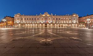


Tournai

Tournai is a Walloon city and municipality of Belgium located 85 kilometres southwest of Brussels, on the river Scheldt, in the province of Hainaut.
Along with Tongeren, Tournai is the oldest city in Belgium and it has played an important role in the country's cultural history.
Tournai, known as Tornacum, was a place of minor importance in Roman times, a stopping place where the Roman road from Cologne on the Rhine to Boulogne on the coast crossed the river Scheldt. It was fortified under Roman Emperor Maximian in the third century, when the Roman border defence was withdrawn to the string of outposts along the road. It came into the possession of the Salian Franks in 432. Under king Childeric I, who was buried or reburied there, Tournai was the capital of the Frankish empire. In 486, Clovis moved the center of power to Paris. In turn, a native son of Tournai, Eleutherius, became bishop of the newly created bishopric of Tournai, extending over most of the area west of the Scheldt. In 862 Charles the Bald, first king of Western Francia and still to become Holy Roman Emperor, would make Tournai the seat of the County of Flanders.

After the partition of the Frankish empire by the Treaties of Verdun (843) and of Meerssen (870), Tournai remained in the western part of the empire, which in 987 became France. The city participated in eleventh-century rise of towns in the Low Countries, with a woollen cloth industry based on English wool, which soon made it attractive to wealthy merchants. An ambitious rebuilding of the cathedral was initiated in 1030. The commune's drive for independence from the local counts succeeded in 1187, and the city was henceforth directly subordinated to the French Crown, as the seigneurie de Tournaisis, as the city's environs are called. The stone Pont des Trous over the Scheldt, with defensive towers at either end, was built in 1290, replacing an earlier wooden structure.
During the 15th century, the city's textile trade boomed and it became an important supplier of tapestry. The art of painting flourished too: Jacques Daret, Robert Campin and Rogier van der Weyden all came from Tournai. It was conquered in 1513 by Henry VIII of England, making it the only Belgian city ever to have been ruled by England. It was also represented in the 1515 Parliament of England. The city was handed back to French rule in 1519.
During the 15th century, the city's textile trade boomed and it became an important supplier of tapestry. The art of painting flourished too: Jacques Daret, Robert Campin and Rogier van der Weyden all came from Tournai. It was conquered in 1513 by Henry VIII of England, making it the only Belgian city ever to have been ruled by England. It was also represented in the 1515 Parliament of England. The city was handed back to French rule in 1519.

In 1521, Emperor Charles V added the city to his possessions in the Low Countries, leading to a period of religious strife and economic decline. During the 16th century, Tournai was a bulwark of Calvinism, but eventually it was conquered by the Spanish governor of the Low Countries, the Duke of Parma, following a prolonged siege in 1581. After the fall of the city, its Protestant inhabitants were given one year to sell their possessions and emigrate, a policy that was at the time considered relatively humane, since very often religious opponents were simply massacred.
One century later, in 1668, the city briefly returned to France under Louis XIV in the Treaty of Aachen. After the end of the War of Spanish Succession in 1713, under terms of the Treaty of Utrecht the former Spanish Netherlands, including Tournai, came into possession of the Austrian Habsburgs. From 1815 on, following the Napoleonic Wars, Tournai formed part of the United Netherlands and after 1830 of newly independent Belgium. Badly damaged in 1940, Tournai has since been carefully restored.
One century later, in 1668, the city briefly returned to France under Louis XIV in the Treaty of Aachen. After the end of the War of Spanish Succession in 1713, under terms of the Treaty of Utrecht the former Spanish Netherlands, including Tournai, came into possession of the Austrian Habsburgs. From 1815 on, following the Napoleonic Wars, Tournai formed part of the United Netherlands and after 1830 of newly independent Belgium. Badly damaged in 1940, Tournai has since been carefully restored.

Tournai’s Top 5:
- The Cathedral of Our Lady is Roman Catholic church, see of the Diocese of Tournai. It has been classified both as a Wallonia's major heritage since 1936 and as a World Heritage Site since 2000. There was a diocese centered at Tournai from the late 6th century and this structure of local blue-gray stone occupies rising ground near the south bank of the Scheldt, which divides the city of Tournai into two roughly equal parts. Begun in the 12th century on even older foundations, the building combines the work of three design periods with striking effect, the heavy and severe character of the Romanesque nave contrasting remarkably with the Transitional work of the transept and the fully developed Gothic of the choir. The transept is the most distinctive part of the building, with its cluster of five bell towers and apsidal (semicircular) ends.
- The belfry of Tournai is a freestanding bell tower of medieval origin, 72 metres in height with a 256-step stairway. This landmark building is one of a set of belfries of Belgium and France registered on the UNESCO World Heritage List. Construction of the belfry began around 1188 when King Philip Augustus of France granted Tournai its town charter, conferring among other privileges the right to mount a communal bell to ring out signals to the townsfolk. The tower in its original form was evocative of the feudal keep, with a square cross section and crenelated parapet. It served in part as a watchtower for spotting fires and enemies. The growing city saw fit to expand the belfry in 1294, raising it by an additional stage, and buttressing its corners with four polygonal towerlets. A soldier statue was placed atop each towerlet, and a dragon icon surmounted the entire structure. The dragon, symbol of power and vigilance, also adorns other old tower tops in Belgium, including those of the Cloth Hall of Ypres and the belfry of Ghent.
- The Museum of Fine Arts. Inaugurated on Sunday 17th June 1928, the Museum of Fine Arts is a building created by the genius for spatial conception, Belgian great Art Nouveau architect Victor Horta. He conceived it especially for presenting the very rich collections bequeathed to the city by the Brussels mecenas Henri Van Cutsem, deceased in 1904. The combinaition of the rooms that radiate from the central polygonal entrance hall is so original that the building itself deserves a visit. The collections shown include many ancient paintings, which added to the works bequeathed by Henri Van Cutsem, together with purchases, deposits, gifts and legacies, permit to offer the visitors an interesting overvieuw of the pictorial production history from the 15th century up to now.
- Tournai Town Hall Before 1940, the accesses of the Town Hall contained some visible vestiges of the Gothic cloister erected in around 1500 by Abbot Jean le Flameng and a garden that was open towards the municipal park. The deambulatory of the cloister’s only remaining wing was adulterated by the addition of a floor and by the obstruction of its ogival bays by bricks and bars, as well as by its division into administrative offices.
After the Second World War, the restoration of the building gave the deambulatory back all of its imposing presence with its brick and stone vaults and enabled its original Gothic appearance to be returned to it. One can still admire, on one of the keystones, Jean le Flameng’s coat of arms. - The Pont des Trous is one of the country’s most prestigious monuments of mediaeval military architectural remains. This former aqueduct belonged to the second municipal precinct and defended the Scheldt with its enormous grids. The architectural structure includes two towers: The one known as The Bourdiel (1281) on left bank and the other, known as The Thieulerie, on the right bank (1302-1304). The curtain wall is perforated with bays and arrow-slits. This bridge has had its fair share of ups and downs. In 1340, an attack on the city by King Edward III of England damaged its pillars. Later, in 1940, the English blew it up. At the time of its reconstruction in 1947, the towers and pillars were elevated by 2.40 metres in order to facilitate the passage of the ships.


Tours

Tours is a city in central France, the capital of the Indre-et-Loire department.
It stands on the lower reaches of the river Loire, between Orléans and the Atlantic coast. Touraine, the region around Tours, is known for its wines, the alleged perfection (as perceived by some speakers) of its local spoken French, and the Battle of Tours in 732. It is also the site of the Paris–Tours road bicycle race. Tours is the largest city in the Centre region of France, although it is not the regional capital, which is the region's second-largest city, Orléans.
In Gallic times the city was important as a crossing point of the Loire. Becoming part of the Roman Empire during the first century AD, the city was named "Caesarodunum" ("hill of Caesar"). The name evolved in the 4th century when the original Gallic name, Turones, became first "Civitas Turonum" then "Tours". It was at this time that the amphitheatre of Tours, one of the five largest in the Empire, was built. Tours became the metropolis of the Roman province of Lugdunum towards 380–388, dominating the Loire Valley, Maine and Brittany. One of the outstanding figures of the history of the city was Saint Martin, second bishop who shared his coat with a naked beggar in Amiens. This incident and the importance of Martin in the medieval Christian West made Tours, and its position on the route of pilgrimage to Santiago de Compostela, a major centre during the Middle Ages.

In the 6th century Gregory of Tours, author of the Ten Books of History, made his mark on the town by restoring the cathedral destroyed by a fire in 561. Saint Martin's monastery benefited from its inception, at the very start of the 6th century from patronage and support from the Frankish king, Clovis, which increased considerably the influence of the saint, the abbey and the city in Gaul. In the 9th century, Tours was at the heart of the Carolingian Rebirth, in particular because of Alcuin abbot of Marmoutier.
In 732 AD, Abdul Rahman Al Ghafiqi and a large army of Muslim horsemen from Al-Andalus advanced 500 km deep into France, and were stopped at Tours by Charles Martel and his infantry igniting the Battle of Tours. The outcome was defeat for the Muslims, preventing France from Islamic conquest. In 845, Tours repulsed the first attack of the Viking chief Hasting (Haesten). In 850, the Vikings settled at the mouths of the Seine and the Loire. Still led by Hasting, they went up the Loire again in 852 and sacked Angers, Tours and the abbey of Marmoutier.
During the Middle Ages, Tours consisted of two juxtaposed and competing centres. The "City" in the east, successor of the late Roman 'castrum', was composed of the archiepiscopal establishment (the cathedral and palace of the archbishops) and of the castle of Tours, seat of the authority of the Counts of Tours (later Counts of Anjou) and of the King of France. In the west, the "new city" structured around the Abbey of Saint Martin was freed from the control of the City during the 10th century (an enclosure was built towards 918) and became "Châteauneuf". This space, organized between Saint Martin and the Loire, became the economic centre of Tours. Between these two centres remained Varenne, vineyards and fields, little occupied except for the Abbaye Saint-Julien established on the banks of the Loire. The two centres were linked during the 14th century. Tours is a good example of a medieval double city.

Tours became the capital of the county of Tours or Touraine, territory bitterly disputed between the counts of Blois and Anjou – the latter were victorious in the 9th century. It was the capital of France at the time of Louis XI, who had settled in the castle of Montils (today the castle of Plessis in La Riche, western suburbs of Tours), Tours and Touraine remained until the 16th century a permanent residence of the kings and court. The rebirth gave Tours and Touraine many private mansions and castles, joined together to some extent under the generic name of the Chateaux of the Loire. It is also at the time of Louis XI that the silk industry was introduced – despite difficulties, the industry still survives to this day.


The recent history of Tours is marked by the personality of Jean Royer, who was Mayor for 36 years and helped to save the old town from demolition by establishing one of the first Conservation Areas. This example of conservation policy would later inspire the Malraux Law for the safeguarding of historic city centres. In the 1970s, Jean Royer also extended the city to the south by diverting the course of the River Cher to create the districts of Rives du Cher and des Fontaines; at the time, this was one of the largest urban developments in Europe.

Charles IX passed through the city at the time of his royal tour of France between 1564 and 1566, accompanied by the Court and various noblemen: his brother the Duke of Anjou, Henri de Navarre, the cardinals of Bourbon and Lorraine. At this time, the Catholics returned to power in Angers: the intendant assumed the right to nominate the aldermen. The Massacre of Saint-Barthelemy was not repeated at Tours. The Protestants were imprisoned by the aldermen – a measure which prevented their extermination. The permanent return of the Court to Paris and then Versailles marked the beginning of a slow but permanent decline. Guillaume the Metayer (1763–1798), known as Rochambeau, the well known counter-revolutionary chief of Mayenne, was shot there on Thermidor 8, year VI.
The city was greatly affected by the First World War. A force of 25,000 American soldiers arrived in 1917, setting up textile factories for the manufacture of uniforms, repair shops for military equipment, munitions dumps, an army post office and an American military hospital at Augustins. Thus Tours became a garrison town with a resident general staff. The American presence is remembered today by the Woodrow Wilson bridge over the Loire, which was officially opened in July 1918 and bears the name of the man who was President of the USA from 1912 to 1920. Three American air force squadrons, including the 492nd, were based at the Parçay-Meslay airfield, their personnel playing an active part in the life of the city. Americans paraded at funerals and award ceremonies for the Croix de Guerre; they also took part in festivals and their YMCA organised shows for the troops. Some men married girls from Tours.

Tours was also marked by the Second World War. In 1940, the city suffered massive destruction and for four years it was a city of military camps and fortifications. From 10–13 June 1940, Tours was the temporary seat of the French government before its move to Bordeaux. German incendiary bombs caused a huge fire which blazed out of control from 20–22 June and destroyed part of the city centre. Some architectural masterpieces of the 16th and 17th centuries were lost, as was the monumental entry to the city. The Wilson Bridge (known locally as the 'stone bridge'), carried a water main which supplied the city; the bridge was dynamited to slow the progress of the German advance. With the water main severed and unable to extinguish the inferno, the inhabitants had no option but to flee to safety. More heavy air raids devastated the area around the railway station in 1944 causing several hundred deaths.

A plan for the rebuilding of the downtown area drawn up by the local architect Camille Lefèvre was adopted even before the end of the war. The plan was for 20 small quadrangular blocks of housing to be arranged around the main road (la rue Nationale), which was widened. This regular layout attempted to echo, yet simplify, the 18th century architecture. Pierre Patout succeeded Lefèvre as the architect in charge of rebuilding in 1945. At one time there was talk of demolishing the southern side of the rue Nationale in order to make it in keeping with the new development.
The recent history of Tours is marked by the personality of Jean Royer, who was Mayor for 36 years and helped to save the old town from demolition by establishing one of the first Conservation Areas. This example of conservation policy would later inspire the Malraux Law for the safeguarding of historic city centres. In the 1970s, Jean Royer also extended the city to the south by diverting the course of the River Cher to create the districts of Rives du Cher and des Fontaines; at the time, this was one of the largest urban developments in Europe.

Tours’ Top 5:
- Saint Gatien's Cathedral is the Roman Catholic cathedral church of the Tours diocese and the metropolitan cathedral of the Tours ecclesiastic province. Saint-Gatien's Cathedral was built between 1170 and 1547. At the time construction began, it was located at the south end of the bridge over the Loire, on the road from Paris to the south-west of France. It has been a classified Monument historique since 1862.
- The Basilique de St-Martin The new Basilique de St-Martin is neo-Byzantine in style and is much smaller than its great medieval predecessor. Next to it stand the only remains of the Romanesque basilica: the Tour de Charlemagne and the western clock tower. The relics and shrine to St. Martin are in the basilica's crypt, the walls of which are carved with hundreds of votive prayers dedicated to the saint. In December 1860, excavations located the site of St. Martin's tomb, of which some fragments were discovered. A new basilica to house these relics was constructed by Mgr Meignan, Archbishop of Tours, from 1886-1924. Martin's tomb is still a place of pilgrimage for the faithful.
- The Musée des beaux-arts de Tours is located in the bishop's former palace, near the cathedral St. Gatien, where it has been since 1910. It displays rich and varied collections, including that of painting which is one of the first in France both in quality and the diversity of the works presented. The museum has over 12,000 works but only 1,000 are on show to the public. On the ground floor, the museum has a room especially dedicated to Tours art of the fifteenth and sixteenth centuries. The museum was classified as a monument historique on 27 June 1983.
- Pont Wilson. Crossing the River Loire, is the elegant Pont Wilson. Known locally as the pont de pierre (stone bridge), it is an exact replica of the original 18th century bridge which collapsed in a flood in 1978. It had previously been repaired after serious damage in the Second World War. On the opposite bank from Tours city centre are four pavilions arranged in a semi-circle to create a small plaza.
- The Château de Tours Built in the 11th century, the building displayed an architecture of the Carolingian period, and was the residence of the Lords of France. Until the 2000s, the Royal Castle of Tours was used as an aquarium where about 1,500 fish of 200 different species could be seen. It also served as Grévin museum. The castle was classified as monument historique on 20 August 1913. Currently, the building houses contemporary exhibitions of paintings and photographs, including works by Joan Miró, Daniel Buren, Nadar, and the workshop of Tours history where archeological and historical documents, models, audio-visual films on the history of Tours, etc., are shown.


Trier

Trier, historically called in English Treves, is a city in Germany on the banks of the Moselle. It is the oldest city in Germany, founded in or before 16 BC. Trier lies in a valley between low vine-covered hills of ruddy sandstone in the west of the state of Rhineland-Palatinate, near the border with Luxembourg and within the important Mosel wine region.
The city is the oldest seat of a Christian bishop north of the Alps. In the Middle Ages, the Archbishop of Trier was an important prince of the church, as the Archbishopric of Trier controlled land from the French border to the Rhine. The Archbishop also had great significance as one of the seven electors of the Holy Roman Empire.

According to the legendarium recorded in the 12th-century Gesta Treverorum, the city was founded by an eponymous otherwise unrecorded Trebeta, an Assyrian prince, placing the city's founding legend centuries before and independently of ancient Rome: a medieval inscription on the facade of the Red House in Trier market,
ANTE ROMAM TREVIRIS STETIT ANNIS MILLE TRECENTIS.PERSTET ET ÆTERNA
PACE FRVATVR. AMEN.
"Thirteen hundred years before Rome, Trier stood / may it stand on and enjoy eternal peace, amen," reflects the proud city tradition. Further embroidery in the monkish Gesta made of Trebeta the son of Ninus, a "King of Assyria" imagined by the ancient Greeks, by a wife prior to his marriage to the equally non-historical Queen Semiramis. His stepmother, Semiramis, despised him and when she took over the kingdom after the death of his father, Ninus, Trebeta left Assyria and went to Europe. After wandering for a time, he led a group of colonizers to the site of Trier. Upon his death, his body was cremated on Petrisberg by the people of Trier. The image of "Trebeta" became an icon of the city during the Middle Ages.
In historical time, the Roman Empire subdued the Treveri in the 1st century BC and established Augusta Treverorum (Lit: August (Regal, noble) [City] of the Treveri) in 30 BC. The name is likely to be taken from the title Augustus held by the Princeps or head of state at the time, Augustus Caesar. The city later became the capital of the Roman province of Gallia Belgica, as well as the Roman prefecture of Gaul. It covered 282 ha within its walls and may have had as many as 70,000 inhabitants. The Porta Nigra is counted among the Roman architecture of the city. A residence of the Western Roman Emperor, Roman Trier was the birthplace of Saint Ambrose. Sometime between 395 and 418 the Roman administration moved the staff of Pretorian Prefecture from the city to Arles. The city continued to be inhabited, but was not as prosperous as before, because of the absence of 2,000 staff members of the Prefecture and military. However, the city remained the seat of a governor and had state factories for the production of ballistae and armor, and a wool mill for uniforms for the troops, clothing for the civil service and high-quality garments for the Court. Northern Gaul was held by the Romans along a line from north of Cologne to the coast at Boulogne through what is today southern Belgium until 460. South of this line, Roman control was firm, as evidenced by the continuing operation of the imperial arms factory at Amiens.
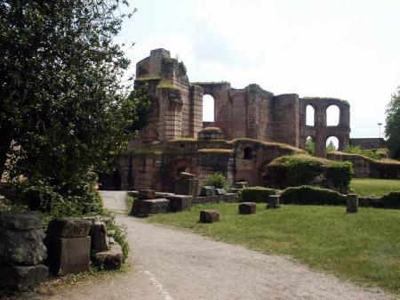
The Franks seized Trier from Roman administration in 459 AD. In 870, it became part of Eastern Francia, which developed into the Holy Roman Empire. Relics of Saint Matthias brought to the city initiated widespread pilgrimages. The bishops of the city grew increasingly powerful and the Archbishopric of Trier was recognized as an electorate of the empire, one of the most powerful states of Germany. The University of Trier was founded in the city in 1473.
In the 17th century, the Archbishops and Prince-Electors of Trier relocated their residences to Philippsburg Castle in Ehrenbreitstein, near Koblenz. A session of the Reichstag was held in Trier in 1512, during which the demarcation of the Imperial Circles was definitively established.
In the 17th and 18th centuries, Trier was sought after by France, who invaded during the Thirty Years' War, the War of the Grand Alliance, the War of the Spanish Succession, and the War of the Polish Succession. France succeeded in finally claiming Trier in 1794 during the French Revolutionary Wars, and the electoral archbishopric was dissolved. After the Napoleonic Wars ended in 1815, Trier passed to the Kingdom of Prussia. Karl Marx was born in the city in 1818.
In the 17th and 18th centuries, Trier was sought after by France, who invaded during the Thirty Years' War, the War of the Grand Alliance, the War of the Spanish Succession, and the War of the Polish Succession. France succeeded in finally claiming Trier in 1794 during the French Revolutionary Wars, and the electoral archbishopric was dissolved. After the Napoleonic Wars ended in 1815, Trier passed to the Kingdom of Prussia. Karl Marx was born in the city in 1818.
As part of the Prussian Rhineland, Trier developed economically during the 19th century. The city rose in revolt during the revolutions of 1848 in the German states, although the rebels were forced to concede. It became part of the German Empire in 1871.
In June 1940 over 60,000 British prisoners of war, captured at Dunkirk and Northern France, were marched to Trier, which became a staging post for British soldiers headed for German prisoner-of-war camps. Trier was heavily bombed and bombarded in 1944 during World War II. The city became part of the new state of Rhineland-Palatinate after the war. The university, dissolved in 1797, was restarted in the 1970s, while the Cathedral of Trier was reopened in 1974. Trier officially celebrated its 2,000th anniversary in 1984.
In June 1940 over 60,000 British prisoners of war, captured at Dunkirk and Northern France, were marched to Trier, which became a staging post for British soldiers headed for German prisoner-of-war camps. Trier was heavily bombed and bombarded in 1944 during World War II. The city became part of the new state of Rhineland-Palatinate after the war. The university, dissolved in 1797, was restarted in the 1970s, while the Cathedral of Trier was reopened in 1974. Trier officially celebrated its 2,000th anniversary in 1984.

Trier’s Top 5:
- The Cathedral of Saint Peter is the oldest cathedral in Germany. The edifice is notable for its extremely long life span under multiple different eras each contributing some elements to its design, including the center of the main chapel being made of Roman brick laid under the direction of Saint Helen, resulting in a cathedral added on to gradually rather than rebuilt in different eras. Its dimensions, 112.5 by 41 m, make it the largest church structure in Trier. Since 1986 it has been on the UNESCO list of World Heritage Sites. The structure is raised upon the foundations of Roman buildings of Augusta Treverorum. Following the conversion of the Emperor Constantine the Bishop Maximin of Trier (329-346) coordinated the construction of the grandest ensemble of ecclesiastical structures in the West outside Rome: on a groundplan four times the area of the present cathedral no less than four basilicas, a baptistery and outbuildings were constructed; the four piers of the crossing formed the nucleus of the present structure. The fourth century structure was left in ruins by the Franks and rebuilt. Normans destroyed the structure again in 882. Under Bishop Egbert the Dom was restored once more.
- The Porta Nigra (Latin for black gate) is a large Roman city gate in Trier. It is today the largest Roman city gate north of the Alps and has been designated a World Heritage Site. The name Porta Nigra originated in the Middle Ages due to the darkened color of its stone; the original Roman name has not been preserved. Locals commonly refer to the Porta Nigra simply as Porta. The Porta Nigra was built in grey sandstone between 186 and 200 AD. The original gate consisted of two four-storied towers, projecting as near semicircles on the outer side. A narrow courtyard separated the two gate openings on either side. For unknown reasons, however, the construction of the gate remained unfinished. For example, the stones at the northern (outer) side of the gate were never abraded, and the protruding stones would have made it impossible to install movable gates. Nonetheless, the gate was used for several centuries until the end of the Roman era in Trier.
- St. Matthias' Abbey is a Benedictine monastery in Trier. The abbey church, a Romanesque basilica, is a renowned place of pilgrimage because of the tomb of Saint Matthias the Apostle, after whom the abbey is named, located here since the 12th century, and the only burial of an apostle in Germany and north of the Alps. The abbey was originally named after Saint Eucharius, first Bishop of Trier, whose tomb is in the crypt. The church has been given the status of a basilica minor.
- The Basilica of Constantine. or Aula Palatina, is a Roman palace basilica that was built by the emperor Constantine (306–337 AD) at the beginning of the 4th century.
Today it is owned and used as church by a congregation within the Evangelical Church in the Rhineland. The basilica contains the largest extant hall from antiquity ranked a World Heritage Site. The room has a length of 67 m, a width of 26.05 m and a height of 33 m. The Aula Palatina was built around 310 AD as a part of the palace complex. Originally it was not a free standing building, but had other smaller buildings (such as a forehall, an entrance vestibule and some service buildings) attached to it. The Aula Palatina was equipped with a floor and wall heating system (hypocaust). During the Middle Ages, it was used as the residence for the bishop of Trier. For that, the apse was redesigned into living quarters and pinnacles were added to the top of its walls. In the 17th century, the archbishop Lothar von Metternich constructed his palace just next to the Aula Palatina and incorporating it into his palace some major redesign was done. Later in the 19th century, Frederick William IV of Prussia ordered the building to be restored to its original Roman state, which was done under the supervision of the military architect Carl Schnitzler. In 1856, the Aula Palatina became a Protestant church. In 1944, the building burned due to an air raid of the allied forces during World War II. When it was repaired after the war, the historical inner decorations from the 19th century were not reconstructed, so that the brick walls are visible from the inside as well. - The Roman Bridge is an ancient structure over the Mosel. It is the oldest standing bridge in the country. The nine bridge pillars date from the 2nd century AD. The upper part was renewed twice, in the early 12th and in the early 18th century, after suffering destruction in war.


References: http://www.trier-info.de/english/index
Trieste

Trieste is a city and seaport in northeastern Italy. It is situated towards the end of a narrow strip of land lying between the Adriatic Sea and Italy's border with Slovenia, which lies almost immediately south and east of the city. Trieste is located at the head of the Gulf of Trieste and throughout history it has been influenced by its location at the crossroads of Germanic, Latin and Slavic cultures. It is the capital of the autonomous region Friuli-Venezia Giulia and Trieste province.
Originally an Illyrian settlement the town was later captured by the Carni. From 177 BC Tergeste was under the Romans. It was granted the status of colony under Julius Caesar, who recorded its name as Tergeste in his Commentarii de bello Gallico (51 BC). During Roman times, Tergeste was defined an "Illyrian city" by Artemidorus of Ephesus, a Greek geographer, and "Carnic" by Strabo.

After two centuries of war against the nearby major power, the Republic of Venice (which occupied it briefly from 1369 to 1372), the main citizens of Trieste petitioned Leopold III of Habsburg, Duke of Austria to become part of his domains. The agreement of cessation was signed in October 1382, in St. Bartholomew's church in the village of Šiška, today one of the city quarters of Ljubljana. The citizens, however, maintained a certain degree of autonomy up until the 17th century.
Following an unsuccessful Habsburg invasion of Venice in the prelude to the War of the League of Cambrai, the Venetians occupied Trieste again in 1508, and under the terms of the peace were allowed to keep the city. The Habsburg Empire recovered Trieste a little over one year later, however, when conflict resumed.
Trieste became an important port and trade hub. In 1719, it was made a free port within the Habsburg Empire by Emperor Charles VI, and remained a free port until 1 July 1891. The reign of his successor, Maria Theresa of Austria, marked the beginning of a flourishing era for the city.
Trieste was occupied by French troops three times during the Napoleonic Wars, in 1797, 1805 and in 1809. Between 1809 and 1813, it was annexed to the Illyrian Provinces, interrupting its status of free port and losing its autonomy. The municipal autonomy was not restored after the return of the city to the Austrian Empire in 1813. Following the Napoleonic Wars, Trieste continued to prosper as the Free Imperial City of Trieste (Reichsunmittelbare Stadt Triest), a status that granted economic freedom, but limited its political self-government. With the introduction of the constitutionalism in the Austrian Empire in 1860, the municipal autonomy of the city was restored, with Trieste became capital of the Adriatisches Küstenland, the Austrian Littoral region.
Together with Trento, Trieste was a main focus of the irredentist movement, which aimed for the annexation to Italy of all the lands they claimed were inhabited by an Italian speaking population. Many local Italians enrolled voluntarily in the Royal Italian Army (a notable example is the writer Scipio Slataper).
After the end of World War I, the Austro-Hungarian Empire dissolved, and many of its border areas, including the Austrian Littoral, were disputed among its successor states. On November 3, 1918, the Armistice of villa Giusti was signed ending hostilities between Italy and Austria-Hungary. Trieste was occupied by the Italian Army (warmly welcomed by the Italian portion of the local population) after the Austro-Hungarian troops had been ordered to lay down their arms, a day before the Armistice was due to enter into effect, effectively allowing the Italians to claim the region had been taken before the cessation of hostilities (a similar situation occurred in South Tyrol). Trieste was officially annexed to the Kingdom of Italy only with theTreaty of Rapallo in 1920. Immediately a policy of "deslavification" started with the Italianisation of the Slovene toponyms. The region reorganized under a new administrative unit, known as the Julian March (Venezia Giulia).
Following an unsuccessful Habsburg invasion of Venice in the prelude to the War of the League of Cambrai, the Venetians occupied Trieste again in 1508, and under the terms of the peace were allowed to keep the city. The Habsburg Empire recovered Trieste a little over one year later, however, when conflict resumed.
 |
Trieste was occupied by French troops three times during the Napoleonic Wars, in 1797, 1805 and in 1809. Between 1809 and 1813, it was annexed to the Illyrian Provinces, interrupting its status of free port and losing its autonomy. The municipal autonomy was not restored after the return of the city to the Austrian Empire in 1813. Following the Napoleonic Wars, Trieste continued to prosper as the Free Imperial City of Trieste (Reichsunmittelbare Stadt Triest), a status that granted economic freedom, but limited its political self-government. With the introduction of the constitutionalism in the Austrian Empire in 1860, the municipal autonomy of the city was restored, with Trieste became capital of the Adriatisches Küstenland, the Austrian Littoral region.
 |
| Miramar Castle |
The union to Italy, however, brought a loss of importance to the city, as the new state border deprived it of its former hinterland. The Slovene ethnic group (around 25% of the population according to the 1910 census) suffered persecution by rising Italian Fascism. The period of violent persecution of Slovenes began with riots in April 13, 1920, which were organized as a retaliation for the assault on Italian occupying troops in Split by the local Croatian population. Many Slovene-owned shops and buildings were destroyed during the riots, which culminated when a group of Italian Fascists, led by Francesco Giunta, burned down the Narodni dom ("National House"), the community hall of Trieste's Slovenes.
After the emergence of the Fascist regime in 1922, an official policy of Italianization continued. Public use of the Slovene language was prohibited, by 1927 all Slovene associations were dissolved, while names and surnames of Slavic and German origin were Italianized by the end of 1930.
 Several artistic and intellectual subcultures continued to swarm even under the repressive Fascist regime. In the 1920s, the city was home to an important avant-gardist movement in visual arts, centered around the futurist Tullio Crali and the constructivist Avgust Černigoj. In the same period, Trieste consolidated its role as one of the centres of modern Italian literature, with authors such as Umberto Saba, Biagio Marin, Giani Stuparich, and Salvatore Satta. Among the non-Italian authors and intellectuals that remained in Trieste, the most notable were the Austrian Julius Kugy and the Slovene Boris Pahor. Intellectuals were frequently associated with Caffè San Marco, a cafè in the city still open today.
With the invasion and occupation of Yugoslavia in April 1941, World War Two came close to Trieste. Starting from the winter of 1941, the first Yugoslav partisan units appeared in Trieste province, although the resistance movement did not reach the city itself until late 1943.
After the Italian armistice in September 1943, the city was occupied by German troops. Trieste became nominally part of the newly constituted Italian Social Republic, but it was de facto ruled by Nazi Germany: the Nazis created the Operation Zone of the Adriatic Littoral out of former Italian north-eastern regions, with Trieste as the administrative center. The new administrative entity was headed by Friedrich Rainer. Under the Nazi occupation, the only concentration camp with a crematorium on Italian soil was built in a suburb of Trieste, at the Risiera di San Sabba, on 4 April 1944. Around 3,000 Jews, South Slavs and Italian anti Fascists were killed in the Risiera, while thousands of others were imprisoned before being transferred to other concentration camps.
 The city saw intense Italian and Yugoslav partisan activity, and suffered from Allied bombings. The city's Jewish community was deported to extermination camps, where most of them died.
On April 30, 1945, the Italian anti-Fascist National Liberation Committee (Comitato di Liberazione Nazionale, or CLN) of don Marzari and Savio Fonda, constituted of approximately 3,500 volunteers, incited a riot against the German occupiers. On May 1, Allied forces of the Yugoslav Partisans' 8th Dalmatian Corps arrived and took over most of the city, except for the courts and the castle of San Giusto, where the German garrisons refused to surrender to any force other than New Zealanders. The 2nd New Zealand Division continued to advance towards Trieste along Route 14 around the northern coast of the Adriatic sea and arrived in the city the next day. The German forces capitulated on the evening of May 2, but were then turned over to the Yugoslav forces.
The Yugoslavs held full control of the city until June 12, a period known in the Italian historiography as the "forty days of Trieste".During this period, hundreds of local Italians and anti-Communist Slovenes were arrested by the Yugoslav authorities, and many of them disappeared. These included former Fascists and Nazi collaborators, but also Italian nationalists, and any other real or potential opponents of Yugoslav Communism. Some were interned in Yugoslav concentration camps (in particular at Borovnica, Slovenia), while others were murdered and thrown into the potholes ("foibe") on the Karst plateau.
 After an agreement between the Yugoslav leader Josip Broz Tito and the British Field Marshal Harold Alexander, the Yugoslav forces withdrew from Trieste, which came under a joint British-U.S. military administration. The Julian March was divided between Anglo-American and Yugoslav military administration until September 1947, when the Paris Peace Treaty established the Free Territory of Trieste.
In 1947, Trieste was declared an independent city state under the protection of the United Nationsas the Free Territory of Trieste. The territory was divided into two zones, A and B, along the Morgan Line, established in 1945.
From 1947 to 1954, the A Zone was governed by the Allied Military Government, composed of the American "Trieste United States Troops" (TRUST), commanded by Major General Bryant E. Moore, the commanding general of the American 88th Infantry Division, and the "British Element Trieste Forces" (BETFOR), commanded by Sir Terence Airey, who were the joint forces commander and also the military governors. Zone A covered almost the same area of the current Italian Province of Trieste, except for four small villages south of Muggia, which were given to Yugoslavia after the dissolution of the Free Territory in 1954. Zone B, which remained under the military administration of the Yugoslav People's Army, was composed of the north-westernmost portion of the Istrian peninsula, between the river Mirna and the Debeli Rtič cape.
In 1954, the Free Territory of Trieste was dissolved. The vast majority of Zone A, including the city of Trieste, was ceded to Italy. Zone B became part of Yugoslavia, along with four villages from the Zone A and was divided among the Socialist Republic of Slovenia and Croatia. The annexation of Trieste to Italy was officially announced on 26 October 1954, and was welcomed by the majority of the Trieste population.
The final border line with Yugoslavia, and the status of the ethnic minorities in the areas, was settled in 1975 with the Treaty of Osimo. This line is now the border between Italy and Slovenia.
.jpg)
After the emergence of the Fascist regime in 1922, an official policy of Italianization continued. Public use of the Slovene language was prohibited, by 1927 all Slovene associations were dissolved, while names and surnames of Slavic and German origin were Italianized by the end of 1930.

With the invasion and occupation of Yugoslavia in April 1941, World War Two came close to Trieste. Starting from the winter of 1941, the first Yugoslav partisan units appeared in Trieste province, although the resistance movement did not reach the city itself until late 1943.
After the Italian armistice in September 1943, the city was occupied by German troops. Trieste became nominally part of the newly constituted Italian Social Republic, but it was de facto ruled by Nazi Germany: the Nazis created the Operation Zone of the Adriatic Littoral out of former Italian north-eastern regions, with Trieste as the administrative center. The new administrative entity was headed by Friedrich Rainer. Under the Nazi occupation, the only concentration camp with a crematorium on Italian soil was built in a suburb of Trieste, at the Risiera di San Sabba, on 4 April 1944. Around 3,000 Jews, South Slavs and Italian anti Fascists were killed in the Risiera, while thousands of others were imprisoned before being transferred to other concentration camps.
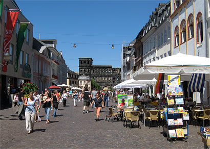
On April 30, 1945, the Italian anti-Fascist National Liberation Committee (Comitato di Liberazione Nazionale, or CLN) of don Marzari and Savio Fonda, constituted of approximately 3,500 volunteers, incited a riot against the German occupiers. On May 1, Allied forces of the Yugoslav Partisans' 8th Dalmatian Corps arrived and took over most of the city, except for the courts and the castle of San Giusto, where the German garrisons refused to surrender to any force other than New Zealanders. The 2nd New Zealand Division continued to advance towards Trieste along Route 14 around the northern coast of the Adriatic sea and arrived in the city the next day. The German forces capitulated on the evening of May 2, but were then turned over to the Yugoslav forces.
The Yugoslavs held full control of the city until June 12, a period known in the Italian historiography as the "forty days of Trieste".During this period, hundreds of local Italians and anti-Communist Slovenes were arrested by the Yugoslav authorities, and many of them disappeared. These included former Fascists and Nazi collaborators, but also Italian nationalists, and any other real or potential opponents of Yugoslav Communism. Some were interned in Yugoslav concentration camps (in particular at Borovnica, Slovenia), while others were murdered and thrown into the potholes ("foibe") on the Karst plateau.

In 1947, Trieste was declared an independent city state under the protection of the United Nationsas the Free Territory of Trieste. The territory was divided into two zones, A and B, along the Morgan Line, established in 1945.
From 1947 to 1954, the A Zone was governed by the Allied Military Government, composed of the American "Trieste United States Troops" (TRUST), commanded by Major General Bryant E. Moore, the commanding general of the American 88th Infantry Division, and the "British Element Trieste Forces" (BETFOR), commanded by Sir Terence Airey, who were the joint forces commander and also the military governors. Zone A covered almost the same area of the current Italian Province of Trieste, except for four small villages south of Muggia, which were given to Yugoslavia after the dissolution of the Free Territory in 1954. Zone B, which remained under the military administration of the Yugoslav People's Army, was composed of the north-westernmost portion of the Istrian peninsula, between the river Mirna and the Debeli Rtič cape.
In 1954, the Free Territory of Trieste was dissolved. The vast majority of Zone A, including the city of Trieste, was ceded to Italy. Zone B became part of Yugoslavia, along with four villages from the Zone A and was divided among the Socialist Republic of Slovenia and Croatia. The annexation of Trieste to Italy was officially announced on 26 October 1954, and was welcomed by the majority of the Trieste population.
The final border line with Yugoslavia, and the status of the ethnic minorities in the areas, was settled in 1975 with the Treaty of Osimo. This line is now the border between Italy and Slovenia.
.jpg)
Trieste’s Top 5:
- Trieste Cathedral dedicated to Saint Justus, is the cathedral and main church of Trieste. It is the seat of the Bishop of Trieste. The first religious edifice on the site was built in the 6th century. Between the 9th and 11th centuries, two basilicas were erected on the ruins of the old church, the first dedicated to Our Lady of the Assumption and the second, the cathedral, to Saint Justus (San Giusto). The original design of the latter building was subsequently lengthened. In the 14th century the two basilicas were joined by means of the demolition of one nave of either basilica and the construction of a simple asymmetrical façade, dominated by a delicately worked Gothic rose window, as ornate as the new bell tower, using the Romanesque debris stones found on the site and friezes of arms.
- Miramar Castle The Schloß Miramar, on the waterfront 8 km from Trieste, was built between 1856 and 1860 from a project by Carl Junker working under Archduke Maximilian. The Castle gardens provide a setting of beauty with a variety of trees, chosen by and planted on the orders of Maximilian, that today make a remarkable collection. Features of particular attraction in the gardens include two ponds, one noted for its swans and the other for lotus flowers, the Castle annexe ("Castelletto"), a bronze statue of Maximilian, and a small chapel where is kept a cross made from the remains of the "Novara", the flagship on which Maximilian, brother of Emperor Franz Josef, set sail to become Emperor of Mexico. Much later, the castle was also the home of Prince Amedeo, Duke of Aosta, the last commander of Italian forces in East Africa during the Second World War. During the period of the application of the Instrument for the Provisional Regime of the Free Territory of Trieste, as establish in the Treaty of Peace with Italy (Paris 10/02/1947), the castle served as headquarters for the United States Army's TRUST force.
- Grotta Gigante ("Giant Cave"), also known as Riesengrotteor as Grotta di Brisciachi, is a giant cave on the Italian side of the Trieste Carso, in the municipality of Sgonico. Its central cavern is 107 metres (351 ft) high, 65 metres (213 ft) wide and 130 metres (430 ft) long putting it in the 1995 Guinness Book of Records as the world's largest tourist cave. The cave contains many large stalactites and stalagmites, many of exceptional beauty. A feature of the stalagmites is their "dish-pile" appearance, formed by water dropping from up to 80 m (260 ft) above and depositing calcium carbonate over a wide area.
- The Teatro Lirico Giuseppe Verdi is an opera house named after the composer Giuseppe Verdi. Privately constructed, it was inaugurated as the Teatro Nuovo to replace the smaller 800-seat "Cesareo Regio Teatro di San Pietro" on 21 April 1801 with a performance of Johann Simon Mayr's Ginevra di Scozia. Initially, the Nuovo had 1,400 seats.
- The Roman theatre lies at the foot of the San Giusto hill, facing the sea. The construction partially exploits the gentle slope of the hill, and much of the theatre is made of stone. The topmost portion of the amphitheatre steps and the stage were supposedly made of wood. The statues that adorned the theatre, brought back to light in the 1930s, are now preserved at the Town Museum. Three inscriptions from the Trajan period mention a certain Q. Petronius Modestus, someone closely connected to the development of the theatre, which was erected during the second half of the 1st century.


Trondheim

Trondheim, historically, Nidaros and Trondhjem, is a city and municipality in Sør-Trøndelag county, Norway. With a population of 177,258, it is the third most populous municipality in Norway and city in the country, although the fourth largest urban area. It is the administrative centre of Sør-Trøndelag county. Trondheim lies on the south shore of the Trondheimsfjord at the mouth of the river Nidelva.
 Trondheim was named Kaupangen (English: market place or trading place) by Viking King Olav Tryggvason in 997. Fairly soon, it came to be called Nidaros. In the beginning it was frequently used as a military retainer of King Olav. It was frequently used as the seat of the king, and was the capital of Norway until 1217.
People have been living in the region for thousands of years as evidenced by the rock carvings in central Norway, the Nøstvet and Lihult cultures and the Corded Ware culture. In ancient times, the Kings of Norway were hailed at Øretinget in Trondheim, the place for the assembly of all free men by the mouth of the river Nidelva. Harald Fairhair (865–933) was hailed as the king here, as was his son, Haakon I – called 'the Good'. The battle of Kalvskinnet took place in Trondheim in 1179: King Sverre Sigurdsson and his Birkebeiner warriors were victorious against Erling Skakke (a rival to the throne). Some scholars believe that the famous Lewis chessmen, 12th century chess pieces carved from walrus ivory found in the Hebrides and now at the British Museum, may have been made in Trondheim.
Trondheim was the seat of the (Catholic) Archdiocese of Nidaros for Norway from 1152. Due to the introduction of Lutheran Protestantism in 1537, the last Archbishop, Olav Engelbrektsson, had to flee from the city to the Netherlands, where he died in present-day Lier, Belgium.
The city has experienced several major fires. Since it was a city of log buildings, made out of wood, most fires caused severe damage. Great fires ravaged the city in 1598, 1651, 1681, 1708, twice in 1717, 1742, 1788, 1841 and 1842; these were only the worst cases. The 1651 fire destroyed 90% of all buildings within the city limits. The fire in 1681 (the "Horneman Fire") led to an almost total reconstruction of the city, overseen by General Johan Caspar von Cicignon, originally from Luxembourg. Broad avenues like Munkegaten were created, with no regard for property rights, in order to stop the next fire. At the time, the city had a population of roughly 8000 inhabitants. After the Treaty of Roskilde on 26 February 1658, Trondheim and the rest of Trøndelag, became Swedish territory for a brief period, but the area was reconquered after 10 months. The conflict was finally settled by the Treaty of Copenhagen on 27 May 1660.
The city has experienced several major fires. Since it was a city of log buildings, made out of wood, most fires caused severe damage. Great fires ravaged the city in 1598, 1651, 1681, 1708, twice in 1717, 1742, 1788, 1841 and 1842; these were only the worst cases. The 1651 fire destroyed 90% of all buildings within the city limits. The fire in 1681 (the "Horneman Fire") led to an almost total reconstruction of the city, overseen by General Johan Caspar von Cicignon, originally from Luxembourg. Broad avenues like Munkegaten were created, with no regard for property rights, in order to stop the next fire. At the time, the city had a population of roughly 8000 inhabitants. After the Treaty of Roskilde on 26 February 1658, Trondheim and the rest of Trøndelag, became Swedish territory for a brief period, but the area was reconquered after 10 months. The conflict was finally settled by the Treaty of Copenhagen on 27 May 1660.
 |
| Gamle Bybro -The Old Town Bridge |
Following the example set by the renaming of the capital Kristiania to Oslo, Nidaros was reintroduced as the official name of the city for a brief period from 1 January 1930 until 6 March 1931. The name was restored in order to reaffirm the city's link with its glorious past, despite the fact that a 1928 referendum on the name of the city had given this result: 17,163 votes in favour of Trondhjem and 1,508 votes in favour of Nidaros. Public outrage later in the same year, even taking the form of riots, forced the Storting to settle for the medieval city name Trondheim. The name of the diocese was, however, changed from Trondhjem stift to Nidaros bispedømme (English: Diocese of Nidaros) in 1918.
 Shortly during World War II Trondheim has been named Drontheim, as a German exonym.
Historically, Trondheimen indicates the area around the Trondheimsfjord. The spelling Trondhjem was officially rejected, but many still prefer that spelling of the city's name. Today, most natives still refer to the city as Trånnjæmm.
Most of the downtown area of Trondheim is scattered with small specialty stores and shops, however a considerable part of the downtown shopping area is concentrated around the pedestrianized streets Nordre gate (English: Northern street), Olav Tryggvasons gate and Thomas Angells gate even though the rest of the city center also is riddled with everything from old, well established companies to new, hip and trendy shops.
In the mid- to late 1990s, the area surrounding the old drydock and ship construction buildings of the defunct Trondhjems mekaniske Værksted shipbuilding company at the Nedre Elvehavn were renovated and old industrial buildings were torn down to make way for condominiums. A shopping mall was also built, known as Solsiden (The Sunny Side). This is a popular residential and shopping area, especially for young people.

Trondheim’s Top 5:
- Nidaros Cathedral is a Church of Norway cathedral located in the city of Trondheim. It is the traditional location for the consecration of the King of Norway. King Harald was consecrated at Nidaros Cathedral on June 23, 1991. It was the cathedral of the Roman Catholic Archdiocese of Nidaros from its establishment in 1152 until its abolition in 1537. Since the Reformation, it has been the cathedral of the Lutheran bishops of Trondheim (or Nidaros) in the Diocese of Nidaros. The architectural style of the cathedral is Romanesque and Gothic. Historically it was an important destination for pilgrims coming from all of Northern Europe. It is the northernmost medieval cathedral in the world. Work on the cathedral started in 1070 and was finished sometime around 1300. The cathedral was badly damaged by fires in 1327 and again in 1531. The nave west of the transept was destroyed and was not rebuilt until the restoration in early 1900s. In 1708 it burned down completely except for the stone walls. It was struck by lightning in 1719, and was again ravaged by fire. Major rebuilding and restoration of the cathedral started in 1869, initially led by architect Heinrich Ernst Schirmer, and nearly completed by Christian Christie. It was officially completed in 2001. Maintenance of the cathedral is an ongoing process.
- Kristiansten Fortress is located on a hill east of the city. It was built after the city fire of Trondheim in 1681 to protect the city against attack from the east. Construction was finished in 1685. It fulfilled its purpose in 1718 when Swedish forces laid siege against Trondheim. The fortress was decommissioned in 1816 by king Charles XIV John. The fortress was built during the period from 1682 to 1684 and strengthened to a complete defence fortification in 1691 by building an advanced post Kristiandsands bastion in the east and in 1695 with the now vanished Møllenberg skanse by the river Nidelven. These fortifications were encircled by a continuous palisade and thereby connected to the fortified city. In 1750 the fortress was modernized with new bastions and casemates to protect against mortar artillery. Two new isolated defensive works were also built to the east - Grüners and Frølichs redutt - but they are hardly visible today.
- The Old Town Bridge. Known locally as Gamle Bybro, crosses the Nidelva River from the south end of the main street Kjøpmannsgata connecting to the Trondheim neighborhood of Bakklandet. Gamle Bybro was constructed by Johan Caspar von Cicignon in 1681 in conjunction with the reconstruction of Trondheim after the great fire of 1681. Johan Caspar von Cicignon laid out plans for the reconstruction of Trondheim as well as its fortification. The bridge location was of military-strategic significance. King Christian V of Denmark assumed the cost of construction. It was completed in 1685. The bridge was built in the vicinity of the original Elgeseter Bridge. When it was opened the older bridge was allowed to decay and collapse. Since then Gamle Bybro has undergone many changes. Originally Gamle Bybro was constructed of wood, but the wood was supported on three stone piers. In the middle of the bridge, an iron gate was placed. This remained a guarded city gate until 1816. At each end of the bridge there was a toll and guardhouse. The access house on the west end still stands, but that on the east side was taken down in 1824. Gamle Bybro was reconstructed in 1861 by the engineer Carl Adolf Dahl (1828-1907). Today Gamle Bybro is one of Trondheim's characteristic landmarks.
- Stiftsgården is the royal residence in Trondheim. It is centrally situated on the city’s most important thoroughfare, Munkegaten. At 140 rooms constituting 4000 m² (43000 ft²), it is possibly the largest wooden building in Northern Europe, and it has been used by royals and their guests since 1800. It was built 1774–1778 for Cecilie Christine Schøller (1720–1786), the wealthy widow of Stie Tønsberg Schøller (1700–1769), chamberlain and merchant in Trondheim. Through her mother she was descended from some of the most prominent noble families in Denmark. From her father, the army Commander in Chief of central Norway, she inherited a large property in the city centre. When she inherited her husband's large fortune, she commenced the construction of the largest private town house in Trondheim. In 1777 she was given the title of privy counselor. She is a representative of the cultural and commercial growth that Trondheim experienced in the late 18th century, and of the city's strong women in that period. She often traveled abroad and seldom used the palace herself before she died in Copenhagen in 1786. The palace was constructed on the grounds of the former residence of her father, General Johan Friderich Frølich (1681–1757).
- Museum of Natural History and Archaeology is a department of the Norwegian University of Science and Technology with collections and displays related to natural history and cultural history. The archaeological displays show findings from the stone, bronze, iron and viking ages. In addition the museum has a separate display about the development of Trondheim as a city in the middle ages, a display on Sami culture and a display about church art and church inventory until ca. 1700. The natural science sections show birds, fish, mammals, insects, minerals and Northern European nature types nature-environment display. The museum dates back to 1767 when the Royal Norwegian Society of Sciences and Letters (DKNVS) was officially founded.

Kristiansten Fortress


Turin

Turin is a city and major business and cultural centre in northern Italy, capital of the Piedmont region, located mainly on the left bank of the Po River and surrounded by the Alpine arch.
The city has a rich culture and history, and is known for its numerous art galleries, restaurants, churches, palaces, opera houses, piazzas, parks, gardens, theatres, libraries, museums and other venues. Turin is well known for its baroque, rococo, neo-classical, and Art Nouveau architecture. Much of the city's public squares, castles, gardens and elegant palazzi such as Palazzo Madama, were built in the 16th and 18th century, after the capital of the Duchy of Savoy (later Kingdom of Sardinia) was moved to Turin from Chambery ( nowadays France) as part of the urban expansion.

The Taurini were an ancient Celto-Ligurian Alpine people, who occupied the upper valley of the river Po, in the centre of modern Piedmont. In 218 BC, they were attacked by Hannibal since his allies were the Insubres. The Taurini and the Insubres had a long-standing feud. Their chief town (Taurasia) was captured by Hannibal's forces after a three-day siege. As a people they are rarely mentioned in history. It is believed that a Roman colony was established in 27 BC with the name Castra Taurinorum and afterwards Julia Augusta Taurinorum (modern Turin). Both Livy and Strabo speak of the country of the Taurini as including one of the passes of the Alps, which points to a wider use of the name in earlier times.
In the first century BC, probably 28 BC, the Romans created a military camp (Castra Taurinorum), later dedicated to Augustus (Augusta Taurinorum). The typical Roman street grid can still be seen in the modern city, but especially in the neighborhood known as theQuadrilatero Romano. Via Garibaldi traces the exact path of the Decumanus of the Roman City which began at the Porta Decumani which was later incorporated into the Castello or Palazzo Madama. The Porta Palatina, on the north side of the district is still preserved in a park near the Cathedral. Turin reached about 5,000 inhabitants at the time, all living inside the high walls.
After the fall of the Roman Empire, the town was conquered by the Lombards, then the Franks of Charlemagne (773). The Contea di Torino (countship) was founded in the 940s, which was held by the Arduinic dynasty until 1050. After the marriage of Adelaide of Susa with Humbert Biancamano's son Otto, the family of the Counts of Savoy gained control. While the dignity of count was held by the Bishop as count of Turin (1092–1130 and 1136–1191) it was ruled as a prince-bishopric by the Bishops. In 1230–1235 it was a lordship under the Marquess of Montferrat, styled Lord of Turin. At the end of the 13th century, when it was annexed to the Duchy of Savoy, the city already had 20,000 inhabitants. Many of the gardens and palaces were built in the fifteenth century when the city was redesigned. The University of Turin was also founded during this period.

Emmanuel Philibert, known with the nickname "Iron Head", made Turin the capital of the Duchy of Savoy in 1563. Piazza Reale, today named Piazza San Carlo and Via Nuova, today called Via Roma were added with the first enlargement of the walls, in the first half of the 17th century; in the same period the Royal palace (Palazzo Reale) was also built. In the second half of that century, a second enlargement of the walls was planned and executed, with the building of the arcaded Via Po, connecting diagonally Piazza Castello with the bridge on the Po through the regular street grid.
In 1706, during the Battle of Turin, the French besieged the city for 117 days without conquering it. By the Treaty of Utrecht the Duchy of Savoy acquired part of the former Duchy of Milan, including Turin, and the architect Filippo Juvarra began a major redesign of the city. Now the capital of a European kingdom, Turin had about 90,000 inhabitants at the time.
Turin, like the rest of Piedmont, was annexed by the French Empire in 1802. The city thus became seat of the prefecture of Pô department until the fall of Napoleon in 1814, when the Kingdom of Piedmont-Sardinia was restored with Turin as its capital. In the following decades, the Kingdom of Piedmont-Sardinia led the struggle towards the unification of Italy. In 1861, Turin became the capital of the newly proclaimed united Kingdom of Italy until 1865, when the capital was moved to Florence and then to Rome after the conquest of the Papal States in 1870. In 1871, the Fréjus Tunnel was opened, making Turin an important communication node between Italy and France. The city in that period had 250,000 inhabitants. Some of the most iconic landmarks of the city, like the Mole Antonelliana, the Egyptian Museum, the Gran Madre di Dio Church and Piazza Vittorio Veneto were built in this period. The late 1800s were also a period of rapid industrialization, especially in the automotive sector: in 1899 Fiat was established in the city, followed by Lancia in 1906. The Universal Exposition held in Turin in 1902 is often considered the pinnacle of Art Nouveau design, and the city hosted the same event in 1911. By this time, Turin had grown to 430,000 inhabitants.

After the Great War, harsh conditions brought a wave of strikes and workers protests. In 1920 the Lingotto Fiat factory was occupied. The Fascist regime put and end to the social unrest banning trade unions and jailing socialist leaders, notably as Turinese Antonio Gramsci. On the other hand, Benito Mussolini largely subsidized the automotive industry, in order to provide vehicles to the army. Turin was then a target of Allied strategic bombing during World War II, being heavily damaged in its industrial areas by the air raids. The Allied campaign in Italy, that started from the South, slowly moved northwards in the following two years, so leaving northern regions occupied by Germans and collaborationist forces. Turin was not captured by the Allies until the end of Spring Offensive of 1945, and by when the vanguard of the armored reconnaissance units of Brazilian Expeditionary Force reached the city, it was already freed by the Italian Partisans, that had began revolting against the Germans on 25 April 1945. Days later, troops from the U.S. Army's 1st Armored and 92nd Infantry Divisions came to substitute the Brazilian ones.
In the postwar years, Turin was rapidly rebuilt. The city's automotive industry played a pivotal role in the Italian economic miracle of the 1950s and 1960s, attracting to the city hundred of thousands of immigrants, particularly from rural southern regions of Italy. The population soon reached 1 million in 1960 and peaked at almost 1.2 million in 1971. The exceptional growth gained to the city the nickname of "Automobile Capital of Italy" or "Detroit of Italy" (Turin is twinned with Detroit since 1998). In the 1970s and 1980s, the oil and automotive industry crisis severely hit the city, and its population began to sharply decline, losing more than one-fourth of its total in 30 years. The long population decline of the city has begun to reverse itself only in recent years, as the population grew from 865,000 to slightly over 900,000 by the end of the century. In 2006, Turin hosted the Winter Olympic Games.

Turin’s Top 5:
- Turin Cathedral is the major Roman Catholic church of Turin. Dedicated to Saint John the Baptist, it was built during 1491-1498 and it is adjacent to an earlier campanile (1470). The Chapel of the Holy Shroud, the current resting place of the Shroud of Turin, was added to the structure in 1668-1694. The church lies in the place where the theatre of the ancient Roman city was located. The original Christian sacred house included three churches, dedicated to the Holy Saviour, Saint Mary of Dompno (Santa Maria de Dompno) and, the main of three, St. John the Baptist. According to some sources, the latter's consecration was carried on by Agilulf, the Lombard King of northern Italy from 591 to 613. Here, in 662, Garibald, Duke of Torino was assassinated in the church by a follower of Godepert, whose murder Garibald is believed to have had a part in. The three churches were demolished between 1490 and 1492. The new cathedral, again entitled to St. John the Baptist, was begun in 1491 under design of Amedeo de Francisco di Settignano, also known as Meo del Caprino, who finished it in seven years. The bell tower, however, remained the one erected in 1469, which is still visible today. Filippo Juvarra brought some modifications in the 17th century. Pope Leo X officially confirmed it as metropolitan see in 1515.
- The Shroud of Turin or Turin Shroud is a linen cloth bearing the image of a man who appears to have suffered physical trauma in a manner consistent with crucifixion. It is kept in the royal chapel of the Cathedral of Saint John the Baptist. The image on the shroud is commonly associated with Jesus Christ, his crucifixion and burial. It is much clearer in black-and-white negative than in its natural sepia color. The negative image was first observed in 1898, on the reverse photographic plate of amateur photographer Secondo Pia, who was allowed to photograph it while it was being exhibited in the Turin Cathedral.
- The Palatine Gate was the ancient Porta Principalis Dextera which allowed access from the North to Julia Augusta Taurinorum, the roman civitas now known as Turin.
It is the main archaeological evidence of a Roman age town, and one of the best preserved structures from the 1st century BC in the world . Together with the ancient theatre, located a short distance away, it is contained within a Archaeological Park opened in 2006. Built in the 1st century BC during the Augustan Era or Flavia Era, Porta Principalis Dextera may have preceded the construction of the walls and perhaps was built on an earlier port of the Republican era. - Palazzo Madama e Casaforte degli Acaja is a palace in Turin. At the beginning of the first century BC, the site of the palace was occupied by a gate in the Roman walls from which the decumanus maximus of Augusta Taurinorum (the ancient name of Turin) departed. Two of the towers, although restored, still testify to this original nucleus. After the fall of the Western Roman Empire, the gate was used as a fortified stronghold in the defences of the city. The Palazzo Madama houses Turin's Museo Civico d'Arte Antica. The museum has a rare collection of artifacts from Gandhara, coming from the Italian excavations of the IsMEO at the Butkara Stupa in Pakistan.
- The Mole Antonelliana is a major landmark building, named for the architect who built it, Alessandro Antonelli. A mole is a building of monumental proportions. Construction began in 1863, soon after Italian unification, and was completed in 1889, after the architect's death. Originally conceived of as a synagogue, it now houses the Museo Nazionale del Cinema, and is the tallest museum in the world. The Mole appears on the reverse of the two cent Italian euro coins and was the inspiration for the official emblem of the 2006 Winter Olympics, as well as those of the 2005 World Bocce Championships and the 2006 World Fencing Championships. On one side of the four-faced dome, the first Fibonacci numbers are written with red neon lights: they are part of the artistic work Il volo dei Numeri ("Flight of the numbers") by Mario Merz.


Turku

Because of its long history it has been the site of many important events and has extensively influenced Finnish history. Along with Tallinn, the capital city of Estonia, Turku was designated the European Capital of Culture for 2011. In 1996 it was declared the official Christmas City of Finland.

Due to its location, Turku is a notable commercial and passenger seaport with over three million passengers travelling through the Port of Turku each year to Stockholm and Mariehamn.
Turku has a long history as Finland's largest city and occasionally as the administrative center of the country, but has, over the last two centuries, lost both titles to Helsinki. To this day, the city's identity stems from its status as the oldest city in Finland and the country's first capital. Originally, the word "Finland" referred only to the area around Turku (hence the title, "Finland Proper" for the region).
Although archaeological findings in the area date back to the Stone Age, the town of Turku was founded in late 13th century. The Cathedral of Turku was consecrated in 1300, and together with Turku Castle and the Dominican monastery (founded in 1249), established the city as the most important location in medieval Finland.
During the Middle Ages, Turku was the seat of the Bishop of Turku (a title later upgraded to Archbishop of Turku), covering the then eastern half of the Kingdom of Sweden (most of the present-day Finland) until the 17th century. Even if Turku had no official capital status, both the short-lived institutions of Dukes and Governors-General of Finland usually had their Finnish residences there. In the aftermath of the War against Sigismund, the town was the site of the Åbo bloodbath. In 1640, the first university in Finland, The Royal Academy of Turku, was founded in Turku. Turku was also the meeting place for the States of Finland in 1676.
During the Middle Ages, Turku was the seat of the Bishop of Turku (a title later upgraded to Archbishop of Turku), covering the then eastern half of the Kingdom of Sweden (most of the present-day Finland) until the 17th century. Even if Turku had no official capital status, both the short-lived institutions of Dukes and Governors-General of Finland usually had their Finnish residences there. In the aftermath of the War against Sigismund, the town was the site of the Åbo bloodbath. In 1640, the first university in Finland, The Royal Academy of Turku, was founded in Turku. Turku was also the meeting place for the States of Finland in 1676.
 |
| Turku Castle |
After the Finnish War, which ended when Sweden ceded Finland to Imperial Russia at the Treaty of Fredrikshamn in 1809, Turku became briefly the official capital, but soon lost the status to Helsinki, as Emperor Alexander I felt that Turku was too far from Russia and too aligned with Sweden to serve as the capital of the Grand Duchy of Finland. The change officially took place in 1812. The government offices that remained in Turku were finally moved to the new capital after the Great Fire of Turku, which almost completely destroyed the city in 1827. After the fire, a new and safer city plan was drawn up by German architect Carl Ludvig Engel, who had also designed the new capital, Helsinki. Turku remained the largest city in Finland for another twenty years.

As for architecture in the city, both the body of architectural styles as well as the prevalent way of living have experienced significant changes in the 20th century. While having survived relatively intact throughout the years of war 1939-1945, the city faced increasing changes in the 1950's and 1960's due to rising demands for apartments, the eagerness to rebuild and most of all the new developement of infrastructure (especially increased automobile traffic). The wooden one to two-story houses that were the dominant mode of building in the city were mostly demolished in the 50´s and 60´s to both enable more efficient building and to ease car traffic. Sadly, this resulted in the destruction of most that was in later decades seen as beautiful and worth saving. This was, however, the case in most of the cities in Finland and only a few examples of intact wooden city centres survive to this day (for example Old Rauma).

Some individual buildings remain controversial to this day when it comes to their demolition in the decades after the war. For example, the building of Hotel Phoenix that stood on corner of Kauppatori was torn down to make way for a large, multistory apartment building in 1959. The building was significant both for its location and history: having stood on one of the most valuable lots in the city centre since 1878 the building had for example served as the first main building of the University of Turku. Other buildings whose demolition was seen as scandalous either already at the time of action or proved to be so in later years include The Nobel House (subject to the very first photograph ever taken in Finland) and the building of Old Hotel Börs (almost directly opposite to Hotel Phoenix, Old Hotel Börs was built in jugendstil in 1909 by Frithiof Strandel).

Turku’s Top 5:
- Turku Cathedral is the Mother Church of the Evangelical Lutheran Church of Finland, and the country's national shrine. It is the central church of the Archdiocese of Turku and the seat of the Archbishop of Finland, Kari Mäkinen. It is also regarded as one of the major records of Finnish architectural history. Considered to be the most important religious building in Finland, the cathedral has borne witness to many important events in the nation's history and has become one of the city's most recognizable symbols. The cathedral is situated in the heart of Turku next to the Old Great Square, by the river Aura. Its presence extends beyond the local precinct by having the sound of its bells chiming at noon broadcast on national radio. It is also central to Finland's annual Christmas celebrations. The cathedral was originally built out of wood in the late 13th century, and was dedicated as the main cathedral of Finland in 1300, the seat of the bishop of Turku. It was considerably expanded in the 14th and 15th centuries, mainly using stone as the construction material. The cathedral was badly damaged during the Great Fire of Turku in 1827, and was rebuilt to a great extent afterwards.
- Turku Castle is a monument of Finnish history situated in the city of Turku in Finland. Together with Turku Cathedral, the castle is one of the oldest buildings still in use in Finland. Turku Castle is the largest surviving medieval building in Finland. It stands as a national monument, on the banks of the Aura River, as it has done since the 14th century. A start was made on building the castle in about 1280. The Swedish conquerors of Finland intended it originally as a military fortress. During the next two centuries its defences were strengthened and living quarters were added. The castle served as a bastion and administrative centre in Eastland, as Finland was then known, during the Swedish period. The main part of the castle was extended considerably during the 16th century after Gustav Vasa had ascended the Swedish throne and his son John headed the Finnish administration following his promotion to duke. The bailey was also supplemented and the round tower at the southeast corner of the bailey was added. Since then no part of the castle has been added or extended, only repaired.
- Aboa Vetus and Ars Nova is a museum in central Turku. The museum is housed in a building known as the Rettig palace, originally built in 1928. Aboa Vetus displays portions of the city dating back to medieval times, while Ars Nova is a museum of contemporary art. The museum was first opened in 1995 as two independent museums. Originally, plans were for only Ars Nova, the contemporary art museum, but during its construction a number of structures and artifacts dating back to the Middle Ages were discovered, and the archaeological excavation that was commissioned eventually transformed into Aboa Vetus. The two museums were combined in 2004 and Aboa Vetus & Ars Nova is now among the most popular tourist venues in the entire region of Finland Proper.
- Turku Orthodox Church or the Church of the Holy Martyr Empress Alexandra is the main church of the Turku orthodox parish located on the northeast corner of Turku Market Square. The church was built in under plans drafted by architect Carl Ludvig Engel and was ordered by Nicholas I of Russia on 5 January 1838. Construction, which began in 1839, cost 67,886 rubles and was completed in 1845. The church was consecrated on 2 September 1845. The church was dedicated to Alexandra, the spouse of Diocletian who had publicly became Christianised and suffered a martyr’s death on 23 April 303. Making her the patron saint may have been because of Nicholas I’s own wife’s name Aleksandra Feodorovna.
- Luostarinmäki Handicrafts Museum is an open air museum consisting of 18 blocks of original 18th century – early 19th century buildings on their original location. The area of the museum was the only old residential area left in 1940, when the museum was opened. The location was the largest area to completely survive the Great Fire of Turku. Contemporary handicraft items are presented. The museum received the Golden Apple international tourism award as the only site in Scandinavia in 1984.


No comments:
Post a Comment