Translate

Monday, 26 November 2012

Avignon

Avignon


Avignon is a French commune in southeastern France in the départment of the Vaucluse bordered by the left bank of the Rhône river. 

Often referred to as the "City of Popes" because of the presence of popes and antipopes from 1309 to 1423 during the Catholic schism, it is currently the largest city and capital of the département of Vaucluse. This is one of the few French cities to have preserved its ramparts, its historic centre, the palace of the popes, Rocher des Doms, and the bridge of Avignon. It was classified a World Heritage Site by UNESCO under the criteria I, II and IV. 


The site of Avignon was settled very early on; the rocky outcrop (le Rocher les Doms) at the north end of the town, overlooking the Rhône River, may have been the site of a Celtic oppidum or hill fort.

Avignon, written as Avennio or Avenio in the ancient texts and inscriptions, takes its name from the Avennius clan. Founded by the Gallic tribe of the Cavares or Cavari, it became the centre of an important Phocaean colony from Massilia (present Marseilles).

Under the Romans, Avenio was a flourishing city of Gallia Narbonensis, the first Transalpine province of the Roman Empire, but very little from this period remains (a few fragments of the forum near Rue Molière).

During the inroads of the Goths, it was badly damaged in the fifth century and belonged in turn to the Goths, the kingdoms of Burgundy and of Arles, in the 12th century. It fell into the hands of the Saracens and was destroyed in 737 by the Franks under Charles Martel for having sided with the Arabs against him. Boso having been proclaimed Burgundian King of Provence, or of Arelat (after its capital Arles), by the Synod of Mantaille, at the death of Louis the Stammerer (879), Avignon ceased to belong to the Frankish kings.

In 1033, when Conrad II inherited the Kingdom of Arelat, Avignon passed to the Holy Roman Empire. With the German rulers at a distance, Avignon set up as a republic with a consular form of government, between 1135 and 1146. In addition to the Emperor, the Counts of Forcalquier, of Toulouse and of Provence exercised a purely nominal sway over the city; on two occasions, in 1125 and in 1251, the Counts of Toulouse and Provence divided their rights in regard to it, while the Count of Forcalquier resigned any right he possessed to the local Bishops and Consuls in 1135.


At the end of the twelfth century, Avignon declared itself an independent republic, but independence was crushed in 1226 during the crusade against the Albigenses (the dualist Cathar heresy centred in neighboring Albi). After the citizens refused to open the gates of Avignon to King Louis VIII of France and the papal Legate, a three month siege ensued starting on 10 June 1226, and ending in capitulation by Avignon on 13 September 1226. Following the defeat, they were forced to pull down the ramparts and fill up the moat of the city.

On 7 May 1251 Avignon was made a common possession of counts Charles of Anjou and Alphonse de Poitiers, brothers of French king Saint Louis IX. On 25 August 1271, at the death of Alphonse de Poitiers, Avignon and the surrounding countship Comtat-Venaissin (which was governed by rectors since 1274) were united with the French crown.

Avignon and the Comtat did not become French until 1791. In 1274, the Comtat became a possession of the popes, with Avignon itself, self-governing, under the overlordship of the Angevin count of Provence (who was also king of "Sicily" [i.e., Naples]). The popes were allowed by the count of Provence (a papal vassal) to settle in Avignon in the early 14th century. The popes bought Avignon from the Angevin ruler for 80,000 florins in 1348. From then on until the French Revolution, Avignon and the Comtat were papal possessions, first under the schismatic popes of the Great Schism, then under the popes of Rome ruling via legates and vice-legates. The Black Death appeared at Avignon in 1348; killing almost two-thirds of the city's population.


In 1309 the city, still part of the Kingdom of Arles, was chosen by Pope Clement V as his residence, and from 9 March 1309 until 13 January 1377 was the seat of the Papacy instead of Rome. This caused a schism in the Catholic Church. At the time, the city and the surrounding Comtat Venaissin were ruled by the kings of Sicily of the house of Anjou. The French King Philip the Fair, who had inherited from his father all the rights of Alphonse de Poitiers (the last Count of Toulouse), made them over to Charles II, King of Naples and Count of Provence (1290). Nonetheless, Phillip was a shrewd ruler. Inasmuch as the eastern banks of the Rhone marked the edge of his kingdom, when the river flooded up into the city of Avignon, Phillip taxed the city since during periods of flood, the city technically lay within his domain.

After the restoration of the Papacy in Rome, the spiritual and temporal government of Avignon was entrusted to a gubernatorial Legate, notably the Cardinal-nephew, who was replaced, in his absence, by a vice-legate (contrary to the legate usually a commoner, and not a cardinal). But Pope Innocent XII abolished nepotism and the office of Legate in Avignon on 7 February 1693, handing over its temporal government in 1692 to the Congregation of Avignon (i.e. a department of the papal Curia, residing at Rome), with the Cardinal Secretary of State as presiding prefect, and exercising its jurisdiction through the vice-legate. This congregation, to which appeals were made from the decisions of the vice-legate, was united to the Congregation of Loreto within the Roman Curia; in 1774 the vice-legate was made president, thus depriving it of almost all authority. It was done away with under Pius VI on 12 June 1790.

Avignon is commemorated by the French children's song, "Sur le pont d'Avignon" ("On the bridge of Avignon"), which describes folk dancing. The bridge of the song is the Saint Bénézet bridge, over the Rhône River, of which only four arches (out of the initial 22) remain which start from the Avignon side of the river. In fact people would have danced beneath the bridge (sous le pont) where it crossed an island (Île de Barthelasse) on its way to Villeneuve-lès-Avignon. The bridge was initially built between 1171 and 1185, with an original length of some 900 m (2950 ft), but it suffered frequent collapses during floods and had to be rebuilt several times. Several arches were already missing (and spanned by wooden sections) before the remainder were destroyed in 1660.


                                                       Avignon’s Top 5:
       
  1. Avignon Cathedral is a Roman Catholic cathedral, and a national monument of France, located in Avignon, above the Palais des Papes. It is the seat of the Archbishop of Avignon. The cathedral is a Romanesque building, mainly of the 12th century, the most prominent feature of which is the gilded statue of the Virgin Mary which surmounts the western tower. Among the many works of art in the interior, perhaps the most beautiful is the mausoleum of Pope John XXII, a masterpiece of Gothic carving of the 14th century.
  2. City Ramparts, built by the popes in the 14th century, still encircle Avignon and they are one of the finest examples of medieval fortification in existence. The walls of great strength are surmounted by machicolated sattlements, flanked at intervals by thirty-nine massive towers and pierced by several gateways, three of which date from the fourteenth century. The walls were restored under the direction of Eugène Viollet-le-Duc.
  3. La Fondation Calvet is an art foundation in Avignon, France, named for Esprit Calvet, who left his collections and library to it in 1810. The foundation maintains a museum and a library, with state support. The original legacies of paintings, archaeological items, coins and medals, and medieval sculpture have been added to by many other legacies, and a significant deposit of works of art from the Louvre. The archaeological collections and medieval sculpture are now housed separately in the "Musée Lapidaire" - once the chapel of the Jesuit College. The main museum is in an 18th century city mansion, to which modern buildings have been added; the Library bequeathed by Calvet, and the important collection of over 12,000 coins and medals, have moved to a different location in the city.
  4. The Pont Saint-Bénezet, also known as the Pont d'Avignon, is a famous medieval bridge. The bridge originally spanned the Rhône River between Avignon and Villeneuve-lès-Avignon on the left bank. It was built between 1171 and 1185, with an original length of some 900 m (2950 ft), but it suffered frequent collapses during floods and had to be reconstructed several times. Over the centuries, it became increasingly perilous as arches collapsed and were replaced by rickety wooden sections. The bridge was finally put out of use by a catastrophic flood in 1668, which swept away much of the structure. It was subsequently abandoned and no more attempts were made to repair it. Since then, its surviving arches have successively collapsed or been demolished, and only four of the initial 22 arches remain intact today.
  5. The Palais des Papes is a historical palace in Avignon, one of the largest and most important medieval Gothic buildings in Europe. Since 1995, the palais des Papes has been classified along with the historic center of Avignon, as a UNESCO World Heritage Site, under cultural criteria i, ii and iv. The Palais construction began in AD 1252. The site, on a natural rocky outcrop at the northern edge of Avignon, overlooking the river Rhône, was that of the old episcopal palace of the bishops of Avignon. The Palais was built in two principal phases with two distinct segments, known as the Palais Vieux(Old Palace) and Palais Neuf (New Palace). By the time of its completion, it occupied an area of 11,000 m² (2.6 acres). The building was enormously expensive, consuming much of the papacy's income during its construction. The Palais Vieux was constructed by the architect Pierre Poisson of Mirepoix at the instruction of Pope Benedict XII. The austere Benedict had the original episcopal palace razed and replaced with a much larger building centred on a cloister, heavily fortified against attackers. Its four wings are flanked with high towers.


Sunday, 25 November 2012

Zaragoza

Zaragoza


Zaragoza also called Saragossa in English, is the capital city of the Zaragoza province and of the autonomous community of Aragon, Spain. It is situated on the Ebro river and its tributaries, the Huerva and the Gállego, near the centre of the region, in a valley with a variety of landscapes, ranging from desert (Los Monegros) to thick forest, meadows and mountains.

The Sedetani, a tribe of ancient Iberians, populated a village called Salduie, Salduba in Roman sources. Later on, Augustus founded there a city called Caesaraugusta to settle army veterans from the Cantabrian wars. The foundation date of Caesaraugusta has not been set with total precision, though it is known to lie between 25 BC and 12 BC. The city did not suffer any decline during the last centuries of the Roman empire and was captured peacefully by the Goths in the 5th century.

In 714 the Berbers and Arabs took control of the city, renaming it Saraqusta, a corruption of the original Roman name. It later became part of the Emirate of Cordoba. It grew to become the biggest Muslim controlled city of Northern Spain and as the main city of the Emirate's Upper March, Zaragoza was a hotbed of political intrigue. In 777 Charlemagne was invited by Husayn, the Wali (governor) of Zaragoza, to take the submission of the city but having marched an army to the city gates he found Husayn to have had a change of heart and was forced to give up after a month-long siege of the city, facing Basque attacks on his rear guard on his withdrawal. Four years later Emir Abd ar-Rahman I sent an army to reestablish firm control over the city. 

Husayn's family rebelled again in 788, and the head of the Banu Qasi was killed trying to put down the insurrection. Subsequent rebellions were launched there by Matruh al-Arabi (789), Bahlul Ibn Marzuq (798) and Amrus ibn Yusuf (802), who reached an accord with the Emir and retained control of the city. In 852, control of the city was awarded to Musa ibn Musa of the Banu Qasi, but following a defeat at Christian hands in 861 he was deprived of the city by the Emir, only for it to be retaken by his son Isma'il a decade later. Muhammad ibn Lubb ibn Qasi rebelled against the Emir in 884, and according to chronicler Ibn Hayyan he sold Zaragoza to Raymond of Pallars, but it was immediately retaken by the Emir and in 886 was given to the Banu Tujibi. In spite of a 17-year siege by the Banu Qasi, the Banu Tujibi continued to hold the city, growing in power and autonomy, until in 1018 they broke from Cordoban control and founded an independent Taifa state.


From 1018 to 1118 Zaragoza was one of the taifa kingdoms, independent Muslim states which emerged in the eleventh century following the destruction of the Cordoban Caliphate. During the first three decades of this period, 1018–1038, the city was ruled by the Banu Tujibi. In 1038 they were replaced by the Banu Hud, who had to deal with a complicated alliance with El Cid of Valencia and his Castilian masters against the Almoravids, who managed to bring the Taifas Emirates under their control. After the death of El Cid his kingdom was overrun by the Almoravids, who, by 1100, had managed to cross the Ebro into Barbastro, which brought Aragon into direct contact with them. The Banu Hud stubbornly resisted the Almoravids and ruled until they were eventually defeated by them in May 1110.

The last sultan of the Banu Hud, Abd-al-Malik Imad ad-Dawla, the last king of Zaragoza, forced to abandon his capital, allied himself with the Christian Aragonese under Alfonso the Battler and from that time the Muslims of Zaragoza became military regulars within the Aragonese forces.


In 1118 the Aragonese conquered the city from the Almoravids and made it the capital of the Kingdom of Aragon. After Alfonso's death without heirs in 1134, Zaragoza was swiftly occupied by Alfonso VII of León and Castile, who vacated it in 1137 only on condition it be held by Ramon Berenguer IV of Barcelona as a fief of Castile.

Zaragoza was the scene of two controversial martyrdoms related with the Spanish Inquisition: those of Saint Dominguito del Val, a choirboy in the basilica, and Pedro de Arbués, head official of the inquisition. While the reality of the existence of Saint Dominguito del Val is questioned, his "murder" at the hands of "jealous Jews" was used as an excuse to murder or convert the Jewish population of Zaragoza.

Zaragoza suffered two famous sieges during the Peninsular War against the Napoleonic army: a first from June to August 1808; and a second from December 1808 to February 1809 (see Agustina de Aragón, Siege of Saragossa (1809)), surrendering only after some 50,000 defenders had died.

Despite a decline in the outlying rural economy, Zaragoza has continued to grow. During the second half of the 20th century, its population boomed as a number of factories opened in the region. In 1979 the Hotel Corona de Aragón fire killed at least 80. The armed Basque nationalist and separatist organization ETA from northern Spain has been blamed, but officially the fire is still regarded as accidental. ETA carried out the 1987 Zaragoza Barracks bombing in the city which killed eleven people, including a number of children, leading to 250,000 people taking part in demonstrations in the city.

Zaragoza has much to offer in the way of shopping, with most central streets in Zaragoza being lined with shopping opportunities. The shopping area stretches from Residencial Paraiso in Sagasta to the Plaza de España. The most exclusive shops are on Francisco de Vitoria, San Ignacio de Loyola, Cadiz, Isaac Peral and the streets crossing them.

Zaragoza's craft and souvenir shops are located at Anticuarios de la Plaza de San Brun.
Mercadillo La Romareda behind the La Romareda Football Stadium is the largest open-air market in Zaragoza, but if you are looking for food and fresh produce head for Mercado Central and Lanuza Market.

If you are looking for everything under one roof, then El Corte Inglés is located next to Plaza de Paraíso, and Centro Comercial Gran Casa is a one-stop super mall where you can find everything including shops, restaurants a bowling alley and cinemas.

Mercado Central is on a site which has been a market place since the Middle Ages. It is the perfect place to buy Zaragozan products as well as observe the atmosphere of a traditional Spanish market. The Misericordia Bullring is the place to go on Sunday as it is the venue for the traditional flea market.

Some of the best known local cuisine specialities are: Bacalao al Ajoarriero, cod-fish with garlic and eggs,Huevos al Salmorejo, eggs with cold tomato cream, Longanizas y Chorizos, highly appreciated kinds of sausages, Ternasco Asado, roasted young lamb, Pollo al Chilindrón, chicken in a sauce of cured ham, tomatoes, onions and paprika, Cordero a la Pastora, lamb Shepherd's style, Lomo de Cerdo a la Zaragozana, cutlet, Migas a la Aragonesa, a dish made of crumbs scrambled with an egg and chorizo. People even eat rabbits stewed in rabbit blood. Borrajas is a vegetable which can only be found in Aragon. It is usually eaten with olive oil.Melocotón con vino, peaches in wine, is also a good option, though sometimes it is hard to find a restaurant serving this dessert.


                                                        Zaragoza’s Top 5:
       
  1. The Cathedral of the Saviour is a Roman Catholic cathedral. It is part of the World Heritage Site Mudéjar Architecture of Aragon. The cathedral is located on the Plaza de la Seo and is commonly known as La Seo (Aragonese for "see") to distinguish it from the nearby El Pilar. The two share co-cathedral status in metropolitan Zaragoza. Construction of the Late Romanesque cathedral began in 1140. The new church, with a basilical layout consisting of a transept and three naves ending in apses, constructed of stone, owed much stylistically to the Cathedral of Jaca, from which it took various elements. Besides the church building itself, it had an archive, a refectory, a nursery, and two cloisters. From this era the lower part of two of the apses is still preserved, with small windows between inscribed capitals depicted, adorned with so-called "checkered jaqués" on the outside, and, inside, a set of sculptures that at present are hidden behind the main altarpiece. The construction of the original cathedral continued throughout the 13th century.
  2. The Aljafería Palace is a fortified medieval Islamic palace built during the second half of the 11th century. It was the residence of the Banu Hud dynasty during the era of Abu Jaffar Al-Muqtadir after abolishing Banu Tujibi of Kindah dynasty. the palace reflects the splendor attained by the kingdom of the taifa of Zaragoza at the height of its grandeur. The palace currently contains the Cortes (regional parliament) of the autonomous community of Aragon. The structure holds unique importance in that it is the only conserved testimony of a large building of Spanish Islamic architecture of the era of the Taifas (independent kingdoms).
  3. Puente de Piedra (English: Stone Bridge) - Bridge across the river Ebro. Puente de Piedra is also called the Bridge of Lions because four lions (symbols of the city) are placed on the pillars at both sides of the bridge. Since the XII century the citizens of Zaragoza tried to build a bridge across the Ebro . In 1401-1440, the stone bridge was built under the direction of Gil de Menestral. The flood in 1643 destroyed two central bridge spans. In 1659 the bridge was reconstructed. Architect Felipe de Busignac restored two destroyed towers and expanded the bridge piers. In 1789, architect Agustín Sanz strengthened the Ebro coast to the Monastery of St. Lazarus to prevent the risk of the flooding of the bridge. The reconstruction of the bridge was of great economic importance for the development of the region and all the country.
  4. Museo del Foro de Caesaraugusta A visit to the ancient city of Caesaraugusta allows you to discover what life was like during the Roman period. The museum is located underneath what is now the square of La Seo (the cathedral), and displays archaeological remains from the old Roman Forum at the time of Emperor Tiberius. There are also the remains of a market, pipes, a sewer and some shop walls from the time of the Emperor Augustus, when Zaragoza was founded. The exhibition is completed with a stunning audio-visual area.
  5. The Basilica–Cathedral of Our Lady of the Pillar is a Roman Catholic church in the city. The Basilica venerates Blessed Virgin Mary, under her title Our Lady of the Pillar praised as Mother of the Hispanic Peoples by Pope John Paul II. It is reputed to be the first church dedicated to Mary in history. Local traditions take the history of this basilica to the dawn of Christianity in Spain attributing to an apparition to Saint James the Great, the apostle who is believed by tradition to have brought Christianity to the country. This is the only reported apparition of Mary to have occurred before her supposed Assumption. Many of the kings of Spain, many other foreign rulers and saints have paid their devotion before this statue of Mary. Saint John of the Cross, Saint Teresa of Avila, Saint Ignatius of Loyola, and Blessed William Joseph Chaminade are among the most outstanding ones. The Basilica of Our Lady of the Pillar is one of two minor basilicas in the city of Zaragoza, and is co-cathedral of the city alongside the nearby La Seo Cathedral. The architecture is of Baroque style, and the present building was predominantly built between 1681 and 1872.


Saturday, 24 November 2012

Aarhus

Aarhus


Aarhus or Århus is the second-largest city in Denmark. The principal port of Denmark, Aarhus is on the east side of the peninsula of Jutland in the geographical centre of Denmark. The city claims the unofficial title "Capital of Jutland".

The bishopric of Aarhus dates back to at least 951, and archaeological findings date back some 1,300 years to Viking times. The city itself is presumably older than 770 AD, making Aarhus the oldest big city in Scandinavia. The favorable central position of the city within Denmark afforded it trade from Germany, the Baltic countries, the greater peninsula of Jutland and the communities on the many smaller islands in its vicinity, which meant that trade always had a great significance to the town – a significance which is still true today.

The oldest archaeological findings in Aarhus are glass pearls, which date to the end of the 7th century. Half buried longhouses, used both as homes and workshops for the Vikings have also been found. In the houses and the adjoining archaeological layers, combs, jewelry and basic multi-purpose tools have been found that indicate the settlement is from approximately year 900. Digs in the spring of 2005 revealed a so-called city-ditch from the year 850 which might have marked the trade centre upon which the city is built.

The finding of six runestones in and around Aarhus indicates the city had some significance around year 1000 as only wealthy nobles traditionally used them. The center of Aarhus was once a pagan burial site until Aarhus' first church, Holy Trinity Church, a timber structure, was built upon it during the reign of Frode, King of Jutland, around 900.

During the wars of the 17th century, it is probable that the city suffered in a significant way. Fortifications still exist south of the city as a reminder of the German imperial campaigns between 1627 and 1629. In 1644, Sweden taxed the city harshly and between 1657 and 1659, it was occupied by Swedish troops on several occasions.

In spite of these and other misfortunes, such as plague and city-wide fires, Aarhus was still quite a significant city in Denmark due to its favourable geographical position which was of significant importance for trading. Trade came mainly from the inland of Jutland but also from Norway, Lübeck, Amsterdam, England, France and Spain. In the middle of the 18th century the trade fleet consisted of approximately 100 ships.

In the 19th century, the city gained more independence from the dominance of Copenhagen and Hamburg. While it had been the third largest city in Jutland during the early 19th century, its population surpassed Randers in 1840 and in 1850, Aalborg, thus becoming the largest city in Jutland and the second largest in Denmark.

The city's material prosperity continued to increase as the harbour expanded and the railway network grew. Culturally, it marketed itself as the "Capital of Jutland" and expanded many of its cultural institutions like the national library, universities, the Aarhus Theatre and hospitals.

There are hundreds of restaurants in Aarhus, reaching from cheap kebab joints, to high-class dining. Aarhus is generally known as one of the best places to eat in Denmark, probably due to the strong competition. However, the best places are not necessarily located on the most prominent addresses, so a bit of browsing is recommended. You could also try Åen - walk down "the river" in the city center, there are lots of restaurants and cafes with high standard.

The locals regularly frequent the many cafés when going out for a meal. Besides being the best option for breakfast, brunch and lunch, most cafés serve excellent home made burgers, salads, sandwiches, soups and snacks at reasonable prices.

Aarhus's large student population fuels a lively nightlife. There is a robust nightlife for those who are looking for a night on the town. Aarhus can deliver everything from big mainstream clubs to small alternative hangouts playing niche music.

Prices for food and drink are higher than in other parts of Europe, especially near the river (Å in Danish). The favorite local beers are Tuborg, Carlsberg and Ceres (which is no longer brewed locally).


                                                        Aarhus’ Top 5:
       
  1. Aarhus Cathedral is the main religious edifice of Aarhus. The cathedral is dedicated to the patron saint of sailors, St. Clemens, and located at the address Domkirkepladsen 2, 8000 Århus C, Denmark, on the port-side of the central market of the town, Store Torv (lit. Danish: Large Square). The church is the longest in Denmark it is 93 m long and is also the tallest church in Denmark with 96 m, with seating for around 1200 people, and its building started at the end of the 12th century. The construction of Aarhus Cathedral began in the decade after year 1190, by Bishop Peder Vognsen of the powerful Hvide family from Zealand. Bishop Vognsen built the cathedral around St. Clement's church because local people venerated St. Niels, and Vognsen wanted to harness that devotion for his cathedral. Vognsen also established the cathedral school before the cathedral was completed. The church was finished in 1300 in typical Romanesque style with half-rounded arches supporting a flat timber ceiling. The second St. Clements was built of large red bricks, a new building material that became popular all over Scandinavia and northern Germany for ecclesiastical and public buildings. Four chapels were built into the north transept. The episcopal chair was moved from Our Lady Church to St. Clements. However, in 1330, the cathedral and much of the town burned down, and the church was abandoned until 1449. By then the Gothic style of architecture had reached Denmark, and the cathedral was enlarged in stages until it reached its present size in year 1500.
  2. The ARoS Aarhus Kunstmuseum  is one of the largest art museums in northern Europe, 10 storeys tall with a total of 17,000 m². The museum opened on 8 April 2004 after a construction process that started with Danish architects schmidt hammer lassen winning the design competition in 1997. ARoS features a shop, café and restaurant. The architectural vision of the museum was completed in 2011 with the addition of the circular skywalk "Your rainbow panorama" by Ólafur Elíasson. The museum is divided into three different permanent collections: The Danish "Golden Age" 1770–1900, Danish Modernism 1900–1960 and Contemporary Art.
  3.  Aarhus City Hall  was inaugurated 2 June 1941, and it was drawn by architects Arne Jacobsen and Erik Møller. The decision to build a city hall was taken during a city hall meeting in 1937. As one of just a few Danish city halls it was marked for preservation in March 1994 because of its unique architecture. On the first proposal the plans did not include a tower but due to massive public pressure it was later added to the drawings.
    The city hall has a total area of 19,380 m² including the basement. The tower is 60 m tall and the tower clock face has a diameter of 7 m. The building is made of concrete plated with 6,000 m² of marble from Porsgrunn in Norway. In January 2006 the city hall was included in the Danish Culture Kanon under architecture.
  4. The Old Town in Aarhus, is an open-air town museum consisting of 75 historical buildings collected from 20 townships in all parts of the country. In 1914 the museum opened as the world's first open-air museum of its kind, concentrating on town culture rather than village culture, and to this day it remains one of just a few top rated Danish museums outside Copenhagen serving some 3.5 million visitors pr. year. The museum buildings are organized into a small town of chiefly half-timbered structures originally erected between 1550 and the late 19th century in various parts of the country and later moved to Aarhus during the 20th century. In all there are some 27 rooms, chambers or kitchens, 34 workshops, 10 groceries or shops, 5 historical gardens, a post office, a customs office, a school and a theatre.
  5. The Aarhus Theatre is the largest provincial theatre in Denmark. The present theatre house constructed in the late 19th century as a replacement for the old theatre, nicknamed "Svedekassen". Since Aarhus had grown to be Jutland's biggest city during the 19th century, the old theatre had become too small for the public. The new building was designed by the Danish architect Hack Kampmann (1856–1920), and the construction began on 12 August 1898. Only two years later the Theatre was completed, and it was inaugurated on 15 September 1900. The style of the building is Art Nouveau, with the national romantic emphasis on natural materials, and the interior was completed by artists Hansen-Reistrup and Hans Tegner. In 2007, the Aarhus Theatre received an audio make-over.


Zurich

Zurich


Zurich is the largest city in Switzerland and the capital of the canton of Zurich. It is located in north-central Switzerland at the northwestern tip of Lake Zurich. Zurich is a leading global city and among the world's largest financial centres. The city is home to a large number of financial institutions and banking giants. Also, most of the research and development centres are concentrated in Zurich and the low rate of tax attracts overseas companies to set up their headquarters there. The earliest known form of the city's name is Turicum, attested on a tombstone of the late 2nd century AD in the form STA(tio) TURICEN(sis) ("Turicum tax post").


Settlements of the Neolithic and Bronze Age were found around Lake Zurich. Traces of pre-Roman Celtic, La Tène settlements were discovered near the Lindenhof hill. In Roman times, Turicum was a tax-collecting point at the border of Gallia Belgica (from AD 90 Germania superior) and Raetia for goods trafficked on the Limmat river. After Emperor Constantine’s reforms in AD 318, the border between Gaul and Italy (two of the four praetorian prefectures of the Roman Empire) was located east of Turicum, crossing the River Linth between Lake Walen and Lake Zurich, where a castle and garrison looked over Turicum’s safety. 

In the 5th century, the Germanic Alamanni tribe settled in the Swiss plateau. The Roman castle remained standing until the 7th century. A Carolingian castle, built on the site of the Roman castle by the grandson of Charlemagne, Louis the German, is mentioned in 835 (in castro Turicino iuxta fluvium Lindemaci). Louis also founded the Fraumünster abbey in 853 for his daughter Hildegard. He endowed the Benedictine convent with the lands of Zurich, Uri, and the Albis forest, and granted the convent immunity, placing it under his direct authority. In 1045, King Henry III granted the convent the right to hold markets, collect tolls, and mint coins, and thus effectively made the abbess the ruler of the city.


Emperor Frederick II promoted the abbess of the Fraumünster to the rank of a duchess in 1234. The abbess nominated the mayor, and she frequently delegated the minting of coins to citizens of the city. The political power of the convent slowly waned in the 14th century, beginning with the establishment of the Zunftordnung (guild laws) in 1336 by Rudolf Brun, who also became the first independent mayor, i.e. not nominated by the abbess.

An important event in the early 14th century was the completion of the Manesse Codex, a key source of medieval German poetry. The famous illuminated manuscript – described as "the most beautifully illumined German manuscript in centuries;" – was commissioned by the Manesse family of Zurich, copied and illustrated in the city at some time between 1304 and 1340. Producing such a work was a highly expensive prestige project, requiring several years work by highly skilled scribes and miniature painters, and it clearly testifies to the increasing wealth and pride of Zurich citizens in this period.

During the 16th and 17th centuries, the Council of Zurich adopted an isolationist attitude, resulting in a second ring of imposing fortifications built in 1624. The Thirty Years' War which raged across Europe motivated the city to build these walls. The fortifications required a lot of resources, which were taken from subject territories without reaching any agreement. The following revolts were crushed brutally. In 1648, Zurich proclaimed itself a republic, shedding its former status of a free imperial city.

The Helvetic Revolution of 1798 saw the fall of the Ancien Régime. Zurich lost control of the land and its economic privileges, and the city and the canton separated their possessions between 1803–1805. In 1839, the city had to yield to the demands of its urban subjects, following the Züriputsch of 6 September. Most of the ramparts built in the 17th century were torn down, without ever having been besieged, to allay rural concerns over the city's hegemony. The Treaty of Zurich between Austria, France, and Sardinia was signed in 1859.

Zurich has a rich cultural tradition. In addition to high-quality museums and galleries, Zurich has high-calibre chamber and symphony orchestras and several important theatres.

The Zurich Film Festival is one of the most important upcoming international film festivals. In just a few years, the Festival became firmly established upon the national and international festival landscape. Over the course of 11 days, it attracts both stars and new talents and celebrates popular international productions.

One of the largest and most popular annual events in Zurich is the Street Parade, which is also one of the largest techno and dance music festivals in the world. Proceeding along the side of Lake Zurich, it normally occurs on the second Saturday in August. The first edition was held In 1992 with about 1,000 participants. By 2001 the event had reached the size of 1 million participants. The Zürifäscht, on the other hand, is a triennial public festival. It features music, fireworks set to music, and other attractions throughout the old town. It is the largest public festival in Switzerland and is attended by up to 2 million visitors.

Zurich offers a great deal of variety when it comes to night-time leisure. The most famous districts for Nightlife are the Niederdorf in the old town with bars, restaurants, lounges, hotels, clubs, etc. and a lot of fashion shops for a young and stylish public and the Langstrasse in the districts 4 and 5 of the city. There are authentic amusements: Brazilian bars, punk clubs, HipHop stages, Caribic restaurants, arthouse-cinemas, Turkish kebabs and Italian espresso-bars, but also sex shops or the famous red light district of Zurich.


                                                       Zurich’s Top 5:
       
  1. The Grossmünster ("great minster") is a Romanesque-style Protestant church. It is one of the three major churches in the city (the others being the Fraumünster and St. Peterskirche). The core of the present building near the banks of the Limmat River was constructed on the site of a Carolingian church, which was, according to legend, originally commissioned by Charlemagne. Construction of the present structure commenced around 1100 and it was inaugurated around 1220. The Grossmünster was a monastery church, vying for precedence with the Fraumünster across the Limmat throughout the Middle Ages. According to legend, the Grossmünster was founded by Charlemagne, whose horse fell to its knees over the tombs of Felix and Regula, Zürich's patron saints. The legend helps support a claim of seniority over the Fraumünster, which was founded by Louis the German, Charlemagne's grandson. Recent archaeological evidence confirms the presence of a Roman burial ground at the site.
  2. The Kunsthaus Zürich houses one of the most important art museums in Switzerland and Europe], collected by the local art association called Zürcher Kunstgesellschaft, and holdings running from the Middle Ages to contemporary art, with an emphasis on Swiss art. The museum was planned by architect Karl Moser and Robert Curjel, it was built and opened in 1910. The bas-reliefs on the facade are by Moser's longtime collaborator Oskar Kiefer. The museum's collection includes works from Edvard Munch, Jacques Lipchitz and Alberto Giacometti. Swiss artists such as Johann Heinrich Füssli, Ferdinand Hodler or from recent times, Pipilotti Rist and Peter Fischli are also represented.
  3. The Fraumünster abbey was founded in 853 by Louis the German for his daughter Hildegard. He endowed the Benedictine convent with the lands of Zurich, Uri, and the Albis forest, and granted the convent immunity, placing it under his direct authority.
    In 1045, King Henry III granted the convent the right to hold markets, collect tolls, and mint coins, and thus effectively made the abbess the ruler of the city. The abbey was dissolved on 30 November 1524 in the course of the reformation of Huldrych Zwingli. The monastery buildings were destroyed in 1898 to make room for the new Stadthaus. The church building today serves as the parish church for one of the city's 34 reformed parishes. Münsterhof, the town square in front of Fraumünster, is named after the former abbey.
  4. St. Peter is one of the four main churches of the old town. Located next to the Lindenhof hill, site of the former Roman castle, it was built on the site of a temple to Iuppiter. An early church of 10 by 7 metres is archaeologically attested for the 8th or 9th century. This building was replaced by an early romanesque church around AD 1000, in turn replaced in 1230 by a late romanesque structure, parts of which survive. Rudolf Brun, first independent mayor of the town, was buried here in 1360. The nave was rebuilt in 1460 in Gothic style. Prior to the reformation, St. Peter was the only parish church of the town, the rest being part of monasteries. The current building was consecrated in 1706 as the first church built under Protestant rule. Until 1911, the steeple was manned by a fire watch. Restoration work was carried out in 1970 to 1975. The steeple's clock face has a diameter of 8.7 m, the largest church clock face in Europe. The bells date to 1880.
  5. The Zurich town hall is the Rathaus of Zurich, Switzerland. It was built in 1694-1698. It served as the seat of government of the Republic of Zurich until 1798. Since 1803, it has been owned by the Canton of Zurich, housing both the cantonal and the city's municipal parliaments. It is built on a fundament anchored in the Limmat river, now facing the Limmatquai at a bridge, the so called Rathausbrücke. The 17th century building replaces an earlier Rathaus built in 1397, which in turn replaced a 13th century court house (Richthus). Rathaus is also the name of a quarter within the Altstadt district. It is the part of the medieval town on the right side of the Limmat, separated by the Hirschengraben from the Hochschulen quarter to the east, and delimited by the Bellevue and Central squares to the south and north, respectively.


Hertz

Friday, 23 November 2012

Yekaterinburg

Yekaterinburg


Yekaterinburg is the fourth-largest city in Russia, situated in the middle of the Eurasian continent, on the border of Europe and Asia.

Yekaterinburg is the administrative center of Sverdlovsk Oblast and the main industrial and cultural center of the Ural Federal District. Between 1924 and 1991, the city was named Sverdlovsk after the Communist party leader Yakov Sverdlov.

Internationally, Yekaterinburg is best known as a city where the last Russian Tsar Nicholas II and his family were executed in 1918.


The city was founded in 1723 by Vasily Tatischev and Georg Wilhelm de Gennin and named after Tsar Peter the Great's wife Catherine I (Yekaterina). The official date of the city's foundation is November 18, 1723. It was granted town status in 1796.

Soon after the Russian Revolution, on July 17, 1918, Tsar Nicholas II, his wife, Alexandra, and their children Grand Duchesses Olga, Tatiana, Maria, Anastasia, and Tsarevich Alexei were murdered by the Bolsheviks at the Ipatiev House in this city. Other members of the Romanov family were killed at Alapayevsk the day after. In 1977, the Ipatiev House was demolished by order of Boris Yeltsin, to prevent it from being used as a rallying location for monarchists. He later became the first President of Russia and represented the people at the funeral of the Tsar in 1998.

On August 24, 2007, the BBC reported that Russian archaeologists had found the remains of two children of Russia's last Tsar. The remains were discovered in the ground close to the site in Yekaterinburg where the Tsar, his wife, and their three other daughters were found in 1991 along with the remains of four servants. The 2007 discoveries are thought to be those of Tsarevich Alexei and either Maria or Anastasia. 

Archaeologist Sergei Pogorelov said bullets found at the burial site indicate the children had been shot. He told Russian television the newly unearthed bones belonged to two young people: a young male aged roughly 10–13 and a young woman about 18–23. Ceramic vessels found nearby appear to have contained sulfuric acid, consistent with an account by one of the Bolshevik firing squad, who said that after shooting the family they doused the bodies in acid to destroy the flesh and prevent them becoming objects of veneration. The Tsar's remains were given a state funeral in July 1998.

During the 1930s, Yekaterinburg was one of several places developed by the Soviet government as a centre of heavy industry, during which time the famous Uralmash was built. Then, during World War II, many state technical institutions and whole factories were relocated to Yekaterinburg away from war-affected areas (mostly Moscow), with many of them staying in Yekaterinburg after the victory. The Hermitage Museum collections were also partly evacuated from Leningrad to Sverdlovsk (as Yekaterinburg was known during Soviet times) in July 1941 and remained there until October 1945.

The lookalike five-story apartment blocks that remain today in Kirovsky, Chkalovsky, and other residential areas of Yekaterinburg sprang up in the 1960s, under the direction of Khrushchev's government.

On May 1 1960, an American U-2 spy plane, piloted by Francis Gary Powers while under the employ of the CIA, was shot down over Sverdlovsk Oblast. He was captured, put on trial, found guilty of espionage and sentenced to seven years of hard labour. He served only about a year before being exchanged for Rudolph Abel, a high-ranking KGB spy, who had been apprehended in the United States in 1957.

There was an anthrax outbreak in Yekaterinburg in April and May 1979, which was attributed to a release from the Sverdlovsk-19 military facility.

During the 1991 coup d'état attempt, Sverdlovsk, the home city of President Boris Yeltsin, was selected by him as a reserve capital for the Russian Federation, in the event that Moscow became too dangerous for the Russian government. A reserve cabinet headed by Oleg Lobov was sent to the city, where Yeltsin enjoyed strong popular support at that time. Shortly after the failure of the coup and subsequent dissolution of the USSR, the city regained its historical name (Yekaterinburg).

When in Yekaterinburg, make a visit to the "Chinese Market" or Bazaar. The market consists of many hundreds of small outdoor stalls, selling everything from toilet paper to fur coats, all at the best prices in the city. But this kind of market is not really the right place to buy souvenirs. Vaynera Street, in the center of the city, has a lot of shops with a wide range of small things to buy. Usually this street (it's pedestrian only) is called The Urals Arbat, after the famous Arbat in Moscow.

Leather in Russia is considered some of the best in Europe; handbags and wallets are of especially high quality. Gold jewellery, while expensive, is also very good. Markets, such as the Chinese market is good for cheap bargains.

MEGA Mall  is a huge mall on the outskirts of town owned by the IKEA group; it features tons of Western/international stores including a decent food court. 

There is a free, bright yellow bus that picks up Ulitsa Kuybysheva, 57 near the centre every 15 mins; return trips leave from in front of the OBI store at the mall.


                                                        Yekaterinburg’s Top 5:
       
  1. The Church on Blood in Honour of All Saints Resplendent in the Russian Land, is a Russian Orthodox church built on the site of the Ipatiev House in Yekaterinburg, where Nicholas II, the last Emperor of Russia, and several members of his family and household were shot by the Bolsheviks during the Russian Civil War. The church commemorates the Romanov sainthood. On September 20 1990, the Sverdlovsk Soviet handed the plot to the Russian Orthodox Church for construction of a memorial chapel. After the former Tsar and his family's canonisation as Passion Bearers, the Church planned to build an impressive memorial complex dedicated to the Romanov family. A state commission was gathered and architectural as well as funding plans were developed. Construction began in 2000 and On June 16 2003, 85 years after the execution of the former imperial family, the main church was consecrated.
  2. The Bolshoi Zlatoust  is a 77-metres-high bell tower that used to dominate the skyline of Yekaterinburg before the Russian Revolution. It was the tallest building in the Urals region. It was destroyed in 1930 and rebuilt 80 years later. The name translates as the "Big (or Great) Chrysostom", a reference to the Orthodox church in the name of St. John Chrysostom that occupied the spot in the early 19th century. The bell tower was designed in 1847 by Vasily Morgan in a Russo-Byzantine style derived from Thon's works. It took almost 30 years to build. The church in the ground floor was dedicated to St. Maximian, one of the Seven Sleepers and the patron saint of the Tsar's son-in-law, Maximilian de Beauharnais, 3rd Duke of Leuchtenberg. After the Russian Revolution the church of St. Maximian was closed for worship and eventually dismantled (in 1930) to make way for a statue of Lenin and Stalin. The church was rebuilt in the early 21st century. The builders relied on old photographs and descriptions.
  3. The Nevyansk Icon Museum is a private museum of icons in Russia. More than 300 Nevyansk icons of 18-20 centuries are exposed there. Entrance is free for everyone.
    The museum was opened in 1999 by Evgeniy Roizman. In its first five years since opening, more than 200,000 persons have visited it (says the chief curator of the museum, Maksim Borovik) The idea of the museum is to save the phenomenon of the Nevyansk icon. The Nevyansk icon is documented as having existed from 1734 (the icon "Our Lady of Egypt"), until 1919 ("The Saviour Pantocrator"). In fact there are even earlier Nevyansk icons in the museum, and the last secret icon painters appear to have existed in 1950. The phenomenon that is called "High Nevyansk" practically didn't outlast the end of the 18th century. With the accession of Alexander I of Russia, the spread of the Common Faith and industrial development in the Urals, Nevyansk icon painting had a new birth. Having orders from rich factory owners, tax farmers and owners of goldmines, Nevyansk masters of Bogatirev's dynasty created magnificent masterpieces until the late 1830, but the original, authentic, strict Nevyansk icons remained in 18th century.
  4. Keyboard monument is an outdoor sculpture featuring the QWERTY keyboard. It was created by Anatoly Vyatkin and installed on October 25, 2005 on the embankment of the Iset River in the city centre. The landmark depicts an IBM PC compatible Cyrillic computer keyboard increased in scale 30:1 (the area covered by the monument being 16 × 4 m), with 86 concrete keys, each weighing up to 1,000 pounds. The keyboard attracts many visitors to the city and is today considered one of its top sights. It is also referred to as "one of the miracles of Russia" by some researchers. Niklaus Wirth, Pascal programming language designer, evaluated the object while it was being constructed and found it to be fascinating.
  5. The Kharitonov Palace is arguably the grandest palatial residence in the Urals. This Neoclassical townhouse was commissioned in 1794 by Lev Rastorguyev, an Old Believer merchant and landowner. The main house was built on the so-called Annunciation Hill in Yekaterinburg. The nearby Annunciation Church was built at the same time. The palace takes its present name from Pyotr Kharitonov, Rastorguyev's son-in-law. He inherited the property in 1824 and employed architect Mikhail Pavlovich Malakhov to connect the buildings with a series of covered passageways. An English park on the grounds was also commissioned by Kharitonov. His harsh treatment of the serfs gave rise to a bevy of legends about a network of underground chambers and passages where his peasants were tortured. In 1837 Kharitonov was officially censured for his cruelty, put on trial and condemned to life imprisonment in Kexholm Fortress. The palace fell into disuse. It was repaired in the late 1930s to house a local Pioneers Palace. Pyotr Latyshev, the Presidential Envoy to Urals Federal District, planned to take over the palace in 2000. It was officially designated his residence but, following a protest campaign, these plans fell through.


Thursday, 22 November 2012

Yerevan

Yerevan


Yerevan is the capital and largest city of Armenia and one of the world's oldest continuously inhabited cities. Situated along the Hrazdan River, Yerevan is the administrative, cultural, and industrial center of the country. It has been the capital since 1918, the thirteenth in the history of Armenia.

The ancient kingdom of Van (Ararat or Urartu or Biainili), was formed in the 9th century BC in the basin of Lake Van of the Armenian Highland, including the territory of modern-day Yerevan. King Arame was the founder of the state which was one of the most developed states of its age.

However, the territory of Yerevan-Erebuni was settled in the fourth millennium B.C. Archaeological evidence, such as a cuneiform inscription, indicates that the Urartian military fortress of Erebuni was founded in 782 BC (29 years earlier than Rome) by the orders of King Argishti I at the site of current-day Yerevan, to serve as a fort and citadel guarding against attacks from the north Caucasus. Yerevan, as mentioned, is one of the most ancient cities in the world.

In 658 AD, Yerevan was conquered, during the height of Arab invasions. Since then, and as a result of the Arab trade activities, the site has been strategically important as a crossroads for the Arab caravan routes passing between Europe and India through lands controlled by the Arabs. It has been known as "Yerevan" since at least the seventh century AD. Between the ninth and eleventh centuries, Yerevan was a secure part of the Armenian Bagratuni Kingdom, before being overrun by Seljuks. The city was seized and pillaged by Tamerlane in 1387 and subsequently became an administrative center of the Ilkhanate. Due to its strategic significance, Yerevan was constantly fought over, and passed back and forth, between the dominion of Persia and the Ottomans.

At the height of the Turkish-Persian wars, Yerevan changed hands fourteen times between 1513 and 1737. In 1604, under the order of Shah Abbas I, tens of thousands of Armenians including citizens from Yerevan were deported to Persia. As a consequence, population became 80 percent Muslim (Persians, Turco, Kurds) and 20 percent Armenian. Muslims were either sedentary, semi-sedentary, or nomadic. Armenians lived in Erevan or the villages. The Armenians dominated the various professions and trade in the area and were of great economic significance to the Persian administration. The Ottomans, Safavids, and Ilkhanids, all maintained a mint in Yerevan. During the 1670s, the Frenchman Jean Chardin visited Yerevan and gave a description of the city in his Travels of Cavalier Chardin in Transcaucasia in 1672–1673. On 7 June 1679, a devastating earthquake razed the city to the ground. During the Safavid Dynasty rule, Yerevan and adjacent territories were part of the Čoḵūr Saʿd administrative territory. This lasted until 1828, when the region was incorporated into Russian Empire.

At the start of the 20th century, Yerevan was a small town with a population of 30,000. In 1917, the Russian Empire ended with the October Revolution. In the aftermath, Armenian, Georgian and Muslim leaders of Transcaucasia united to form the Transcaucasian Federation and proclaimed Transcaucasia's secession.

The Federation, however, was short-lived and on 28 May 1918, the Dashnak leader Aram Manukian declared the independence of Armenia. Subsequently, Yerevan became the capital and the centre of the newly-independent Democratic Republic of Armenia, although the members of the Armenian National Council were yet to stay in Tiflis until their arrival in Yerevan to form the government in the summer of the same year.
However, after a short period of independence, Yerevan fell to the Bolshevik 11th Red Army who entered the city during the Russian Civil War on 29 November 1920, and Armenia was incorporated into the Soviet Union on 2 December 1920. Although nationalist forces managed to retake the city in February 1921 and successfully released all the political leaders, the city's nationalist elite were once again defeated by the Soviet forces on 2 April 1921.

During the Soviet era the city was transformed into a modern industrial metropolis of over a million people, to become a significant scientific and cultural centre.

Following the dismantling of the USSR or Soviet Union, Yerevan became the capital of the Republic of Armenia on 21 September 1991. Maintaining supplies of gas and electricity proved difficult; constant electricity was not restored until 1996 amidst the chaos of the badly instingated and planned transition to a market based economy.

Since 2000, central Yerevan has been transformed into a vast construction site, with cranes erected all over the Kentron district. Officially, the scores of multi-storied buildings are part of large-scale urban planning projects. Roughly $1.8 billion was spent on such construction in 2006, according to the national statistical service. Prices for downtown apartments have increased by about ten times over the last decade.

Tourism in Armenia is developing year by year and the capital city of Yerevan is one of the major tourist destinations. The city has a majority of luxury hotels, modern restaurants, bars, pubs and nightclubs. Zvartnots airport has also conducted renovation projects with the growing number of tourists visiting the country.

The location of Yerevan itself, is an inspiring factor for the foreigners to visit the city in order to enjoy the view of the biblical mount of Ararat, as the city lies on the feet of the mountain forming the shape of a Roman amphitheatre.


                                                        Yerevan’s Top 5:
       
  1. Saint Sarkis Cathedral is an Armenian church in Yerevan. It is the seat of the Araratian Patriarchal Diocese. It is located on the left bank of the Hrazdan River in the Kentron District. Standing up on the upper part of Dzoragyugh village and facing the old Erivan Fortress on the left bank of the River Hrazdan, a hermitage-monastery was functioning since the earliest Christian era. This spacious complex, surrounded by a high, fortified wall, was made up of the Saint Sarkis, the Saint Gevork and the Saint Hakob churches, of the buildings of the patriarchal offices and school, of an orchard and of other buildings. The St. Sarkis Church was the official seat of the Patriarch, whereas the monastery was the patriarchal inn for the guests. The St. Sarkis Church, together with the hermitage-monastery, was destroyed by the large earthquake of 1679. It was, however, rebuilt on the same site during the rule of His Holiness Edesatsi Nahabet Catholicos (1691–1705). The present St. Sarkis Church was rebuilt once again during the period 1835-1842.
  2. The Blue Mosque, also known as the "Iranian Mosque", was constructed by Persians in the 18th century. During the soviet era, because of secularist policy, the Mosque stopped its services and became the Museum of Yerevan. However, with the independence of Yerevan and with the help of Iranian government, the Mosque once again started acting as a Mosque.
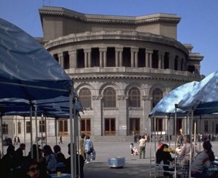
  3. The Yerevan Opera Theatre or, to give it's full title, The Alexander Spendiarian Armenian Opera and Ballet National Academic Theatre  was officially opened on 20 January 1933. The building was designed by the Armenian architect Alexander Tamanian. The building consists of two concert halls: Aram Khatchaturian concert hall and the hall of the Alexander Spendiarian Opera and Ballet National Theatre. The ground-breaking of the Opera-Theatre took place on 28 November 1930 during the celebrations of the 10th anniversary of Soviet Armenia. On January 20, 1933, the building was officially opened. Soon after the theatre foundation, a ballet troupe was established. Swan Lake by Pyotr Ilyich Tchaikovsky was the first ballet performance in 1935. In 1938, the theatre was named after Alexander Spendiaryan, great Armenian composer, author of opera Almast which was performed in 1933 as a first performance at the theatre. The 2nd phase of the construction was completed in 1940 according to Tamanian's design and under the supervision of his son. Large-scale construction works were applied until 1953, when the building was finally completed with its current shape.
  4. The Cascade is a giant stairway that links the downtown Kentron area of Yerevan with the Monument neighborhood. Inside the Cascade, underneath the exterior steps is an escalator going the length of the complex. There are also rooms connected to some of the landings along the escalators which comprise the Cafesjian Museum of Art. The exterior of Cascade, in addition to stairs has multiple levels with fountains and sculptures. The stairs afford walkers unobstructed views of central Yerevan and Mount Ararat. Construction began during Soviet rule, but stopped with the chaos that accompanied the disintegration of the USSR. The complex was purchased by an American-Armenian businessman Gerard Cafesjian in the early 2000s and a complete renovation was performed. A large museum complex was also planned for the top. Although construction began, it was frozen in the early stages and has not continued for years.
  5. Erebuni Fortress  also known as Arin Berd meaning the "Fortress of Blood" is a fortified city from the ancient kingdom of Urartu, located in what is present-day Yerevan. It was one of several fortresses built along the northern Urartian border and was one of the most important political, economic and cultural centers of the vast kingdom. The name Yerevan itself is derived from Erebuni. Erebuni was founded by King Argishti I (r. ca. 785–753 B.C.) in 782 B.C. It was built on top of a hill called Arin Berd overlooking the Arax River Valley to serve as a military stronghold to protect the kingdom's northern borders. According to Margarit Israelyan, Argishti began the construction of Erebuni after conquering the territories north of Yerevan and west of Lake Sevan, roughly corresponding to where the town of Abovyan is currently located. Accordingly, the prisoners he captured in these campaigns, both men and women, were used to help build his town.